
Two moderate earthquakes near Mauna Loa volcano, string of aftershocks, Hawai’i
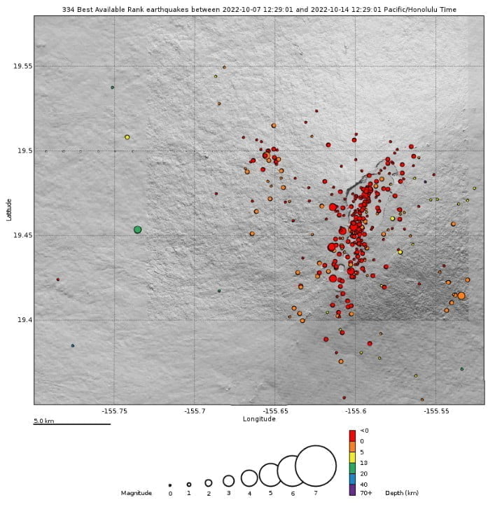
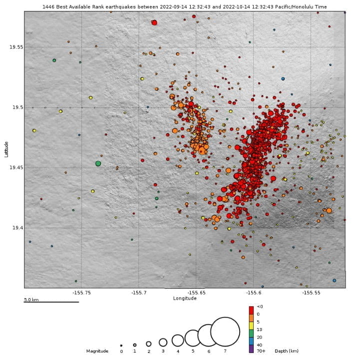
Featured image: Big Island, Hawai'i earthquakes - 24 hours to 22:30 UTC on October 14, 2022. Credit: TW/SAM, Google
Heightened unrest continues under Mauna Loa, with two moderately strong earthquakes within 24 seconds on October 14, 2022, and a string of aftershocks that are still taking place. The unrest is likely caused by renewed input of magma into Mauna Loa’s summit reservoir system. The Alert Level remains at Advisory and the Aviation Color Code at Yellow.
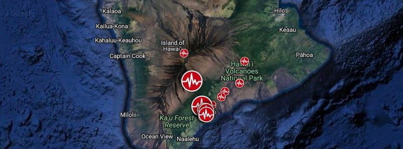
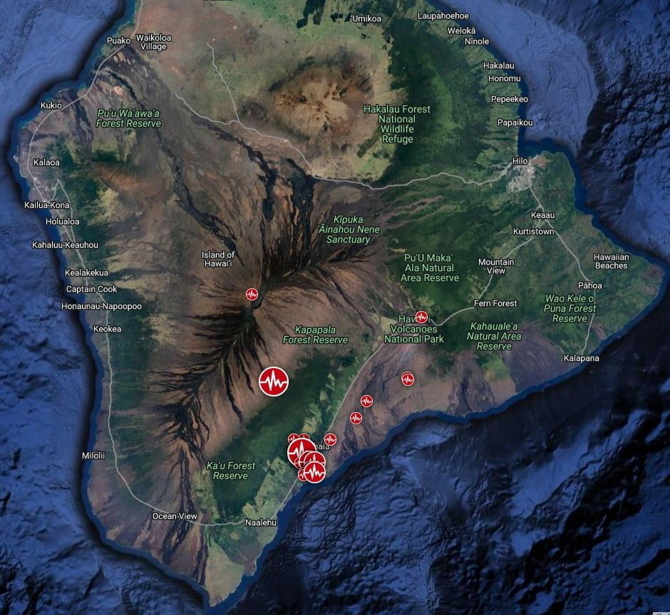
Two moderate earthquakes occurred beneath the southern end of the Island of Hawai‘i at 19:07 UTC on October 14, 2022.1
The first earthquake was registered as M4.6 and was located slightly offshore and south of Pāhala, at a depth of about 13 km (8 miles). It was followed 24 seconds later by an M5.0 earthquake just south of Pāhala, 7.4 km (4.6 miles) beneath Highway 11.
These two larger earthquakes were followed by a string of aftershocks, mostly less than magnitude-3.0, but including some larger ones up to magnitude-4.0.
The aftershock sequence is continuing, between 0 – 12 km (0 – 7 miles) depth, south of Pāhala, the Hawaiian Volcano Observatory (HVO) reported at 21:46 UTC.
The aftershocks could continue for several days to possibly weeks and may be large enough to be felt, HVO added.
The two larger earthquakes were reported by hundreds of people from the Island of Hawaiʻi and felt to a lesser extent across the entire State of Hawai’i. Shaking from the larger earthquakes may have been strong enough to do minor local damage, especially to older buildings.
The earthquakes occurred within 24 seconds of each other creating shaking of longer duration and possibly greater intensity than either of the earthquakes would have created on their own.
This sequence of earthquakes appears to be related to readjustments along the southeast flank of Mauna Loa volcano, HVO said.
There has been no immediate effect on the continuing unrest beneath Mauna Loa summit, which remains elevated at levels similar to the past week.
On several occasions, large earthquakes have preceded past eruptions of Mauna Loa, though these have typically been larger than today’s earthquakes.
It is not known at this time if this sequence of earthquakes is directly related to the ongoing unrest on Mauna Loa, HVO said.
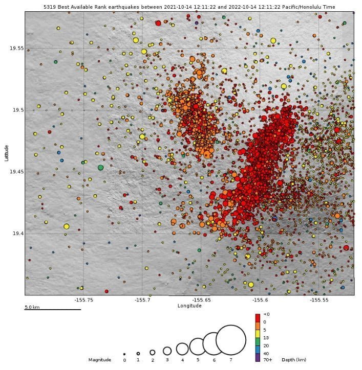
Heightened unrest under Mauna Loa began in mid-September 20222 with increased earthquake rates below its summit (from 10-20 per day to 40-50 per day), an increased rate of inflation recorded by GPS stations, and inflation recorded on the MOK tiltmeter.3
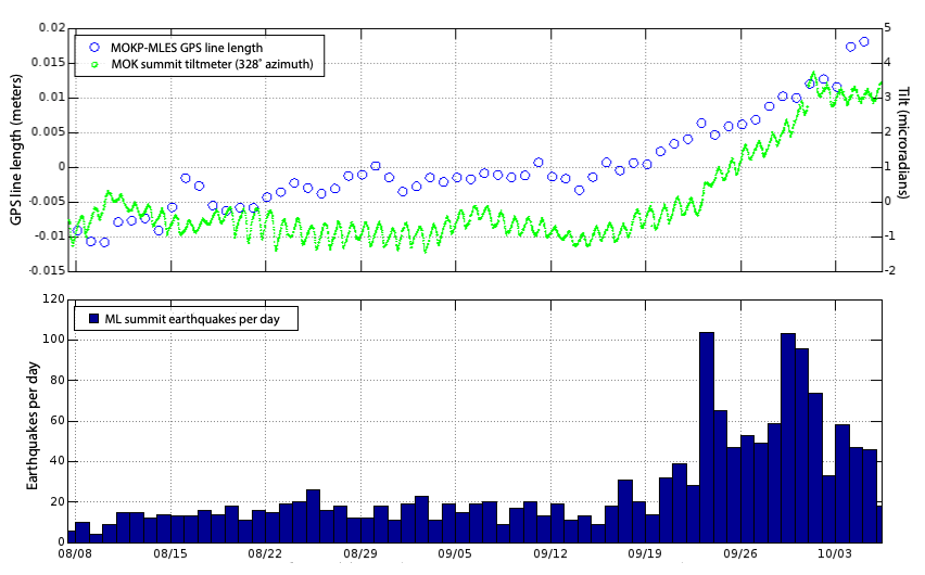
The unrest is likely caused by renewed input of magma into Mauna Loa’s summit reservoir system, according to the HVO.
As the reservoir expands, it is triggering small earthquakes directly beneath Mokuāʻweoweo caldera and in a region just to the northwest of the caldera. Deeper magma input (greater than 3 km / 2 miles) is detected by the continued increase in upward movement and extension measured between GPS stations located on the ground surface.
Shallower magma input (less than 3 km) was likely responsible for inflation recorded on the summit tiltmeter during the last two weeks of September. The current locations of earthquakes and deformation do not necessarily mean that the next eruption will occur there.
The last eruption of Mauna Loa occurred in 1984 and began in a style typical of the volcano.4
At 22:55 HST on March 24, 1984, the rate of earthquakes under Mauna Loa started to rapidly pick up. While rates of earthquakes were already above normal, they quickly rose to 2 – 3 earthquakes per minute.
By 23:30 HST, a strong seismic tremor had begun, indicating that magma was moving underground and getting close to the surface. The eruption began at Mauna Loa’s summit at 01:30 HST on March 25.
Mauna Loa remains at an elevated alert level of ADVISORY/YELLOW. The current increase in activity does not suggest that a progression to an eruption is certain, and there are no indications that an eruption is imminent, HVO said at 18:23 UTC today.
Geological summary
Massive Mauna Loa shield volcano rises almost 9 km (5.6 miles) above the sea floor to form the world’s largest active volcano.
Flank eruptions are predominately from the lengthy NE and SW rift zones, and the summit is cut by the Mokuaweoweo caldera, which sits within an older and larger 6 x 8 km (3.7 x 5 miles) caldera.
Two of the youngest large debris avalanches documented in Hawaii traveled nearly 100 km from Mauna Loa; the second of the Alika avalanches was emplaced about 105 000 years ago (Moore et al. 1989).
Almost 90% of the surface of the basaltic shield volcano is covered by lavas less than 4 000 years old (Lockwood and Lipman, 1987).
During a 750-year eruptive period beginning about 1500 years ago, a series of voluminous overflows from a summit lava lake covered about one-fourth of the volcano’s surface.
The ensuing 750-year period, from shortly after the formation of the Mokuaweoweo caldera until the present, saw an additional quarter of the volcano covered with lava flows predominately from the summit and NW rift zone vents.
This volcano is located within the Hawaiian Islands, a UNESCO World Heritage property.5
References:
1 HAWAIIAN VOLCANO OBSERVATORY INFORMATION STATEMENT – U.S. Geological Survey – Friday, October 14, 2022, 21:46 UTC
2 Seismic activity beneath Mauna Loa increasing, Hawai’i – The Watchers – September 26, 2022
3 HAWAIIAN VOLCANO OBSERVATORY DAILY UPDATE – U.S. Geological Survey – Friday, October 14, 2022, 18:23 UTC)
4 Volcano Watch – Recent events at Mauna Loa remind us to be prepared for quick changes
5 Mauna Loa – Geological summary – GVP
I'm a dedicated researcher, journalist, and editor at The Watchers. With over 20 years of experience in the media industry, I specialize in hard science news, focusing on extreme weather, seismic and volcanic activity, space weather, and astronomy, including near-Earth objects and planetary defense strategies. You can reach me at teo /at/ watchers.news.
Commenting rules and guidelines
We value the thoughts and opinions of our readers and welcome healthy discussions on our website. In order to maintain a respectful and positive community, we ask that all commenters follow these rules.