
Sydney sets new annual rainfall record, Australia
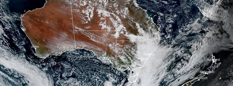
Image credit: JMA/Himawari-8, RAMMB/CIRA, The Watchers. Acquired at 05:40 UTC on October 6, 2022.
Between January 1 and October 6, 2022, Australia’s largest city – Sydney recorded more than 2 194 mm (86 inches) of rainfall, marking its wettest year since 1858 when the records started. Over the next three months, the eastern half of Australia is forecast to receive above-median rainfall.
Soon after 13:00 LT on Thursday, October 6, 2022, Sydney’s official rain gauge at Observatory Hill reached a cumulative annual rainfall total of 2 194.6 mm (86.40 inches) since January 1, 2022.1
This is a new annual record for rain gauges at Sydney (Observatory Hill), exceeding the previous record of 2 194.0 mm (86.37 inches) set over the full 12 months of 1950. The Bureau of Meteorology’s observations for this site date back to 1858.
The March and July 2022 monthly rainfall totals at Observatory Hill were the highest on record for their respective months.
Sydney Airport also exceeded its previous annual cumulative rainfall total on October 6, while several other long-term sites near coastal Sydney exceeded their previous annual record by the end of September, notably Randwick, Bankstown and Lucas Heights.
Widespread moderate to heavy rainfall is expected to affect much of New South Wales, Victoria and Tasmania over the coming weekend, October 8 and 9, and into Monday, October 10.
With the combination of locally falling rain and flood peaks moving downstream, extensive and significant riverine flooding is likely for many inland catchments.
Numerous flood warnings are in place and, with a wetter-than-usual spring and saturated soils, many dams are at capacity and catchments are very sensitive to rainfall.
Major flooding is already occurring across the Macquarie, Darling, Culgoa and Lachlan rivers.
Numerous flood watches have been issued for renewed flooding across both inland and central coastal regions of New South Wales, including major flooding for the Gwydir, Namoi, Macquarie, Belubula rivers, Mandagery Creek, Lachlan and Bogan rivers, Colo River, Wollombi Brook and Lower Hunter rivers.
Many more catchments are listed for minor to moderate flooding.
Wetter than average November to January forecast for the eastern half of Australia
For the fortnight of October 10 to 23, above median rainfall is very likely (greater than 75% chance) for much of the eastern seaboard and the Top End and moderately likely (greater than 65% chance) for most of the remainder of the eastern half of Australia and the northern tropics. Large parts of the west of Western Australia and the northern interior of Western Australia and adjacent parts of the Northern Territory have a moderate chance (greater than 60%) of below-median rainfall.2
During that fortnight, much of the northern tropics have at least three times the average chance of unusually high rainfall (in the wettest 20% of fortnights at this time of year during 1981 to 2018), with chances being more than twice average across larger parts of the eastern seaboard, Victoria, and north-eastern Tasmania.
November to January rainfall is at least moderately likely (greater than 60% chance) to be above median for the eastern half of Australia, rising to very likely (greater than 75% chance) for large parts of tropical and far northern Queensland, north-eastern New South Wales, south-eastern New South Wales, Victoria, and eastern Tasmania.
While the pattern of above median rainfall for eastern Australia is generally consistent throughout each of the three months in the outlook period, the magnitude of the probabilities is greatest in November and decreases in the later months.
Large parts of the east of Queensland, especially in Cape York Peninsula, much of eastern New South Wales, and Tasmania’s Central North and Midlands District have more than twice the average chance of unusually high November to January rainfall (in the wettest 20% of all such periods over 1981–2018).
During November, there is more than three times the usual chance of unusually high rainfall across the north of Cape York Peninsula.
References:
1 Widespread rain and storms to extend across Australia this week – BOM – October 7, 2022
2 Wetter than average November to January likely for eastern half of Australia – BOM, Climate outlooks – October 6, 2022
I'm a dedicated researcher, journalist, and editor at The Watchers. With over 20 years of experience in the media industry, I specialize in hard science news, focusing on extreme weather, seismic and volcanic activity, space weather, and astronomy, including near-Earth objects and planetary defense strategies. You can reach me at teo /at/ watchers.news.
Commenting rules and guidelines
We value the thoughts and opinions of our readers and welcome healthy discussions on our website. In order to maintain a respectful and positive community, we ask that all commenters follow these rules.