
Hurricane Watch issued for San Andres, Providencia and Santa Catalina islands
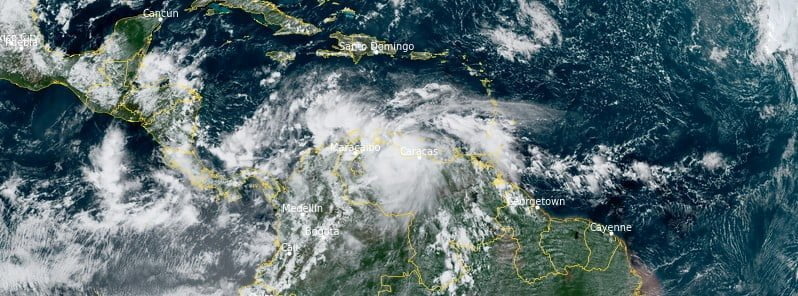
Featured image: Potential Tropical Cyclone 13 at 17:50 UTC on October 6, 2022. Credit: NOAA/GOES-16, RAMMB/CIRA, The Watchers
Potential Tropical Cyclone 13 is strengthening in the Caribbean Sea and is expected to become a tropical depression by tonight (LT), October 6, and a tropical storm on Friday, October 7.
- Tropical storm conditions are expected across portions of the Guajira Peninsula of Colombia tonight and early Friday, where a Tropical Storm Warning has been issued. Gusts to tropical storm force are possible across portions of northern Venezuela, Aruba, Curacao, and Bonaire through early Friday.
- The system is expected to strengthen when it moves over the southwestern Caribbean Sea, and interests in San Andres, Providencia, and portions of Central America should closely monitor its progress. Watches could be required for portions of that area later today or tonight.
- Heavy rainfall could cause life-threatening flash flooding in portions of the Guajira Peninsula of Colombia, northern Venezuela, Aruba, Bonaire and Curacao during the next day or so. Heavy rains, and the potential for flash flooding and mudslides, are expected to spread to portions of Central America this weekend.
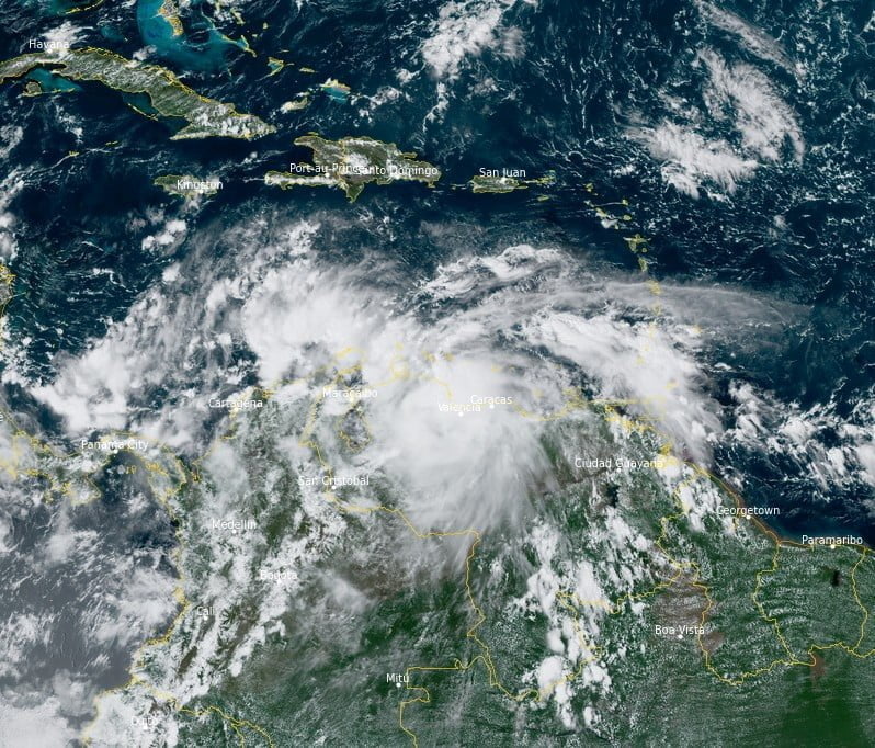
At 18:00 UTC on October 6, the system had maximum sustained winds of 55 km/h (35 mph) and minimum central pressure of 1 005 hPa, according to the National Hurricane Center (NHC).1 Its center was located about 160 km (100 miles) ESE of Curacao and 425 km (256 miles) ESE of the northern tip of Gujaira Peninsula, Colombia.
The system was moving W at 24 km/h (15 mph).
On the forecast track, the system is expected to move near the ABC Islands, the coast of northwestern Venezuela, and the Guajira Peninsula of Colombia through Friday morning. The system is then forecast to move across the southwestern Caribbean Sea, moving near San Andres and Providencia Islands Saturday night, October 8, and approaching the coast of Nicaragua on Sunday, October 9.
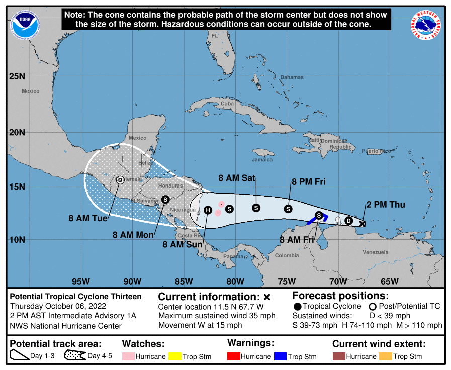
A Hurricane Watch is in effect for San Andres, Providencia, and Santa Catalina Islands, Colombia.
A Tropical Storm Warning is in effect for the coast of Colombia from Riohacha eastward to the Colombia/Venezuela border.
Hurricane conditions are possible on the Colombian islands of San Andres, Providencia, and Santa Catalina Saturday night, with tropical storm conditions possible by late Saturday.
Tropical storm conditions are expected along the coast of Colombia within the warning area by early Friday. Gusts to tropical storm force are also possible across the ABC Islands and the northwestern coast of Venezuela today and tonight.
Potential Tropical Cyclone Thirteen is expected to produce the following rain accumulations through early Monday, October 10:
- Northern Coastal Venezuela: 75 – 150 mm (3 to 6 inches), isolated 250 mm (10 inches)
- Aruba, Bonaire, and Curacao: 75 – 150 mm mm (3 to 6 inches)
- Guajira Peninsula of Colombia: 75 – 150 mm mm (3 to 6 inches), isolated 250 mm (10 inches)
- San Andres and Providencia: 150 – 300 mm (6 to 12 inches)
- Eastern Nicaragua: 150 – 300 mm (6 to 10 inches), isolated 400 mm (16 inches)
- Central Nicaragua: 150 – 300 mm (3 to 6 inches), isolated 250 mm (10 inches)
This rainfall may cause life-threatening flash floods.
A storm surge could raise water levels by as much as 0.3 to 0.9 m (1 to 3 feet) above normal tide levels along the immediate coast in areas of onshore winds on San Andres, Providencia, and Santa Catalina Islands.
Near the coast, the surge will be accompanied by large and damaging waves.
Swells generated by disturbance will affect the ABC Islands and portions of the coasts of northwestern Venezuela and the Guajira Peninsula of Colombia through Friday.
The swells could reach Jamaica, Providencia, and San Andres on Saturday, and portions of the coast of Central America on Sunday.
These swells are likely to cause life-threatening surf and rip current conditions.
References:
1 Potential Tropical Cyclone Thirteen – Intermediate Advisory Number 1A – NWS National Hurricane Center Miami FL – 200 PM AST Thu Oct 06 2022
I'm a dedicated researcher, journalist, and editor at The Watchers. With over 20 years of experience in the media industry, I specialize in hard science news, focusing on extreme weather, seismic and volcanic activity, space weather, and astronomy, including near-Earth objects and planetary defense strategies. You can reach me at teo /at/ watchers.news.
Commenting rules and guidelines
We value the thoughts and opinions of our readers and welcome healthy discussions on our website. In order to maintain a respectful and positive community, we ask that all commenters follow these rules.