
Tropical Storm “Nora” strengthening on its way toward Baja California, Mexico
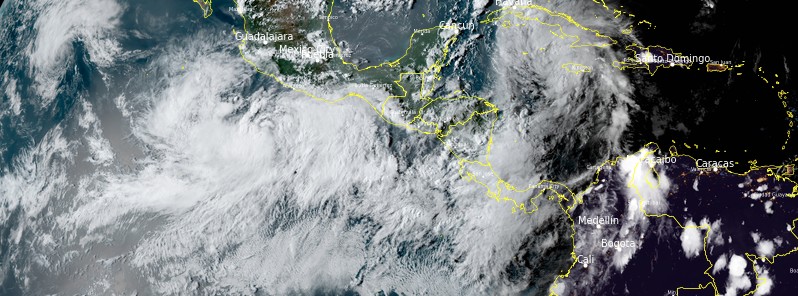
Featured image: Tropical Storm "Nora" at 22:40 UTC on August 26, 2021. Credit: NOAA/GOES-East, RAMMB/CIRA, TW
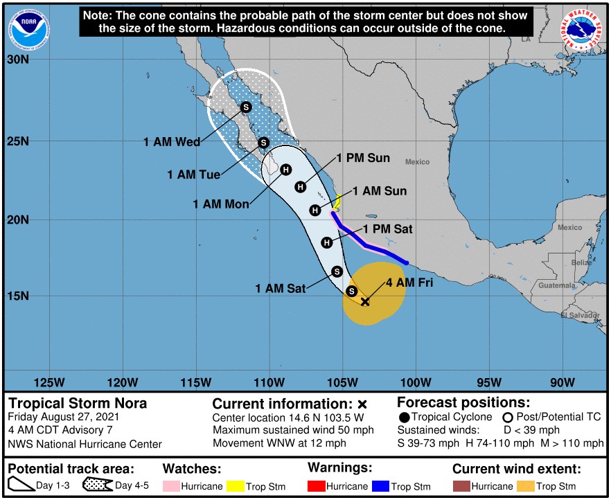
Tropical Storm "Nora" formed south of Mexico at 15:00 UTC on August 26, 2021, as the 14th named storm of the 2021 Pacific hurricane season. The system is expected to strengthen to a hurricane on Saturday, August 27, and approach the southern portion of Baja California Sur on Sunday, August 29.
Heavy rain associated with Tropical Storm "Nora" is expected across coastal sections of the Mexican states of Oaxaca, Guerrero, Michoacan, Colima, and Jalisco. Life-threatening flash flooding and mudslides may occur, the National Hurricane Center (NHC) warns.
Nora is forecast to be near or over the southern portion of Baja California Sur as a hurricane early next week, bringing a risk of wind and rain impacts to that area. Given the above-average uncertainty in the forecast, it is still too soon to determine the magnitude and location of these potential impacts.1
At 09:00 UTC on August 27, the center of Tropical Storm "Nora" was located 400 km (250 miles) SSW of Lazaro Cardenas, Mexico and 495 km (310 miles) S of Manzanillo, Mexico.2
The storm had maximum sustained winds of 85 km/h (50 mph) and a minimum central pressure of 999 hPa. It was moving WNW at 19 km/h (12 mph).
A Hurricane Watch is in effect for Lazaro Cardenas to Cabo Corrientes, Mexico. A Tropical Storm Warning is in effect for Tecpan de Galeana to Cabo Corrientes and a Tropical Storm Watch for areas north of Cabo Corrientes to San Blas, Mexico.
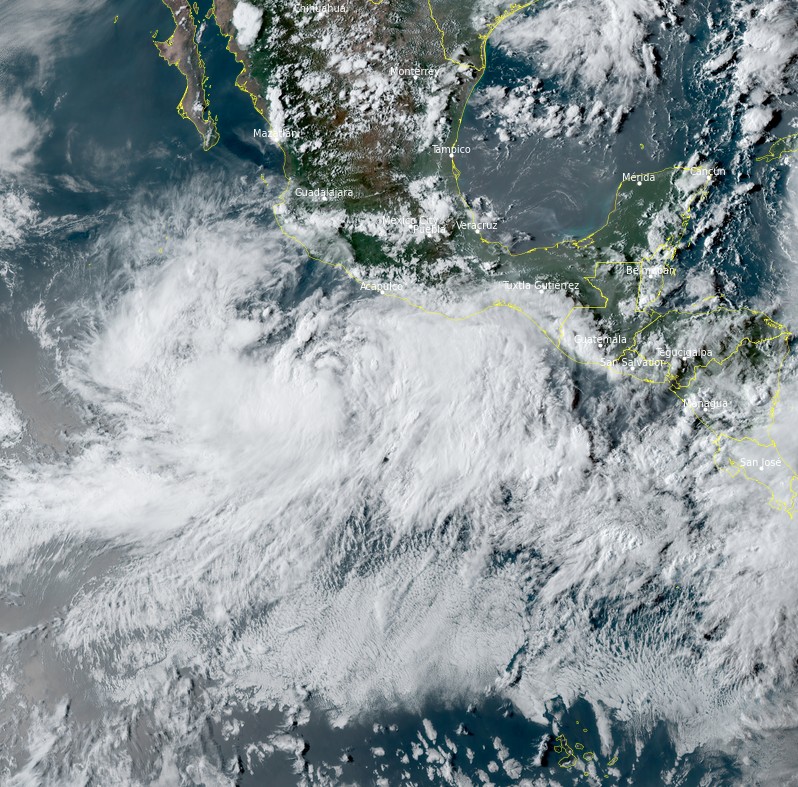
Tropical Storm "Nora" at 22:40 UTC on August 26, 2021. Image credit: NOAA/GOES-East, RAMMB/CIRA, TW
A turn toward the northwest is expected later today, followed by a northwestward or north-northwestward motion on Saturday and Sunday.
On the forecast track, the center of Nora will approach the southwestern coast of Mexico Friday, August 27, and Friday night and pass very near the coast Saturday, August 28, and Saturday night. Nora will then approach the southern portion of Baja California Sur on Sunday, August 29.
Hurricane conditions are possible within the hurricane watch area Saturday, with tropical storm conditions beginning later today.2
Tropical storm conditions are expected within the tropical storm warning area beginning this morning. Tropical storm conditions are possible within the tropical storm watch area beginning on Saturday.
Nora is expected to produce heavy rains over coastal sections of the Mexican states of Oaxaca, Guerrero, Michoacan, Colima, and Jalisco. Rainfall totals of 200 – 305 mm (8 to 12 inches) are forecast through this weekend with isolated maximum amounts of 500 mm (20 inches) possible. Life-threatening flash flooding and mudslides may occur.
Swells generated by Nora are affecting the southern coast of Mexico and will spread northward to the southwestern coast of Mexico later today and into the weekend. These swells are likely to cause life-threatening surf and rip current conditions.
References:
1 Tropical Storm Nora Discussion Number 7 – NWS National Hurricane Center Miami FL EP142021 – 400 AM CDT Fri Aug 27 2021
2 BULLETIN – Tropical Storm Nora Advisory Number 7 – NWS National Hurricane Center Miami FL EP142021 – 400 AM CDT Fri Aug 27 2021
I'm a dedicated researcher, journalist, and editor at The Watchers. With over 20 years of experience in the media industry, I specialize in hard science news, focusing on extreme weather, seismic and volcanic activity, space weather, and astronomy, including near-Earth objects and planetary defense strategies. You can reach me at teo /at/ watchers.news.
Commenting rules and guidelines
We value the thoughts and opinions of our readers and welcome healthy discussions on our website. In order to maintain a respectful and positive community, we ask that all commenters follow these rules.