
Subtropical cyclone forming east of Bermuda, Atlantic Ocean
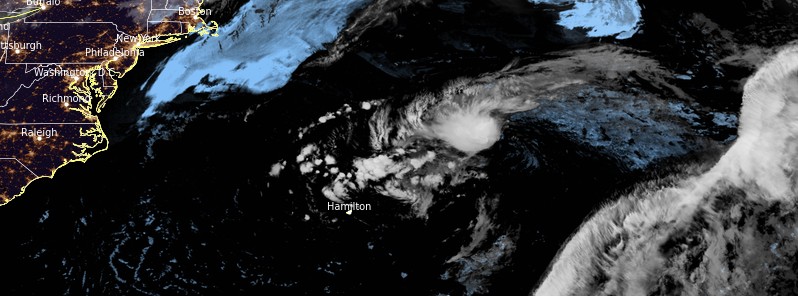
Image credit: NOAA/GOES-16, RAMMB/CIRA, TW. Acquired at 07:30 UTC on May 21, 2021.
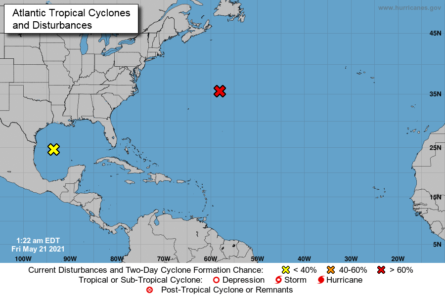
A non-tropical low pressure area located about 800 km (500 miles) ENE of Bermuda at 06:00 UTC on May 21 is producing winds to storm force and disorganized showers and thunderstorms. There is a high potential for this LPA to become the first subtropical storm (Ana) of the 2021 Atlantic Ocean hurricane season. A Tropical Storm Watch is in effect for Bermuda.
The low is expected to move WSW over warmer waters during the next day or so, and it will likely become a subtropical cyclone later today or on Saturday, May 22 near or to the northeast of Bermuda, forecasters at the U.S. National Hurricane Center (NHC) said. Formation chance through the next 48 hours is high — 80%.
Thereafter, the low is forecast to move northeastward into a more hostile environment by Saturday night or Sunday, May 23.
The Bermuda Weather Service (BWS) has issued a Tropical Storm Watch on May 20.
"A non-tropical low pressure to the northeast is expected to drift towards the area tomorrow and through the weekend," BWS said. "We continue to monitor this low for possible subtropical development."
"Regardless of development, the low will maintain cloudier skies and bring strong winds from early tomorrow (Friday), and periods of wet weather mainly from tomorrow afternoon through Saturday."
"A Tropical Storm Watch remains in effect to cover the potential for sustained winds reaching 65 km/h (40 mph) and seas exceeding 3.6 m (12 feet) offshore on Friday. Once formal advisories begin, BWS will start issuing Tropical Update Bulletins with more details about track and intensity."
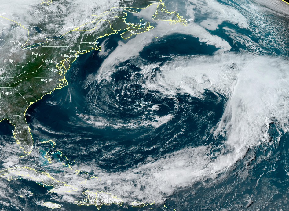
Image credit: NOAA/GOES-16, RAMMB/CIRA, TW. Acquired at 20:10 UTC on May 20, 2021.
Meanwhile, a surface trough and a mid- to upper-level disturbance over the western Gulf of Mexico are producing disorganized showers and thunderstorms.
Environmental conditions are expected to be marginally conducive for development before the disturbance moves inland over the northwestern Gulf coast tonight, May 21.
Regardless of development, the system could produce heavy rainfall over portions of southeastern Texas and southwestern Louisiana during the next few days.
Formation chance through 48 hours is low — 20%.
I'm a dedicated researcher, journalist, and editor at The Watchers. With over 20 years of experience in the media industry, I specialize in hard science news, focusing on extreme weather, seismic and volcanic activity, space weather, and astronomy, including near-Earth objects and planetary defense strategies. You can reach me at teo /at/ watchers.news.
Commenting rules and guidelines
We value the thoughts and opinions of our readers and welcome healthy discussions on our website. In order to maintain a respectful and positive community, we ask that all commenters follow these rules.