
Hurricane “Nicholas” leaves widespread damage, more than 500 000 without power in Texas
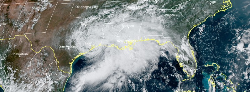
Featured image: Tropical Storm "Nicholas" at 19:50 UTC on September 14, 2021. Credit: NOAA/GOES-East, RAMMB/CIRA, TW
Hurricane "Nicholas" made landfall on the eastern part of the Matagorda Peninsula, Texas at 05:30 UTC on September 14, 2021, with maximum sustained winds of 120 km/h (75 mph) and a minimum central pressure of 991 hPa.1
The storm caused widespread damage and left more than 500 000 customers without power.
As of 20:00 UTC, 263 398 customers are still without power in Texas and 95 704 in Louisiana.
"Under the dark of night, Nicholas unleashed wind gusts as high as 150 km/h (95 mph) near where it made landfall, causing all manner of damage, and drenching rains that, combined with storm surge, resulted in widespread flooding," said Adriana Navarro of AccuWeather.2
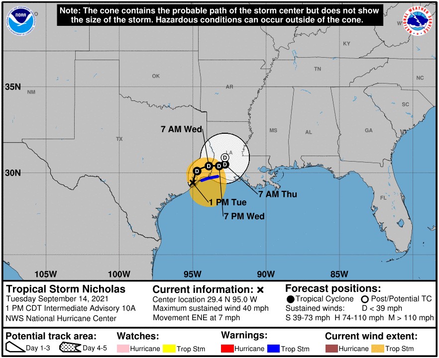
At 18:00 UTC, the center of Tropical Storm "Nicholas" was located about 55 km (30 miles) SE of Houston and 95 km (60 miles) WSW of Port Arthur, Texas.3
It had maximum sustained winds of 65 km/h (40 mph) and minimum central pressure of 1 003 hPa.
Nicholas is moving toward the ENE near 11 km/h (7 mph) and this general motion should continue through tonight. An eastward turn is expected over Louisiana by Wednesday., with little motion anticipated on Thursday.
Additional weakening is forecast during the next couple of days, and the storm is forecast to become a tropical depression by tonight.
- Storm Surge Warning is in effect for High Island, Texas to Sabine Pass.
- Tropical Storm Warning is in effect for High Island, Texas to Cameron, Louisiana.
- Storm Surge Watch is in effect for Sabine Pass to Cameron, Louisiana.
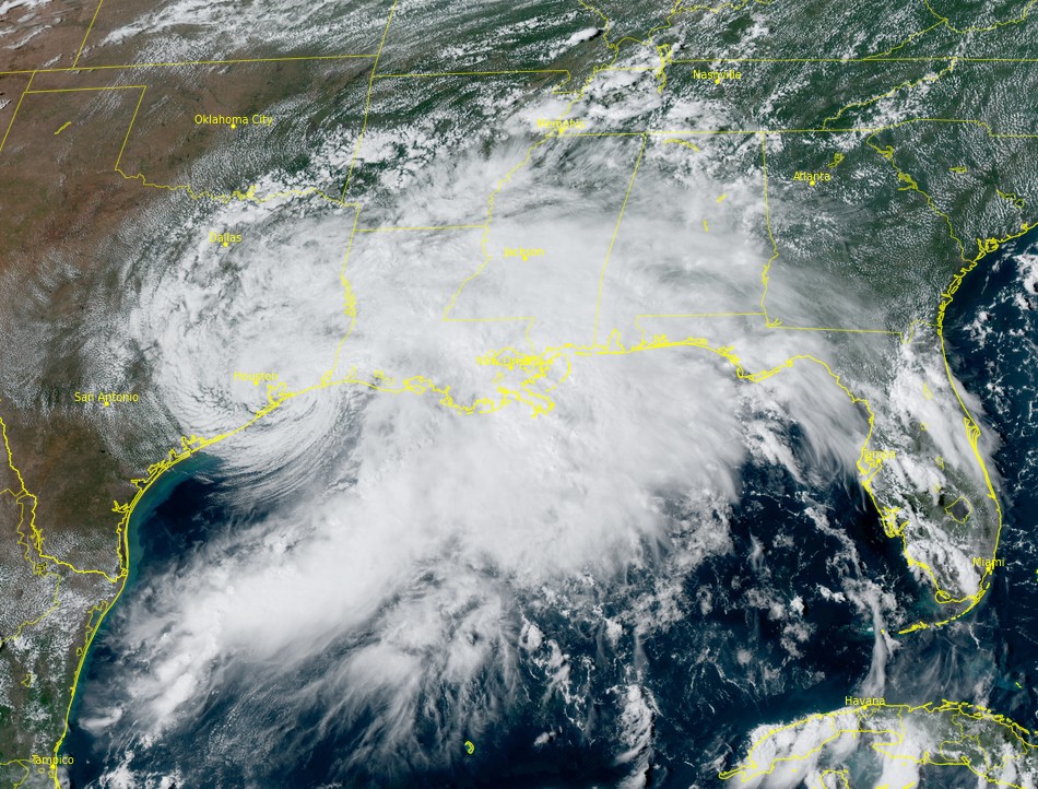
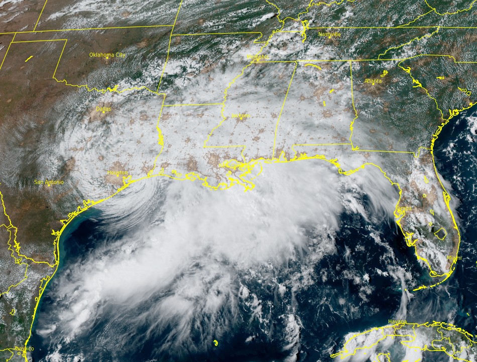
Tropical Storm "Nicholas" at 19:50 UTC on September 14, 2021. Credit: NOAA/GOES-East, RAMMB/CIRA, TW
Heavy rainfall will impact areas from the upper coast of Texas, across Louisiana, southern Mississippi, far southern Alabama and the western Florida Panhandle through Thursday, NHC forecaster Stewart noted.4
Significant rainfall amounts are expected, potentially resulting in areas of life-threatening flash and urban flooding across these areas. Minor to isolated major river flooding is also possible in smaller river basins and urban areas.
There is the danger of life-threatening storm surge inundation along the coast of Texas from Port Bolivar to Sabine Pass. Residents in these areas should follow any advice given by local officials.
Tropical storm conditions are expected to continue along the Louisiana coast into this afternoon (LT). Tropical storm conditions in the warning area across the upper Texas coast will diminish this afternoon as Nicholas moves farther to the northeast.
References:
1 Hurricane "Nicholas" makes landfall along the Texas coast – The Watchers
2 Hurricane Nicholas hammers Gulf Coast communities – AccuWeather
3 BULLETIN – Tropical Storm Nicholas Intermediate Advisory Number 10A – NWS National Hurricane Center Miami FL AL142021 – 100 PM CDT Tue Sep 14 2021
4 Tropical Storm Nicholas Discussion Number 10 – NWS National Hurricane Center Miami FL AL142021 – 1000 AM CDT Tue Sep 14 2021
I'm a dedicated researcher, journalist, and editor at The Watchers. With over 20 years of experience in the media industry, I specialize in hard science news, focusing on extreme weather, seismic and volcanic activity, space weather, and astronomy, including near-Earth objects and planetary defense strategies. You can reach me at teo /at/ watchers.news.
Commenting rules and guidelines
We value the thoughts and opinions of our readers and welcome healthy discussions on our website. In order to maintain a respectful and positive community, we ask that all commenters follow these rules.