
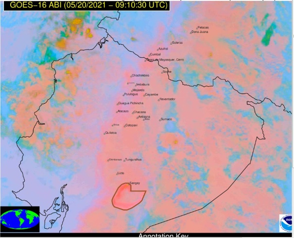
Ash produced by Sangay volcano rising up to 9.5 km (31 000 feet) a.s.l., Ecuador

Image credit: Copernicus EU/Sentinel-2, TW. Acquired on May 16, 2021.
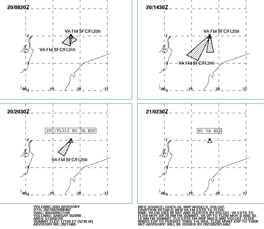
A new volcanic ash emission produced by Sangay volcano, Ecuador is rising to an estimated height of 9.5 km (31 000 feet) above sea level as of 08:40 UTC on May 20, 2021, according to data provided by the Washington VAAC.
The ash is moving SW and was extending about 111 km (69 miles) from the summit at 09:30 UTC.
Another volcanic ash emission up to 7.6 km (25 000 feet) a.s.l. is moving S and SE, and extending 75 – 110 km (46 – 68 miles) from the summit.
The activity could potentially generate slight ash falls in the provinces of Morona Santiago, Chimborazo, and Azogues, Ecuador's Geophysical Institute (IG) warns.
"This phenomenon has been persistent within the current eruptive period that began in May 2019. It is recommended to take pertinent measures and receive the information from official sources," IG volcanologists said.
A significant eruption took place at the volcano at 09:40 UTC on Sunday, May 16, 2021, with ash moving north to an estimated height of 12.2 km (40 000 feet) a.s.l.
On May 15, IGEPN said they received signals associated with mud and debris flows and warned the local population that heavy rains could remobilize accumulated material, generating mud and debris flows that would descend the flanks of the volcano and flow into adjacent rivers.

SO2 produced by Sangay volcano on May 16, 2021. Credit: Copernicus EU/Sentinel-5, DLR/BIRA/ESA

Image credit: Copernicus EU/Sentinel-2, TW. Acquired on May 16, 2021.
Geological summary
The isolated Sangay volcano, located east of the Andean crest, is the southernmost of Ecuador's volcanoes and its most active.
The steep-sided, glacier-covered, dominantly andesitic volcano grew within horseshoe-shaped calderas of two previous edifices, which were destroyed by collapse to the east, producing large debris avalanches that reached the Amazonian lowlands.
The modern edifice dates back to at least 14 000 years ago. It towers above the tropical jungle on the east side; on the other sides flat plains of ash have been sculpted by heavy rains into steep-walled canyons up to 600 m (1 979 feet) deep.
The earliest report of a historical eruption was in 1628. More or less continuous eruptions were reported from 1728 until 1916, and again from 1934 to the present.
The almost constant activity has caused frequent changes to the morphology of the summit crater complex. This volcano is located within the Sangay National Park, a UNESCO World Heritage property.
I'm a dedicated researcher, journalist, and editor at The Watchers. With over 20 years of experience in the media industry, I specialize in hard science news, focusing on extreme weather, seismic and volcanic activity, space weather, and astronomy, including near-Earth objects and planetary defense strategies. You can reach me at teo /at/ watchers.news.
Commenting rules and guidelines
We value the thoughts and opinions of our readers and welcome healthy discussions on our website. In order to maintain a respectful and positive community, we ask that all commenters follow these rules.