
New earthquake swarm at La Soufriere volcano, St. Vincent and the Grenadines
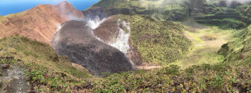
Featured image: La Soufriere volcano on April 1, 2021. Credit: UWI-SRC
A new earthquake swarm was detected at the La Soufrière Volcano, St. Vincent and the Grenadines on April 5, 2021. The swarm was much more intense than the one detected from March 23 to 25. The alert level remains at Orange.
The new swarm of Volcano-Tectonic (VT) earthquakes which began at the volcano at 06:38 LT on April 5 continued at a fairly constant rate before starting to decline at about 14:00 LT.
The activity declined significantly at 16:00 LT although small Volcano-Tectonic earthquakes were still being recorded.
The swarm was located at a depth of about 6 km (3.7 miles) below the summit. This is slightly deeper than those recorded between March 23 and 25, 2021 which were located at depths from 3 to 5 km (1.8 to 3.1 miles) below the summit.
The largest VT earthquake was recorded at 14:16 LT, with a magnitude of 3.9. There were 9 more VT earthquakes in the swarm with magnitudes of 3.0 or more.
Yesterday's swarm was much more intense than the one that took place from March 23 to 25 and contained many more small earthquakes, with an average rate of about 50 earthquakes per hour compared with 1.5 per hour in March, the National Emergency Management Organisation (NEMO) St. Vincent and the Grenadines said.
There were several reports of earthquakes being felt today in communities close to the volcano such as Fancy and Chateaubelair.
The alert level remains at Orange.
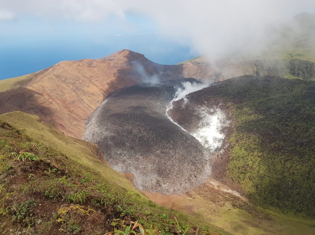
Lava dome at La Soufriere volcano on April 1, 2021. Credit: UWI-SRC
The NEMO is reminding the public that no evacuation order or notice has been issued and encouraging residents, especially persons living in communities close to the volcano, to be prepared in the event that it becomes necessary to evacuate at short notice.
Geological summary
Soufrière St. Vincent is the northernmost and youngest volcano on St. Vincent Island. The NE rim of the 1.6 km (1 mile) wide summit crater is cut by a crater formed in 1812.
The crater itself lies on the SW margin of a larger 2.2 km (1.3 miles) wide Somma crater, which is breached widely to the SW as a result of slope failure.
Frequent explosive eruptions since about 4 300 years ago produced pyroclastic deposits of the Yellow Tephra Formation, which blanket much of the island.
The first historical eruption took place in 1718; it and the 1812 eruption produced major explosions.
Much of the northern end of the island was devastated by a major eruption in 1902 that coincided with the catastrophic Mont Pelée eruption on Martinique.
A lava dome was emplaced in the summit crater in 1971 during a strictly effusive eruption, forming an island in a lake that filled the crater prior to an eruption in 1979.
The lake was then largely ejected during a series of explosive eruptions, and the dome was replaced with another. (GVP)
I'm a dedicated researcher, journalist, and editor at The Watchers. With over 20 years of experience in the media industry, I specialize in hard science news, focusing on extreme weather, seismic and volcanic activity, space weather, and astronomy, including near-Earth objects and planetary defense strategies. You can reach me at teo /at/ watchers.news.
Commenting rules and guidelines
We value the thoughts and opinions of our readers and welcome healthy discussions on our website. In order to maintain a respectful and positive community, we ask that all commenters follow these rules.