
Wild weather hit parts of Australia as bushfires destroy more homes in NSW
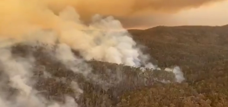
Image credit: NSW RFS
Wild weather continues across large parts of southeast Australia as strong winds and thunderstorms hit bushfire-stricken New South Wales and Victoria beginning January 31, 2020. Rains are also forecast across southern Queensland in the following days.
Strong storms generated hazardous conditions for firefighters in NSW on Sunday, February 2, as more homes were destroyed in the Bega Valley.
"There have been additional homes lost in the Bega Valley," said mayor Kristy McBain.
"We're talking probably dozens more. We want to make sure we continue to support our community. This fire isn't over yet," the mayor added.
With this, the NSW Health also advised residents in several parts of the state to avoid outdoors in the meantime as bushfire smoke and dust produced poor air quality.
On Monday, February 3, the Bureau of Meteorology (BOM) issued severe thunderstorm warnings for damaging winds, heavy rainfall, and huge hailstones for the Mid North Coast, parts of Northern Rivers, Hunder, and Northern Tablelands.
In addition, BOM advised residents to remain vigilant with wind changes within the day– although fire conditions in many areas across southern NSW have reportedly improved on Monday, there are still 22 uncontained out of 61 fires burning.
"Around 2 000 firefighters and support personnel are in the field today. A southerly change is due later today which will bring in drier conditions. Stay alert to changing conditions," the NSW Rural Fire Service (NSW RFS) also warned.
GUSTY STORMS WITH HEAVY BURSTS OF RAINFALL IN THE NORTHEAST #NSW. Severe #Thunderstorm Warning for Damaging Winds, Heavy Rainfall & Large Hail Stones for #MidNorthCoast, parts of #NorthernRivers, Hunter & #NorthernTablelands. Latest warnings at https://t.co/vrZOdcTJ9k. pic.twitter.com/fFl8M6h0pt
— Bureau of Meteorology, New South Wales (@BOM_NSW) February 3, 2020
While fire conditions in many areas have been better today people, particularly in sthn #NSW & #ACT, should remain vigilant with wind changes this afternoon & tonight. One fire near #Canberra has just gone to Emergency level https://t.co/UfWhZ6xbK3 or https://t.co/Zva2Vl0Hcf pic.twitter.com/L3urX9cJde
— Bureau of Meteorology, New South Wales (@BOM_NSW) February 3, 2020
EMERGENCY WARNING – Calabash (Snowy Monaro LGA)
The fire is spreading E & NE direction under strong SW winds.
People in the Tinderry, Calabash areas including Calabash Rd, Tinderry Rd, Egans Rd and Naylers Lane, should seek shelter as fire approaches. #nswrfs #nswfires pic.twitter.com/3vhugKthBc— NSW RFS (@NSWRFS) February 3, 2020
The satellite is showing smoke from fires in the #ACT, #NSW and #Gippsland streaming into the Tasman, while a storm and rain band moves through South Australia, #Victoria and into #Tasmania. For the latest weather warnings, forecasts and observations: https://t.co/k4NxvWCfmp pic.twitter.com/zh5NZZ8K1f
— Bureau of Meteorology, New South Wales (@BOM_NSW) February 1, 2020
In Victoria, storms reportedly knocked off transmission towers, affecting power supply. On January 31, power provider AusNet confirmed that the storm brought down about eight to 10 towers.
"These lines feed into the Interconnector from Eastern Victoria to South Australia," said state reporter Simon Love.
Over 26 000 homes mostly in Melbourne lost electricity, including more than 17 000 customers of AusNet.
Singer Elton John's show at Rochford Wines in the Yarra Valley was also affected by heavy downpour, which was eventually canceled after several musical instruments and monitors were damaged.
"It was a wild weekend across Victoria," said BOM on Monday. "Humid, tropical air brought storms, heavy rainfall, and damaging winds."
A gale warning was issued for East Gippsland Coast on February 3, while strong wind warnings were in effect for Gippsland Lakes, Central Coast, and Central Gippsland Coast.
Meanwhile, in Queensland, significant rain is expected to drench drought-stricken parts of the state this week.
"This is going to be the most significant rainfall by the time we finish this week that they have seen in quite some time," said BOM forecaster Harry Clark.
The state sweltered through Monday, February 3, with areas west of Brisbane including Ipswich, Gatton, Warwick, and Roma scorching around 40 °C (104 °F).
By Tuesday, southerly change in the west will make the temperatures cooler as the sweltering conditions disappear.
"It will be the start of a fairly showery and wet week for much of south-east Queensland and the southern interior as well," Clark said.
Much of the state will receive the heaviest rainfall on Wednesday, February 5. Daily falls up to 30 mm (1.2 inches) are expected across the regions of Maranoa and Warrego, which lacked rain in January.
"On Wednesday, we could see those falls become a little heavier as we see a coastal trough develop."
"In the west, we do have a trough system at the surface which is combining with an upper trough and that’s going to really lead to some decent totals over the southern interior of the state over the coming days and, indeed, into the weekend."
Queensland Swelters: “The highest temperatures we’re seeing around 41° for Gatton today, Ipswich around 40°, then Brisbane City reaching around 36 °,” – Harry Clark, BOM Meteorologist. https://t.co/YReZ2enOEh #qldweather #7NEWS pic.twitter.com/Kr9WjrS54I
— 7NEWS Sunshine Coast (@7NewsSC) February 3, 2020
Tomorrow marks the start of a wet week for the southern coast and interior. Persistent showers and a few storms will lead to useful rainfall totals for many. However some falls could be heavy, particularly on Wednesday. Stay up to date with warnings: https://t.co/WF4G3mcxuc pic.twitter.com/zlYOXbN75S
— Bureau of Meteorology, Queensland (@BOM_Qld) February 3, 2020
Commenting rules and guidelines
We value the thoughts and opinions of our readers and welcome healthy discussions on our website. In order to maintain a respectful and positive community, we ask that all commenters follow these rules.