
Shallow M6.0 earthquake hits Papua, Indonesia
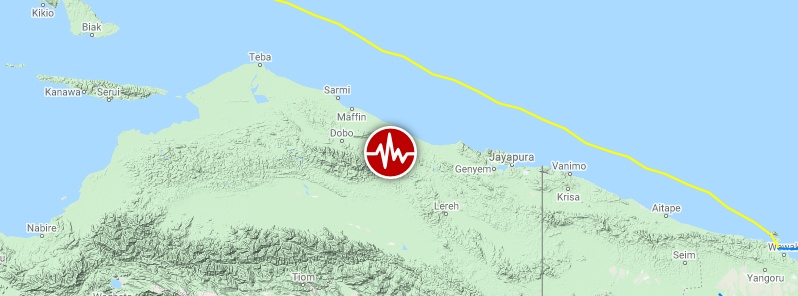
Image credit: Google, TW/SAM
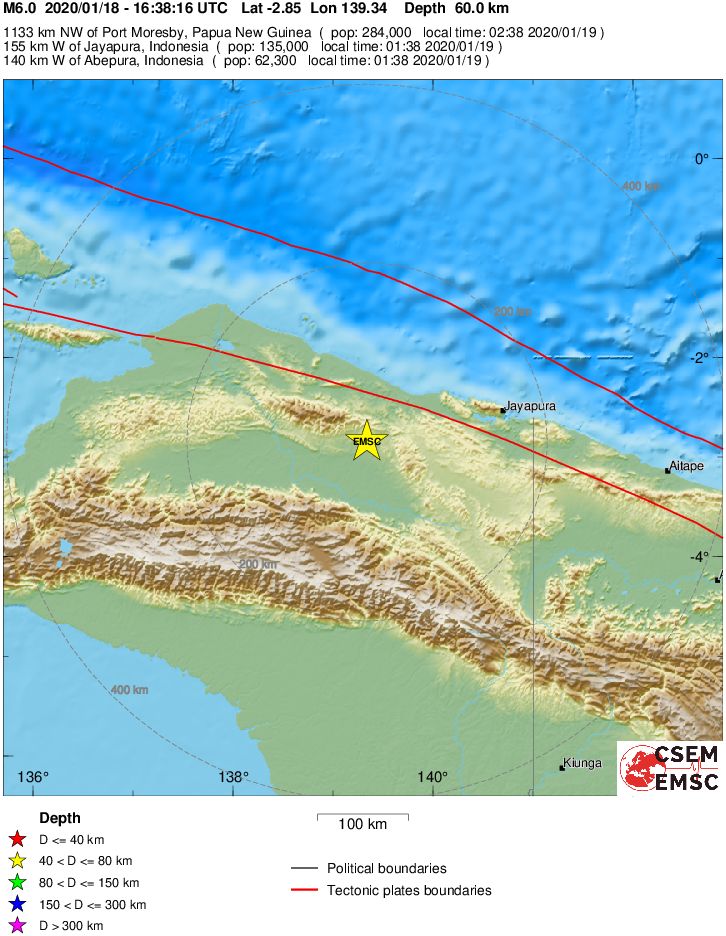
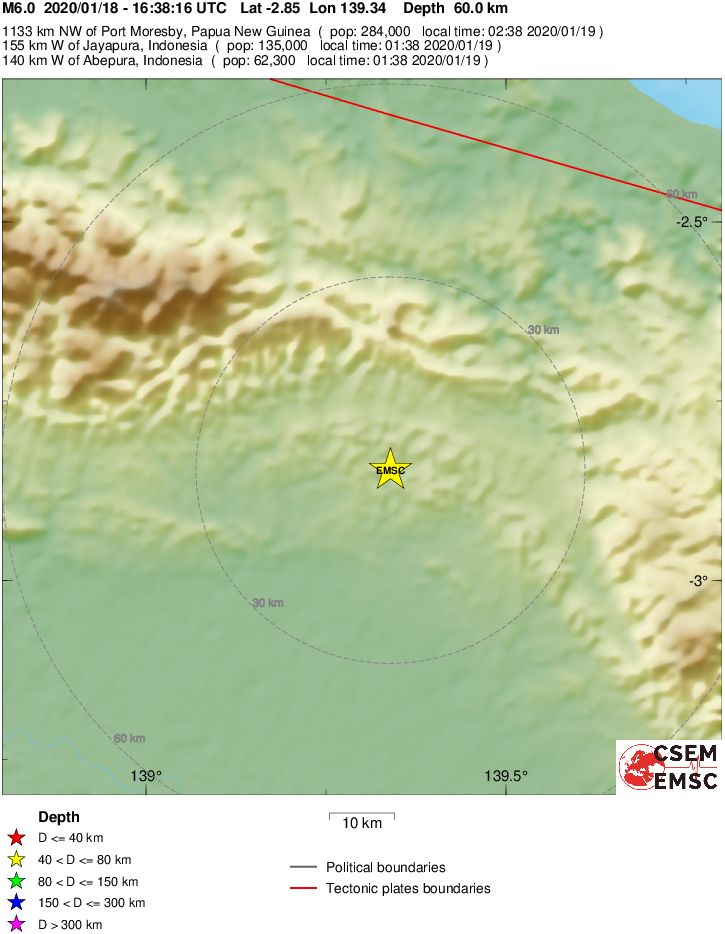
A strong and shallow earthquake registered by the USGS as M6.0 hit Papua, Indonesia at 16:38 UTC on January 18, 2020 (01:38 LT, January 19). The agency is reporting a depth of 33 km (20 miles). EMSC is reporting M6.0 at a depth of 60 km (37 miles).
The epicenter was located 147.1 km (91.2 miles) W of Abepura (population 62 248), Indonesia, 157.9 km (97.9 miles) WSW of Jayapura (population 134 895), Indonesia, 219.6 km (136.1 miles) W of Vanimo (11 204), Papua New Guinea, 421.6 km (261.4 miles) NNW of Kiunga (population 11 536), Papua New Guinea, and 429.8 km (266.5 miles) E of Nabire (population 43 898), Indonesia.
There are 150 000 people living within 100 km (62 miles).
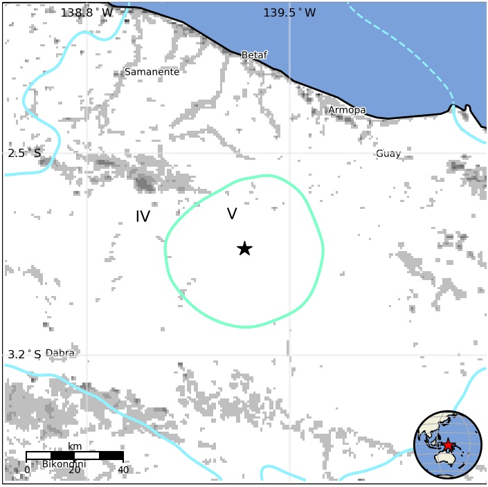
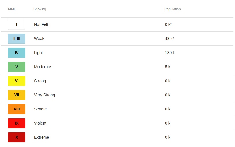
5 000 people are estimated to have felt moderate shaking and 139 000 light.
The USGS issued a green alert for shaking-related fatalities and economic losses. There is a low likelihood of casualties and damage.
Overall, the population in this region resides in structures that are vulnerable to earthquake shaking, though resistant structures exist. The predominant vulnerable building types are unreinforced brick with concrete floor and precast concrete frame with wall construction.
Recent earthquakes in this area have caused secondary hazards such as landslides that might have contributed to losses.
Estimated population exposure to earthquake shaking
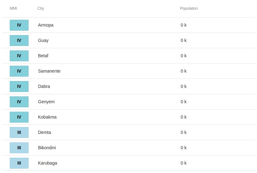
Selected cities exposed
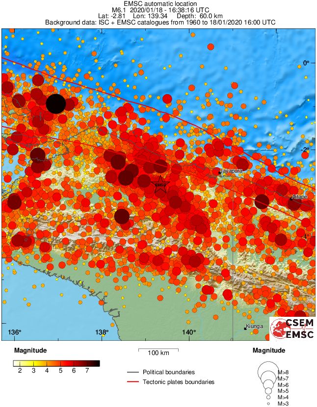
Regional seismicity
I'm a dedicated researcher, journalist, and editor at The Watchers. With over 20 years of experience in the media industry, I specialize in hard science news, focusing on extreme weather, seismic and volcanic activity, space weather, and astronomy, including near-Earth objects and planetary defense strategies. You can reach me at teo /at/ watchers.news.
Commenting rules and guidelines
We value the thoughts and opinions of our readers and welcome healthy discussions on our website. In order to maintain a respectful and positive community, we ask that all commenters follow these rules.