
Seismic activity continues at Coso Volcanic Field in Inyo County, California
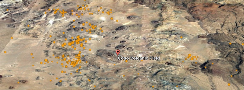
Featured image: Coso Volcanic Field. Credit: Google, TW, USGS
The seismic activity that started early July 6, 2019 at the southern margin of Coso Volcanic Field in Inyo County, California continues at a rate of about 600 M1.0 or greater earthquakes per day.
The activity was triggered by a magnitude M5.4 earthquake at 04:19 UTC on July 6 located about 20 km (12 miles) ESE of Little Lake, which itself was an aftershock of the M7.1 earthquake that occurred an hour earlier, located 17 km (10.5 miles) NNE of Ridgecrest to the south, the California Volcano Observatory reports.
Of the approximately 1 600 earthquakes detected at M1.0 or above since July 8, only 12 have been M3.0 or above, with the largest two registering M4.1.
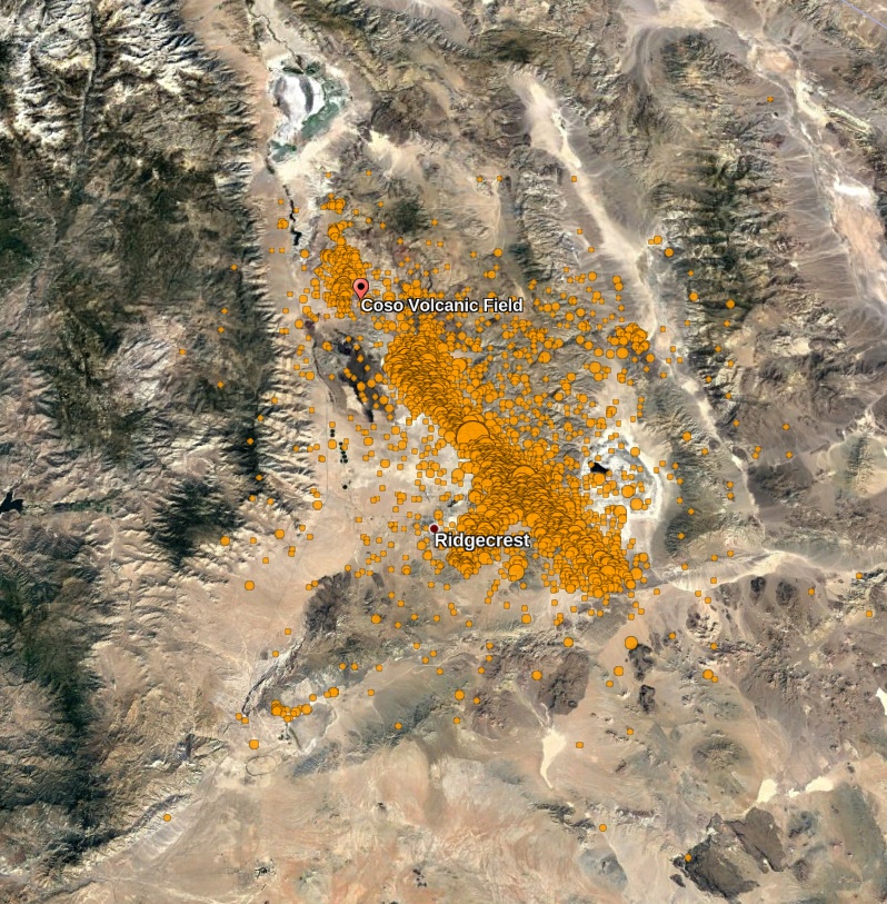
Coso Volcanic Field and July 2019 Ridgecrest earthquakes. Credit: Google, TW. Earthquake data USGS
The intensity of the activity at Coso is now gradually declining.
The current activity at Coso can be considered distant aftershocks, or triggered earthquakes.
The M7.1 on July 6 occurred on a NW-trending fault oriented toward the Coso area, and it is common for large earthquakes to cause aftershocks beyond the actual fault rupture.
No ground deformation indicative of volcanic activity has been detected, and there is no imminent threat of an eruption.
The California Volcano Observatory will continue to monitor the situation for any sign of volcanic activity and provide updates as warranted.
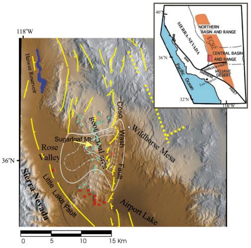
Geologic map schematic of the Coso volcanic field located within the East California Shear Zone (ECSZ – red rectangle in inset map).
White lines are heat flux values from Combs, 1980 (values 3, 5, 10, 15 HFU). Yellow lines are fault positions; blue diamonds represent rhyolite vent locationss and red squares represent basaltic vent locations younger than 0.3 Ma. HFU = 41.87 mW/m2.
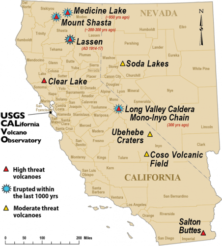
Map of moderate-to-high-threat volcanoes monitored by the California Volcano Observatory. Counties in California and Nevada are labeled.
Geological summary
COSO VOLCANIC FIELD VOLCANO (VNUM #323180)
36°1'48" N 117°49'12" W, Summit Elevation 2 400 m (7 874 feet)
Current Volcano Alert Level: NORMAL
Current Aviation Color Code: GREEN
The Coso volcanic field, located east of the Sierra Nevada Range at the western edge of the Basin and Range province consists of Pliocene to Quaternary rhyolitic lava domes and basaltic cinder cones covering a 400 km2 (154 mi2) area.
Much of the field lies within the China Lake Naval Weapons Center.
Active fumaroles and thermal springs are present in an area that is a producing geothermal field.
The youngest eruptions were chemically bimodal, forming basaltic lava flows along with 38 rhyolitic lava flows and domes, most with youthful, constructional forms.
The latest dated eruption formed the Volcano Peak basaltic cinder cone and lava flow and was Potassium-Argon dated at 39 000 +/- 33 000 years ago.
Although most activity ended during the late Pleistocene, the youngest lava dome may be of Holocene age based on geomorphological evidence (Monastero 1998, pers. comm.).
I'm a dedicated researcher, journalist, and editor at The Watchers. With over 20 years of experience in the media industry, I specialize in hard science news, focusing on extreme weather, seismic and volcanic activity, space weather, and astronomy, including near-Earth objects and planetary defense strategies. You can reach me at teo /at/ watchers.news.
Commenting rules and guidelines
We value the thoughts and opinions of our readers and welcome healthy discussions on our website. In order to maintain a respectful and positive community, we ask that all commenters follow these rules.