
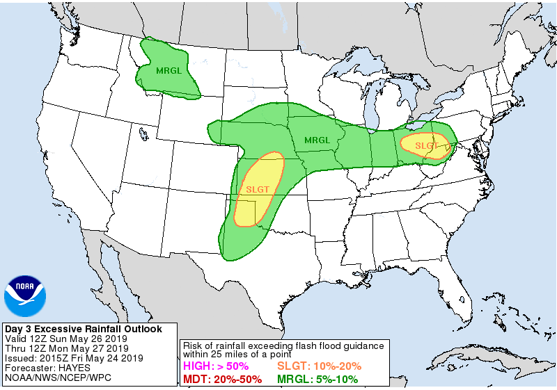
High risk of excessive rainfall across Oklahoma, Kansas, Missouri, Iowa, and Illinois, U.S.
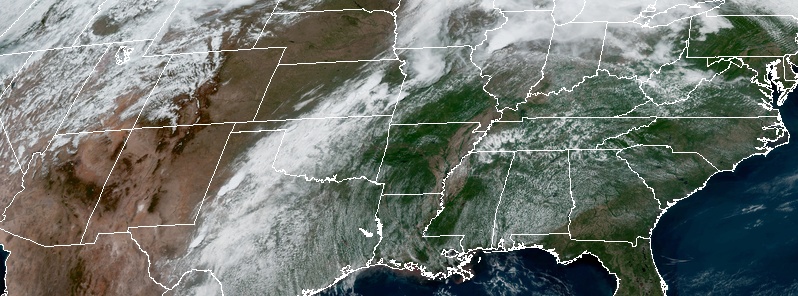
Image credit: NOAA/GOES-East. Acquired 18:10 UTC on May 24, 2019
The threat of flash flooding continues this afternoon and evening across portions of Oklahoma, Kansas, Missouri, Iowa, and Illinois with a HIGH risk of excessive rainfall, NWS WPC warns.
Severe thunderstorms and flash flooding are likely once again from the Southern Plains to the Midwest today. Periodic risks of severe thunderstorms, along with flash flooding, are forecast from the Central and Southern Plains to the Great Lakes and Northeast through the Memorial Day weekend.
Generally, no big changes to the prevailing weather pattern are expected across the United States for this Memorial Day weekend as active weather is forecast to continue.
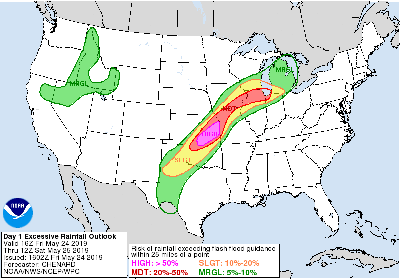
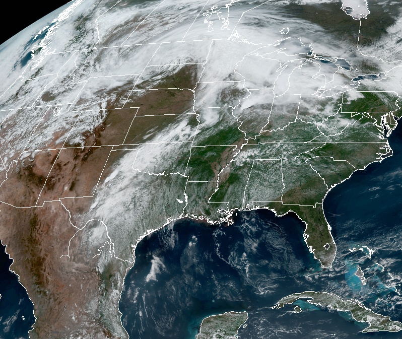
Image credit: NOAA/GOES-East. Acquired 18:10 UTC on May 24, 2019
This will be in response to a strong upper level trough situated over the Intermountain West and a large upper level ridge anchored over the southeastern U.S.
A strong clash of air masses from the southern Plains to the Ohio Valley region will support multiple episodes of severe weather along with the threat for additional flash flooding in the general vicinity of a slow moving frontal boundary where multiple waves of low pressure will be developing along it.
One low pressure system will be lifting northeast across the northern Plains and upper Midwest by this evening which will drive a cold front gradually across the Midwest, but the southwestern portion of this front will stall out and be draped well southwest down across the central and southern High Plains.
Numerous heavy showers and thunderstorms will focus along this front this evening and through Saturday, May 25, bringing multiple threats of severe weather and strong concerns for flash flooding.
In fact, the Storm Prediction Center currently has an Enhanced Risk area of severe weather over parts of west Texas for this evening and overnight, and then extending northward over a broader area of the central and southern High Plains through Saturday and Saturday night.
Meanwhile, a Slight Risk of severe weather extends well to the northeast through the upper Midwest in the vicinity of the aforementioned front.
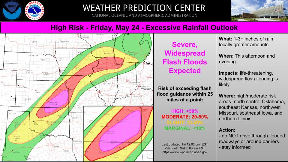
Heavy rainfall that is expected across this entire region will facilitate flash flood concerns, and the Weather Prediction Center has highlighted a High Risk of excessive rainfall through early Saturday morning for areas of north-central Oklahoma and southeast Kansas where additional heavy rain falling on extremely sensitive and generally saturated soil conditions will encourage significant runoff.
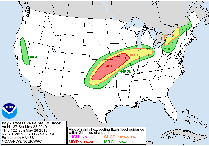
The High Risk area is embedded within a broader Moderate Risk area that extends northeast up across a large area of the Midwest. A Moderate Risk of excessive rainfall includes a large area of the central Plains and middle MS Valley Saturday through Sunday, May 26.
.jpg)
I'm a dedicated researcher, journalist, and editor at The Watchers. With over 20 years of experience in the media industry, I specialize in hard science news, focusing on extreme weather, seismic and volcanic activity, space weather, and astronomy, including near-Earth objects and planetary defense strategies. You can reach me at teo /at/ watchers.news.
Commenting rules and guidelines
We value the thoughts and opinions of our readers and welcome healthy discussions on our website. In order to maintain a respectful and positive community, we ask that all commenters follow these rules.