
Tropical depression forming east of Philippines, landfall, heavy rain expected
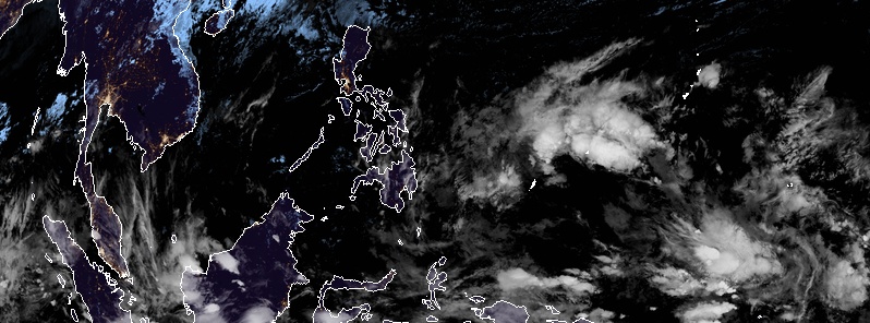
Image credit: JMA/Himawari-8. Acquired: 14:50 UTC, January 18, 2019.
A low pressure area, once known as Tropical Depression 01W is likely to redevelop into a tropical depression east of the Philippines over the next 24 hours or more and be named Amang as it approaches the country. Heavy rainfall is expected, possibly up to 400 mm (15.7 inches).
A low pressure area which will likely develop into a tropical depression and be named Amang over the next couple of days was estimated to be located about 1 390 km (863 miles) east of Mindanao at 00:00 UTC, January 18. The low is expected to be about 720 km (447 miles) E of Mindanao by Saturday, January 19.
Cagayan Valley region and Cordillera administrative region will have cloudy periods with light rains while the rest of the country including Metro Manila will be partly cloudy aside from isolated rain showers and thunderstorms on Saturday, while, on the second half, cloudy skies with light to moderate rains will be expected in Eastern Visayas, Caraga, Compostela Valley, and Davao Oriental.
The low is expected to strengthen into Tropical Depression "Amang" by Sunday and be located about 100 km (62 miles) east of Hinatuan, Surigao del Sur, PAGASA said.
Eastern Visayas, Caraga, Compostela Valley, Davao del Norte, Davao Oriental, Misamis Oriental, Bukidnon, and Lanao del Sur will be cloudy to overcast with occasional rains becoming moderate to sometimes heavy as Amang develops and moves closer to Mindanao.
Amang is forecast to be located in the vicinity of Dumaguete City on Monday, January 21 and reach southern waters of Negros Oriental by Tuesday, January 22.
Visayas and Mindanao will be cloudy with rains and gusts becoming heavy over the Bicol region, Eastern and Central Visayas, the southern portion of Western Visayas, Compostela Valley, Davao Oriental, northern Mindanao, and Zamboanga peninsula, as Amang moves into the southern islands of Visayas.
Partly cloudy to cloudy skies with scattered rain showers and thunderstorms will be experienced in a southern part of Calabarzon and the Mimaropa while the rest of Luzon including Metro Manila will be partly cloudy to cloudy with isolated rain showers.

Available data does not justify issuance of numbered tropical cyclone warnings at this time, JTWC said 07:00 UTC, January 18.
Winds in the area are estimated to be 37 to 46 km/h (23 to 29 mph). MetSat imagery at 06:30 UTC today indicates that a circulation center is located near 6.5n 138.3e. The system is moving westward at 11 km/h (7 mph). Minimum sea level pressure is estimated to be near 1 003 hPa.
Animated multispectral satellite imagery depicts low level cloud lines wrapping tightly into a well defined low level circulaton center with flaring convection in the western quadrant.
The upper level environment is marginally favorable with low to moderate vertical wind shear and strong divergence. Sea surface temperatures remain favorable (28 – 30 °C / 82 – 86 °F).
Global models are in agreement with a continued westward track and gradual development prior to landfall over Mindanao, JTWC said.
The potential for the development of a significant tropical cyclone within the next 24 hours is high.
I'm a dedicated researcher, journalist, and editor at The Watchers. With over 20 years of experience in the media industry, I specialize in hard science news, focusing on extreme weather, seismic and volcanic activity, space weather, and astronomy, including near-Earth objects and planetary defense strategies. You can reach me at teo /at/ watchers.news.
Commenting rules and guidelines
We value the thoughts and opinions of our readers and welcome healthy discussions on our website. In order to maintain a respectful and positive community, we ask that all commenters follow these rules.