
Tropical Storm “Rumbia” forms, about to make landfall near Shanghai, China
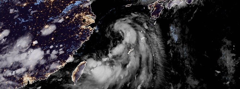
Image credit: JMA/Himawari-8, RAMMB/CIRA
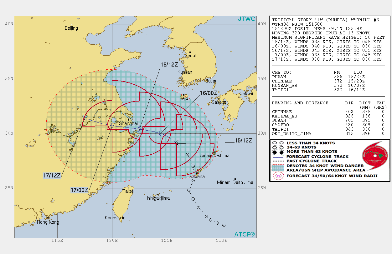
Tropical Storm "Rumbia" formed August 15, 2018, in the East China Sea as the 18th named storm of the 2018 Pacific typhoon season. The system is expected to continue intensifying, reaching maximum sustained winds of 85 km/h (53 mph) before making landfall near Shanghai, China around 12:00 UTC on August 16.
At 15:00 UTC on August 15, Tropical Storm "Rumbia" was located about 344 km (186 miles) north-northwest of Okinawa, Japan and 480 km (300 miles) east of Shanghai, China.
Its 10-minute sustained winds were 65 km/h (40 mph) with gusts up to 95 km/h (60 mph). The system had the minimum barometric pressure of 996 ha and was moving northwestward at 22 km/h (14 mph).
Heavy rain is still lashing Japanese islands but the roughest of winds are well northwest of Okinawa.
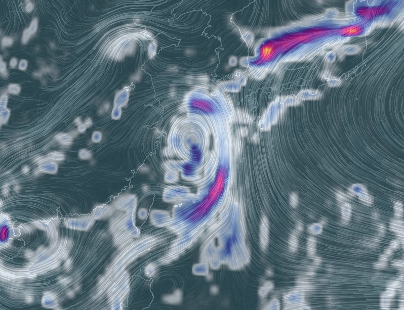
3-hour precipitation accumulation at 18:00 UTC on August 15, 2018. Credit: earth.nullschool.net
The current forecast track takes Rumbia very close to Shanghai on August 16. The cyclone is expected to peak at 85 km/h (53 mph) just before landfall.
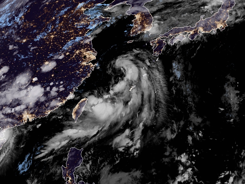
Tropical Storm "Rumbia" at 12:20 UTC on August 15, 2018. Credit: JMA/Himawari-8, RAMMB/CIRA
I'm a dedicated researcher, journalist, and editor at The Watchers. With over 20 years of experience in the media industry, I specialize in hard science news, focusing on extreme weather, seismic and volcanic activity, space weather, and astronomy, including near-Earth objects and planetary defense strategies. You can reach me at teo /at/ watchers.news.
Commenting rules and guidelines
We value the thoughts and opinions of our readers and welcome healthy discussions on our website. In order to maintain a respectful and positive community, we ask that all commenters follow these rules.