
Tropical Cyclone “Fehi” forms near New Caledonia, heading toward New Zealand
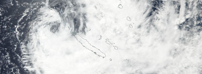
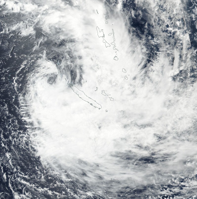
Featured image: Tropical Cyclone "Fehi" on January 29, 2018. Credit: NASA/NOAA Suomi NPP
Tropical Cyclone "Fehi" formed late Sunday, January 28, 2018 (UTC) just west of New Caledonia as the first named storm of the 2017/18 South Pacific tropical cyclone season. Fehi is expected to produce heavy rain over New Caledonia and the Vanuatu group today and tomorrow, with flooding expected over low lying areas.
This cyclone is expected to be declassified as a tropical cyclone over the next day or so as it moves southeast into the Tasman Sea and then re-intensify as it enters mid-latitudes. Fehi or its remnants are expected to reach South Island, New Zealand with very heavy rain and cross the country on February 1.
Heavy rain is already falling over New Caledonia, causing floods:
Fortes pluies et inondations à Poindimié suite à la Dépression #Fehi en #NouvelleCalédonie pic.twitter.com/lZzTsYrvwF
— Aurely (@kanakwoman) January 29, 2018
Dépression #Fehi : le Nord de la #NouvelleCaledonie en proie à de fortes précipitations https://t.co/aN4Xe2XFzx pic.twitter.com/S0oYf9QXOg
— La1ere.fr (@la1ere) January 29, 2018
As of 09:00 UTC on January 29, the center of Tropical Cyclone "Fehi" was located 372 km (231 miles) WNW of Noumea, New Caledonia and was tracking SSE at 20 km/h (12.6 mph) over the past six hours. Its maximum sustained winds at the time were 83 km/h (52 mph) and gusts to 102 km/h (63 mph).
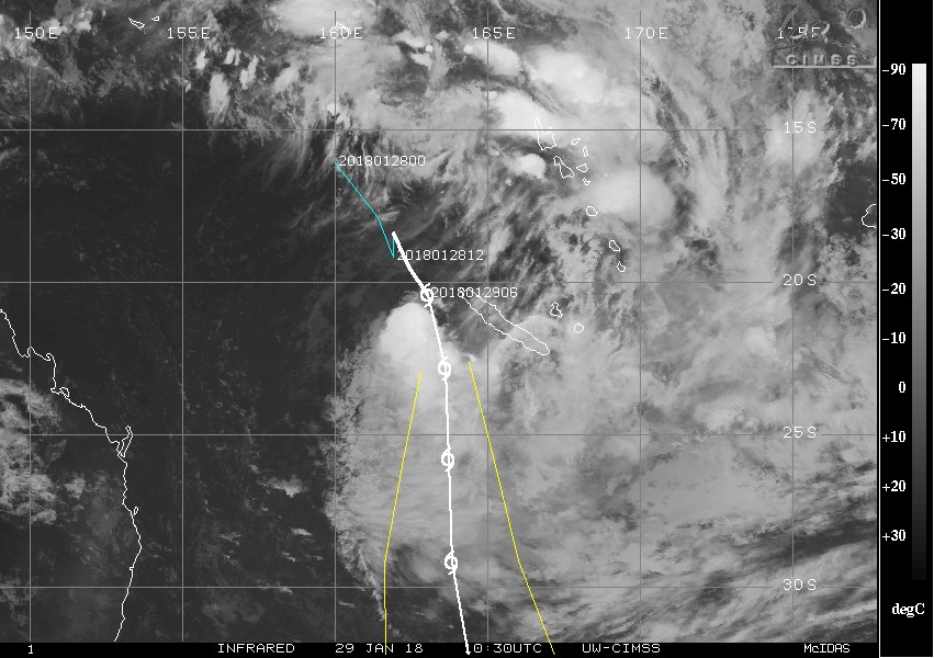
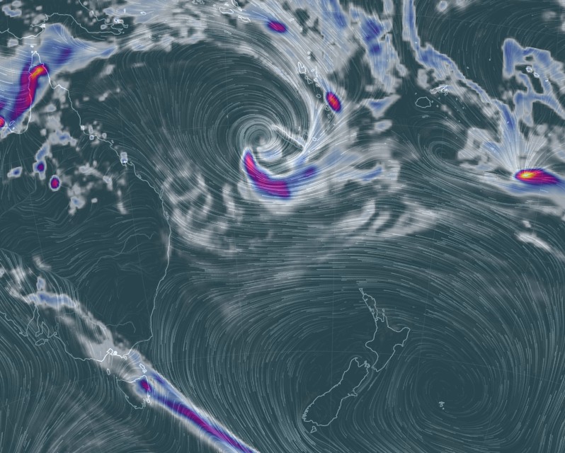
Credit: UW-CIMSS
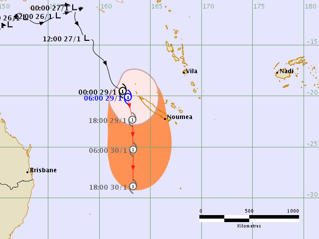
Tropical Cyclone "Fehi" RSMC Nadi forecast track at 07:24 UTC on January 29, 2018.
"Animated multispectral imagery depicts a partially exposed low level circulation center, with convection being sheared to the south, near the poleward end of an active South Pacific Convergence Zone," JTWC noted.
Upper level analysis indicated the vertical wind shear is strong and sea surface temperatures marginal, preventing further development. Fehi should remain near 40 – 45 kt over the next 24 hours and begin the extratropical transition by 18:00 UTC on January 30. The transition is expected to complete by 09:00 UTC on January 31, and models are indicating the system will slightly re-intensify as a cold-core system and expand its wind field as it enters mid-latitudes.
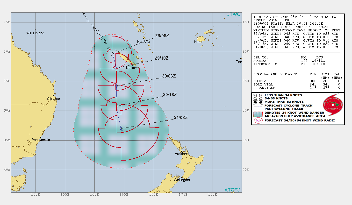
Credit: JTWC
Tropical Cyclone "Fehi" on January 29, 2018. Credit: NASA/NOAA Suomi NPP
Tropical Cyclone "Fehi" 3hr precipitation accumulation at 12:00 UTC on January 29, 2018. Credit: earth.nulschool.net
The warmer than usual waters around New Zealand will help fuel this storm and keep very heavy rain and winds going as it approaches New Zealand's western coastline and then crosses the country on Thursday, February 1, WeatherWatch forecasters warned. There is a chance of flooding from this low as well as wind damage. Seas will also be especially rough in western areas later this week.
"This tropical storm is certainly one to watch and all holidaymakers, trampers and those in rural areas should be well aware of the potential for severe weather it may create."
I'm a dedicated researcher, journalist, and editor at The Watchers. With over 20 years of experience in the media industry, I specialize in hard science news, focusing on extreme weather, seismic and volcanic activity, space weather, and astronomy, including near-Earth objects and planetary defense strategies. You can reach me at teo /at/ watchers.news.
Commenting rules and guidelines
We value the thoughts and opinions of our readers and welcome healthy discussions on our website. In order to maintain a respectful and positive community, we ask that all commenters follow these rules.