
Strong cold front affecting US, followed by another blast of very cold Arctic air
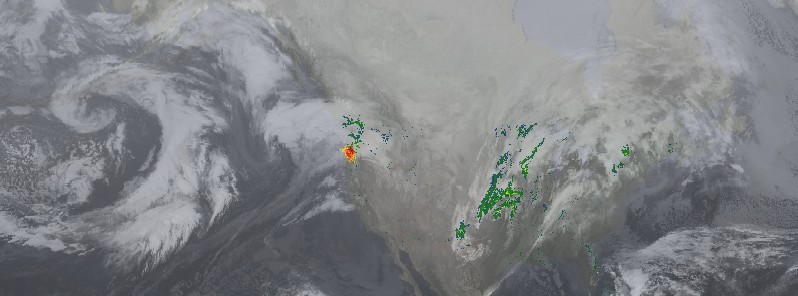
Featured image: IR and radar reflectivity at 11:00 UTC on January 11, 2018. Credit: SSEC/UW-CIMSS
A new winter storm, named Hunter by The Weather Channel, will bring heavy snow, freezing rain and sleet from the West to the Plains, Midwest and Northeast through Saturday, January 13, 2018. The storm is followed by another blast of very cold Arctic air, expected to reach as far south as southern Texas and Florida. Temperatures will be 5.5 – 14 °C (10 – 25 °F) below normal for this time of year. Consequently, wind chill advisories are in effect for portions of the northern High Plains and northern Plains as wind chill values could reach -34 °C (-30 °F).
A strong cold front followed by an Arctic airmass will swiftly move eastward from the Plains through the Mississippi Valley on Thursday, January 11, NWS forecaster Reinhart noted 07:29 UTC.
Late Thursday night and Friday, January 12, the front will push across the Ohio and Tennessee Valleys in addition to the Southeast. Finally, by Friday night and into Saturday, January 13, the cold front will approach the East Coast and linger in New England by Saturday.
"Precipitation will follow behind the front over the next few days, and with temperatures falling, wintry mix along with snow will be possible," Reinhart said.
The heaviest mixed precipitation/ice on Thursday will occur along the western edges of the Ohio and Tennessee Valleys with the heaviest snow in the Upper Midwest/upper Great Lakes in addition to portions of the Ohio Valley.
Wintry mix will spread into the interior of New England and the Northeast along with central portions of the Ohio and Tennessee Valleys on Friday. In addition, heavy snow can be expected along the lower Great Lakes.
This winter storm will move through New England on Saturday by having the bulk of wintry mix and snow in this region.
Travel throughout the Plains to the Northeast will be dangerous as icy conditions are possible. Rain and embedded thunderstorms will occur from the Southeast to the Mid-Atlantic over the next few days as the front moves throughout these areas.
Very cold conditions will follow the strong cold front due to the Arctic airmass following it, NWS warns.
High temperatures will be below zero throughout the northern Plains today, and temperatures below freezing across the central Plains and Upper Midwest. These temperatures are 5.5 – 14 °C (10 – 25 °F) below normal for this time of year.
Consequently, wind chill advisories are in effect for portions of the northern High Plains and northern Plains as wind chill values could reach -34 °C (-30 °F).
In contrast, areas east of the Mississippi Valley will experience temperatures up to 16 °C (30 °F) above average for this time of year today. By Saturday, most areas in the eastern US will be near or below average with the exception to coastal Mid-Atlantic/coastal New England.
I'm a dedicated researcher, journalist, and editor at The Watchers. With over 20 years of experience in the media industry, I specialize in hard science news, focusing on extreme weather, seismic and volcanic activity, space weather, and astronomy, including near-Earth objects and planetary defense strategies. You can reach me at teo /at/ watchers.news.
Commenting rules and guidelines
We value the thoughts and opinions of our readers and welcome healthy discussions on our website. In order to maintain a respectful and positive community, we ask that all commenters follow these rules.