
Eruptive activity at Ambae remains stable, Alert Level lowered to 3
Featured image: Ambae volcano on September 29, 2017. Credit: Patrice Kautonga
The eruptive activity remains stable at Ambae (Aoba) volcano in Vanuatu and the Alert Level was lowered to Level 3 from Level 4 on October 6, 2017, the Vanuatu Meteorology and Geohazards Department (VMGD) reported 04:11 UTC (15:11 local time) today.
The volcanic eruption at Ambae is continuing but remains stable and confined to Lake Voui, VMGD reports. Further scientific analyses confirm that there is currently no evidence of escalation of the activity. As a consequence, the Volcanic Alert Level is lowered to Level 3 from Level 4. The volcanic eruption is likely to continue in a steady state. The danger is restricted to the danger zone that extends 3 km (1.8 miles) from the active vent in Lake Voui.
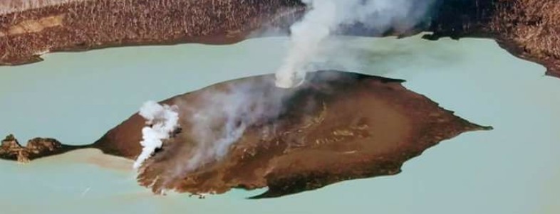
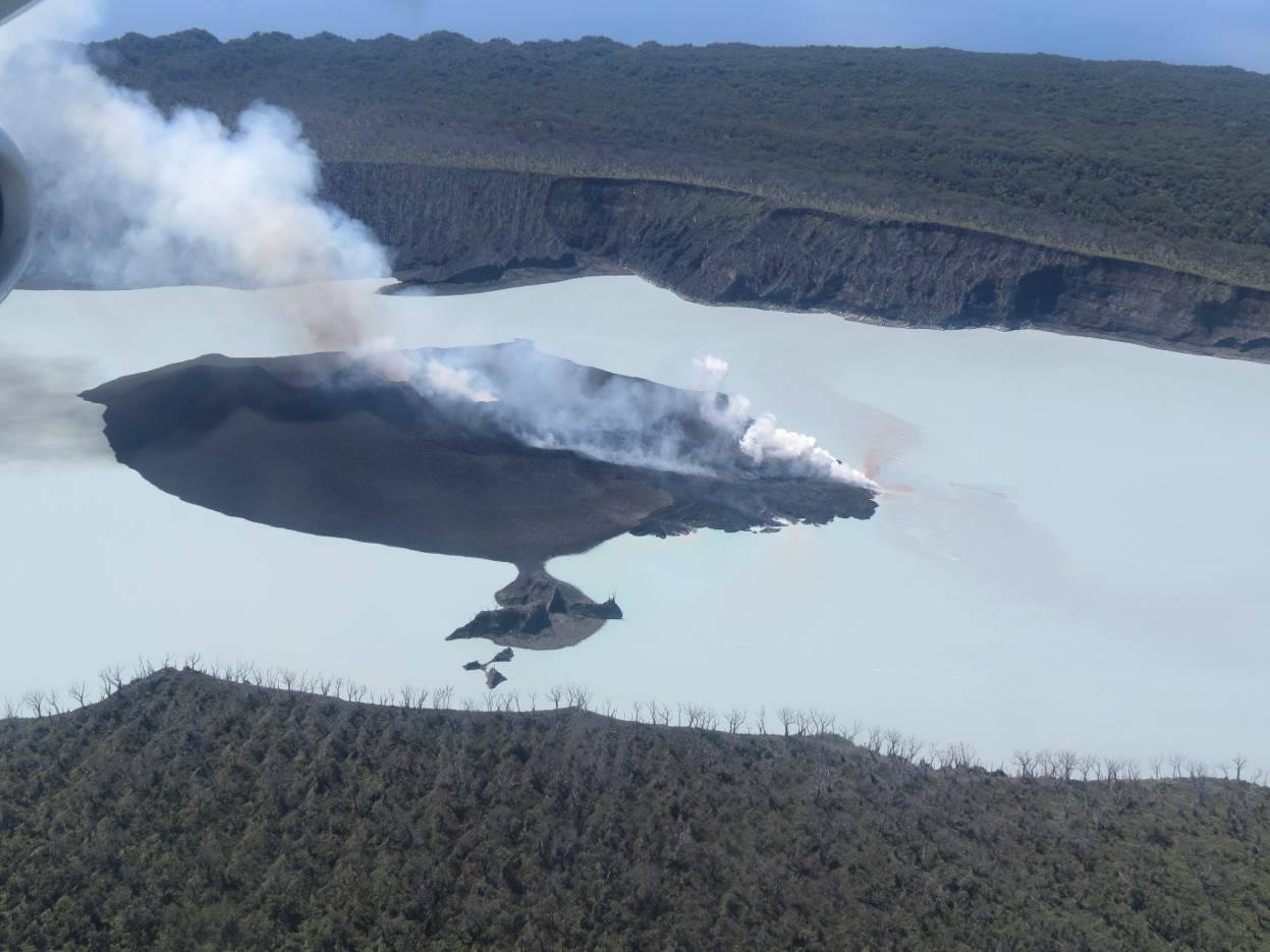
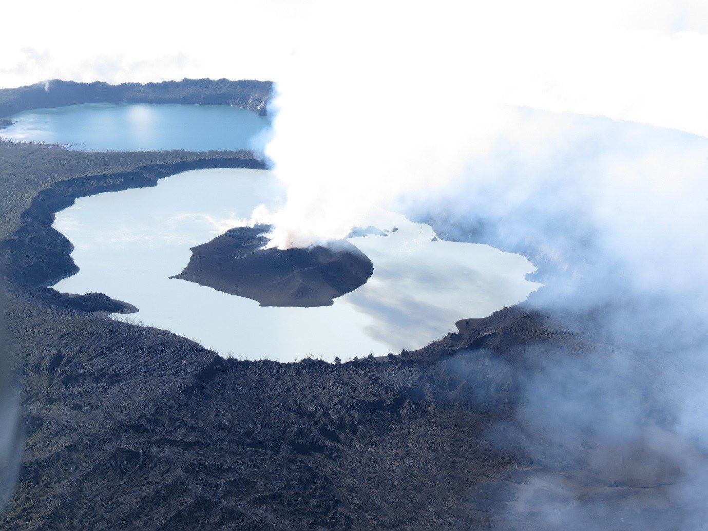
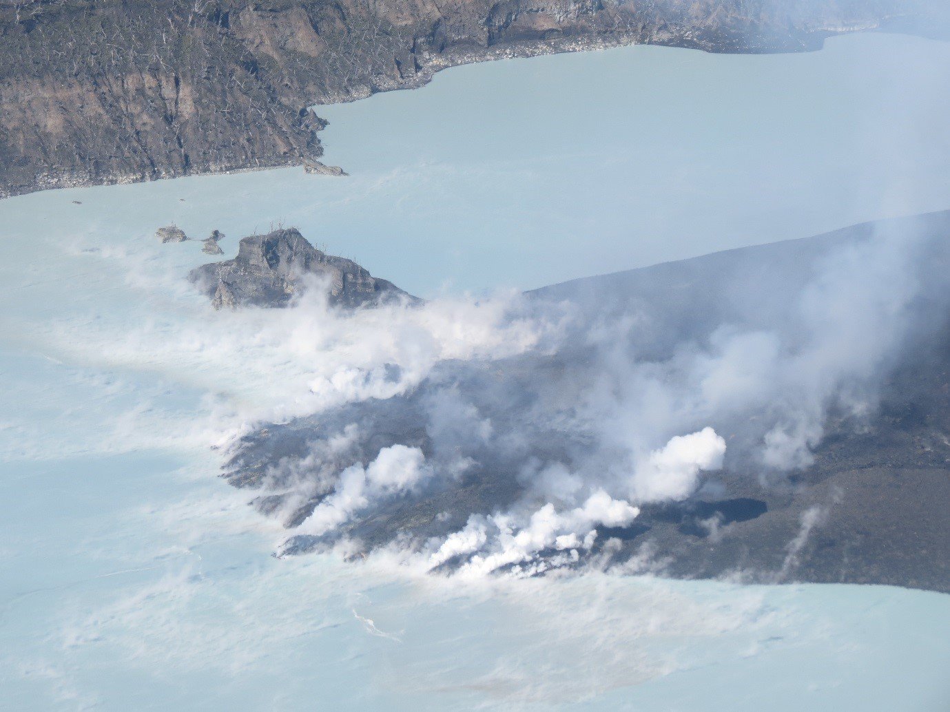
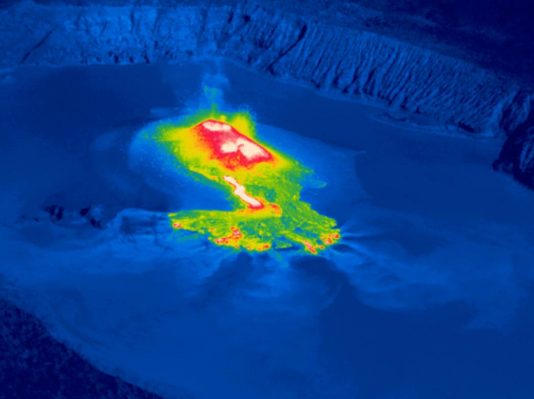
Observation flights conducted on September 30, October 1, 3 and 5, 2017 confirm the activity at the volcano is only occurring in one of the summit crater lakes (Lake Voui) and is not changing. Photographs and thermal infrared images taken during observation flights show the activity consists of small explosions and ejection of hot rocks from vents on the new small island in the lake. There is also a small lava flow from the island into the lake. A small-scale eruption continues in Lake Voui at Ambae volcano.
Ambae (Aoba) volcano – October 3, 2017. Credit: VMGD
These observations and the analysis of seismic, gas and deformation data by scientists from the VMGD and international scientists confirm that the volcano has settled in a more stable state of activity. The activity at Ambae is like what is seen and experienced at Yasur on Tanna Island. The local population can hear some of the explosions and see the glow over the mountain at night.
Ambae (Aoba) volcano – October 3, 2017. Credit: VMGD
Ambae (Aoba) volcano – October 3, 2017. Credit: VMGD
The eruption at Ambae started in September, when the Volcanic Alert Level was raised to Level 3. The volcanic activity has built a volcanic cone (island) in Lake Voui. The cone building phase produced the largest explosions and ashfalls. Some parts of the island experienced ashfalls from this phase of the eruption. The eruptions in mid-September 2017 are similar to those in 2005.
The style of the eruption changed around September 22 when Geohazards staff observed lava (molten rock) at the surface for the first time. This was a significant change and raised the level of uncertainty about the development of the eruption. The volcanic Alert Level was also raised at that time to Level 4.
Ambae (Aoba) volcano – October 3, 2017. Credit: VMGD
Ambae volcano is a very large volcano and is frequently active. In the recorded history, there have been many eruptions, every 10-50 years over the past 150 years. All have been from the summit craters, except one recorded in 1670’s when a lava flow occurred in the Ndui Ndui area. The current eruption is focused in the summit crater and there are no indications of activity elsewhere on Ambae Island.
The danger zone is now within 3 km (1.8 miles) from the vent in Lake Voui. In this area flying rock and volcanic gases may be present (see map below).
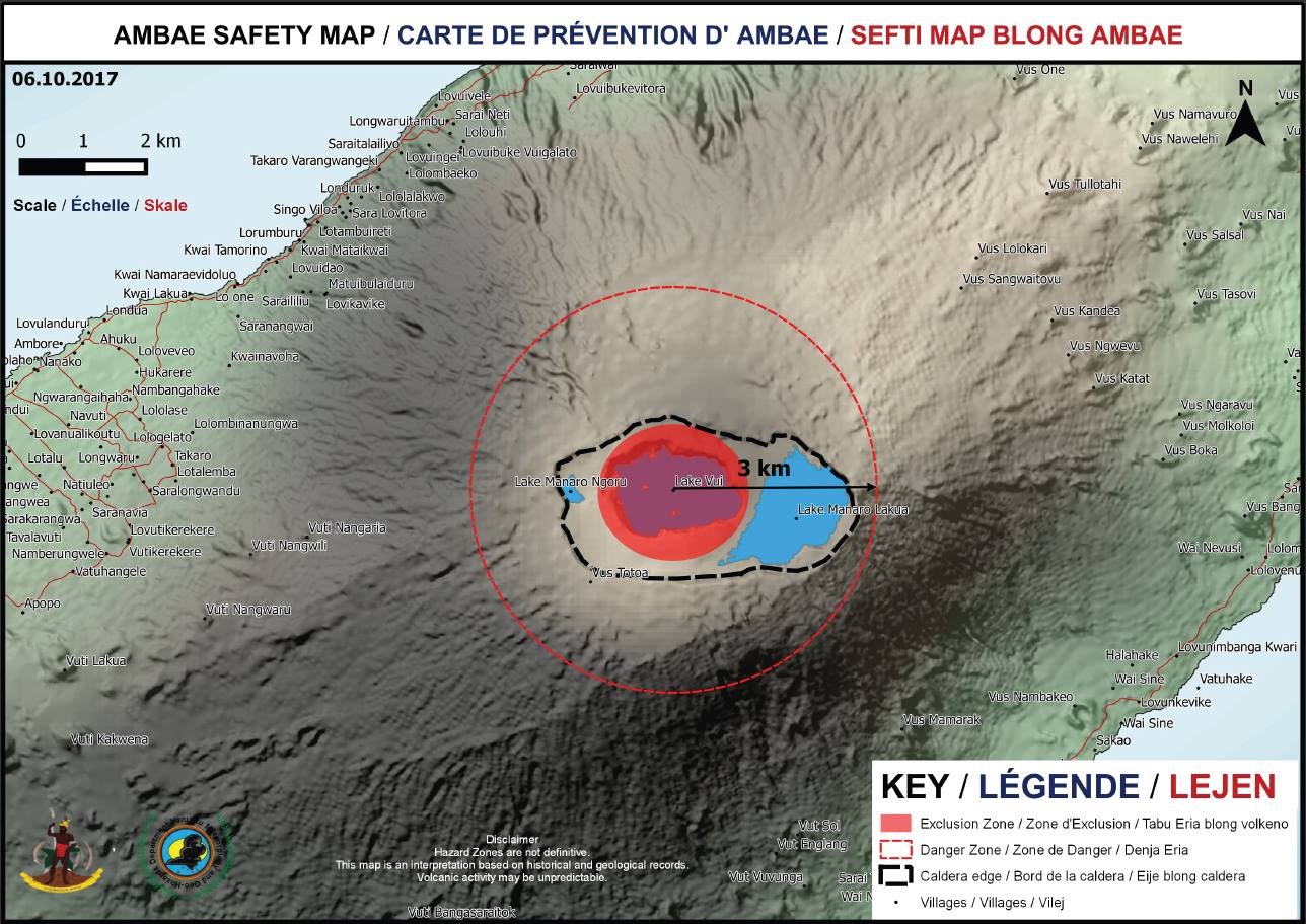
Ambae volcano safety map – October 6, 2017. Credit: VMGD
Villages located further away may experience volcanic hazards from gas plumes, especially villages exposed to prevailing trade winds direction.
Geological summary
Aoba, also known as Ambae, is a massive 2 500 km3 (600 mi3) basaltic shield volcano that is the most voluminous volcano of the New Hebrides archipelago. A pronounced NE-SW-trending rift zone dotted with scoria cones gives the 16 x 38 km (10 x 23.6 miles) island an elongated form.
A broad pyroclastic cone containing three crater lakes is located at the summit of the Hawaiian-style shield volcano within the youngest of at least two nested calderas, the largest of which is 6 km (3.7 miles) in diameter. Post-caldera explosive eruptions formed the summit craters of Lake Voui (also spelled Vui) and Lake Manaro Ngoru about 360 years ago. A tuff cone was constructed within Lake Voui about 60 years later.
The latest known flank eruption, about 300 years ago, destroyed the population of the Nduindui area near the western coast. (GVP)
I'm a dedicated researcher, journalist, and editor at The Watchers. With over 20 years of experience in the media industry, I specialize in hard science news, focusing on extreme weather, seismic and volcanic activity, space weather, and astronomy, including near-Earth objects and planetary defense strategies. You can reach me at teo /at/ watchers.news.
Commenting rules and guidelines
We value the thoughts and opinions of our readers and welcome healthy discussions on our website. In order to maintain a respectful and positive community, we ask that all commenters follow these rules.