
Early-season cold system to spread heavy snow across western US and Canada
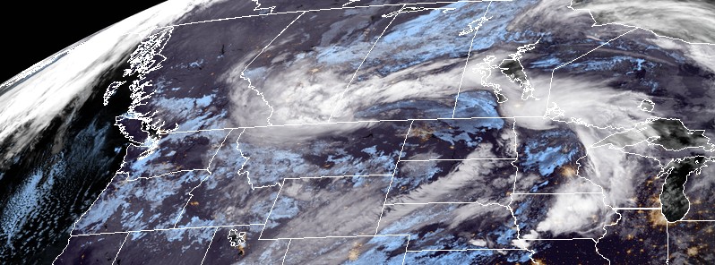
Image credit: NOAA/GOES-16 (preliminary and non-operational). Acquired: 12:30 UTC, October 2, 2017.
An early-season cold weather system could bring 30 cm (12 inches) or more of snow in the higher elevations of the central and northern Rockies early this week; snow could even fall at lower elevations in parts of Montana, NWS warns. The cold front separating this cold air in the west and warmer temperatures in the eastern US will continue to be a focus for heavy rain in the Plains early this week. Winter Storm Warnings are in place in neighboring Alberta, Canada.
A deep upper-level trough will continue to dig into the western third of the US through midweek. Much of the Intermountain West will have snow in the higher terrain over the next few days, with a vast portion of Montana getting strong winds and heavy snow as a surface low pressure center slowly lifts northeast into southern Canada.
Showers and thunderstorms are expected to develop along and ahead of the cold front over the Central and Northern Plains. There is a slight risk that this area could have excessive rainfall and flash flooding conditions.
"A significant snowstorm is set to unfold across the northwestern United States early this week. Temperatures are expected to run 11.1 °C (20 °F) to as much as 19.4 °C (35 °F) below normal, with record-low temperatures likely in many locations across the northern Rockies through midweek," said AccuWeather meteorologist Kyle Elliott.
"Snow levels will dip to below 1.5 km (5 000 feet), meaning that cities such as Great Falls and Helena, Montana, may receive 152 mm (6 inches) to as much as 305 mm (12 inches) of snow from the storm," said Elliott. "Cities such as Billings, Bozeman and Missoula, Montana, are expected to remain warm enough to allow any snow to melt on contact with the ground."
The same weather system is expected to produce hazardous winter conditions across the border in Alberta where Environment Canada has issued a Winter Storm Warning.
The warning was issued in Calgary in light of a low pressure system that is expected to bring snow to portions of the province on Monday. According to Environment Canada, snowfall totals for parts of southeastern Alberta will reach over 20 cm (7.9 inches) by Monday night, with the highest amounts expected near the Cypress Hills.
In Calgary, Global News meteorologist Jordan Witzel says snowfall amounts are expected to reach up to 10 cm (3.9 inches) on Monday, with wind gusts reaching up to 60 km/h (37 mph) throughout the evening.
Environment Canada warns these strong winds will combine with the falling snow to reduce visibilities in some areas. "Surfaces such as highways, roads, walkways and parking lots may become difficult to navigate due to accumulating snow."
I'm a dedicated researcher, journalist, and editor at The Watchers. With over 20 years of experience in the media industry, I specialize in hard science news, focusing on extreme weather, seismic and volcanic activity, space weather, and astronomy, including near-Earth objects and planetary defense strategies. You can reach me at teo /at/ watchers.news.
Commenting rules and guidelines
We value the thoughts and opinions of our readers and welcome healthy discussions on our website. In order to maintain a respectful and positive community, we ask that all commenters follow these rules.