
Extremely dangerous low pressure moving across the Atlantic
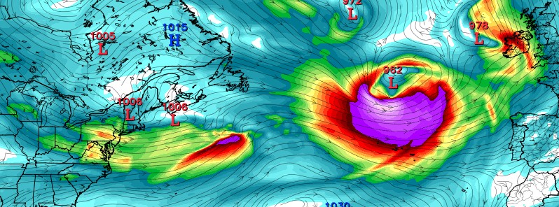
Image credit: NWS/GFS
A very powerful storm is forming off the coast of eastern United States today and is expected to move across the Atlantic toward Europe over the next couple of days. NWS Ocean Prediction Center describes the storm as extremely dangerous.
Official OPC forecast calls for winds up to 128 km/h (80 mph) and significant waves to 15 m (50 feet) within the next 48 hours, the center said 11:00 UTC today.
The storm was 1005 hPa during the early morning UTC hours of January 30, 2017, but it is expected to drop to 957 hPa over the next 72 hours.
The storm will be moving across the Atlantic over the next 5 days.
GWES probabilistic guidance calls for first significant waves to reach Portugal and Spain on February 2.
GWES probabilistic guidance (% wave heights>30 ft) portend an extremely dangerous low pressure moving across the Atlantic next 5 days pic.twitter.com/RpBiQRz9IJ
— NWS OPC (@NWSOPC) January 30, 2017
OPC 48 hour #Atlantic surface & wind/wave #forecast charts highlighting the expected #hurricane force low expected in the Central Atlantic. pic.twitter.com/ZB6rEOeDmm
— NWS OPC (@NWSOPC) January 30, 2017
The Watchers team and our contributors bring the latest on extreme weather, earthquakes, volcanic eruptions, space weather, and all things science. We're all about making sense of the natural world and keeping you informed on what’s happening. Got a tip or a question? Hit us up using the form at newstips!
Commenting rules and guidelines
We value the thoughts and opinions of our readers and welcome healthy discussions on our website. In order to maintain a respectful and positive community, we ask that all commenters follow these rules.