
Strong and shallow M6.3 earthquake hits near Macquarie Island, Australia
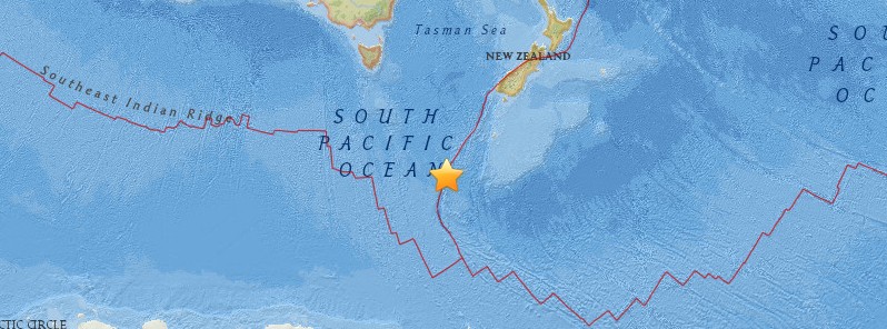
Image credit: USGS
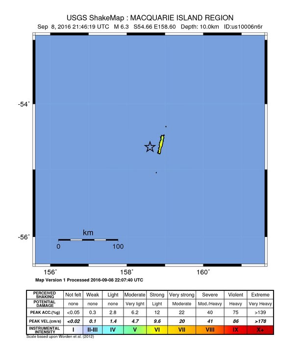
A strong and shallow earthquake registered by the USGS as M6.3 (downgraded from M6.7) hit near Macquarie Island, Australia at 21:46 UTC on September 8, 2016. The agency is reporting a depth of 10 km (6.2 miles). Geoscience Australia is reporting M6.3 at a depth of 0 km.
According to the USGS, the epicenter was located 29 km (17 miles) SW of Macquarie Island, Australia, 1 119.8 km (695.8 miles) SW of Bluff (population 1 938) and 1 139 km (707.7 miles) SW of Invercargill (population 47 297), New Zealand.
There are no people living within 100 km (62 miles).
Based on all available data, there is no tsunami threat from this earthquake, PTWC said.
The Watchers team and our contributors bring the latest on extreme weather, earthquakes, volcanic eruptions, space weather, and all things science. We're all about making sense of the natural world and keeping you informed on what’s happening. Got a tip or a question? Hit us up using the form at newstips!
Commenting rules and guidelines
We value the thoughts and opinions of our readers and welcome healthy discussions on our website. In order to maintain a respectful and positive community, we ask that all commenters follow these rules.