
Strong M6.8 earthquake hits Macquarie Island region
A strong and shallow earthquake registered by the USGS as M6.8 hit the Macquarie Island region at 14:53 UTC on April 29, 2025. The agency reports a depth of 4.5 km (2.8 miles). EMSC is reporting M6.8 at a depth of 10 km (6.2 miles). Macquarie Island is located about halfway between Antarctica and New Zealand.
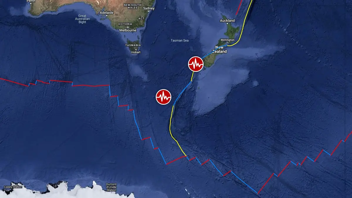
Image credit: TW/SAM, Google
This was the second M6+ earthquake in 2 hours along the Macquarie Ridge Complex, a major plate boundary south of New Zealand.
The epicenter was located about 1 235 km (768 miles) SW of Bluff, Southland, New Zealand, and 1 398 km (869 miles) SSW of Kingston, Tasmania, Australia.
Based on all available data, there is no tsunami threat from this earthquake, NWS PTWC said.
The USGS issued a Green alert for shaking-related fatalities and economic losses. There is a low likelihood of casualties and damage.

The earthquake follows an M6.2 earthquake located near the coast of South Island, New Zealand, approximately 900 km (560 miles) to the north-northeast.
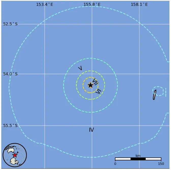
Estimated population exposure to earthquake shaking
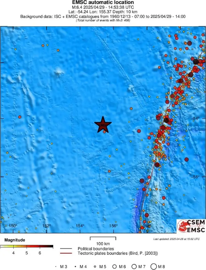
Regional seismicity
References:
1 M6.8 earthquake Macquarie Island – USGS – April 29, 2025
2 M6.8 earthquake Macquarie Island – EMSC – April 29, 2025
3 M6.8 earthquake Macquarie Island – PTWC – April 29, 2025
I'm a dedicated researcher, journalist, and editor at The Watchers. With over 20 years of experience in the media industry, I specialize in hard science news, focusing on extreme weather, seismic and volcanic activity, space weather, and astronomy, including near-Earth objects and planetary defense strategies. You can reach me at teo /at/ watchers.news.
Commenting rules and guidelines
We value the thoughts and opinions of our readers and welcome healthy discussions on our website. In order to maintain a respectful and positive community, we ask that all commenters follow these rules.