
Nepartak forms as the first tropical storm of the 2016 Pacific typhoon season
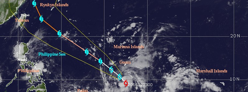
Featured image: Tropical Storm "Nepartak" at 10:30 UTC on July 3, 2016. Credit: UW-CIMSS
A low pressure area formed well south of the Mariana Islands during the last few days of June 2016. By July 2, it developed into a weak tropical depression and strengthened into a tropical storm on July 3, internationally known as Nepartak.
Nepartak is the first named storm of the 2016 Pacific typhoon season, and the first internationally named storm in this region since December 2015.
Its formation came rather late in the season. Had it formed after July 8, it would hold a record for the latest first named storm of the northwest Pacific.
Nepartak is expected to continue strengthening and reach a maximum sustained wind speed of 203 km/h (126 mph) over Okinawa, Japan on July 7, according to JTWC's forecast track issued 09:00 UTC on July 3. There on, Nepartak should start weakening and turn away from China, toward Korea and mainland Japan.
At 09:00 UTC on July 3, Nepartak had a maximum sustained wind speed of 64 km/h (40 mph), with gusts to 83 km/h (52 mph). Its center was located approximately 87 km (54 miles) NE of Faraulep. The system has tracked at 7 km/h (4.6 mph) over the past six hours.
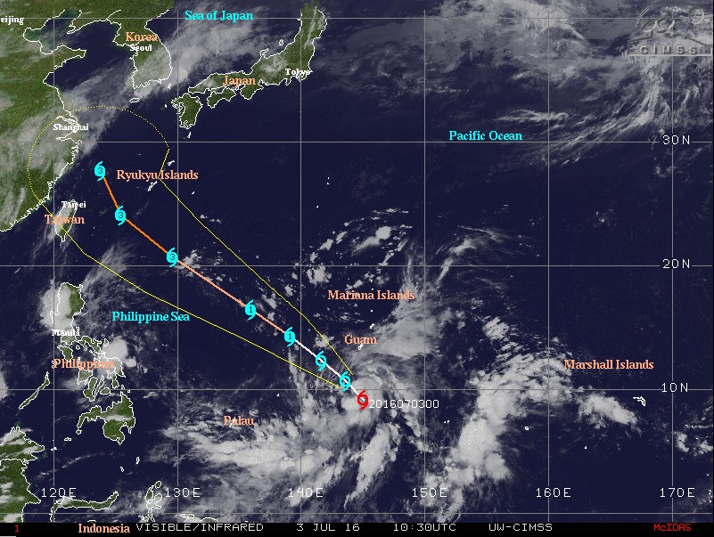
Tropical Storm "Nepartak" at 10:30 UTC on July 3. Forecast track is JTWC, issued 06:00 UTC on July 3. Credit: UW-CIMSS
Environmental conditions are currently conducive for intensification with radial outflow aloft, low (18 – 28 km/h / 11 – 17 mph) vertical wind shear and warm sea surface temperatures.
In the extended period, Nepartak is forecast to intensify to typhoon strength at a steady rate. Its speed of advance is also forecast to increase as it continues on a northwestern track.
"Available dynamical model guidance is in good agreement, differing slightly in the extended tau track, giving high confidence to the forecast," JTWC said.
Nepartak is expected to further fuel rainstorms over the already flooded Philippines.
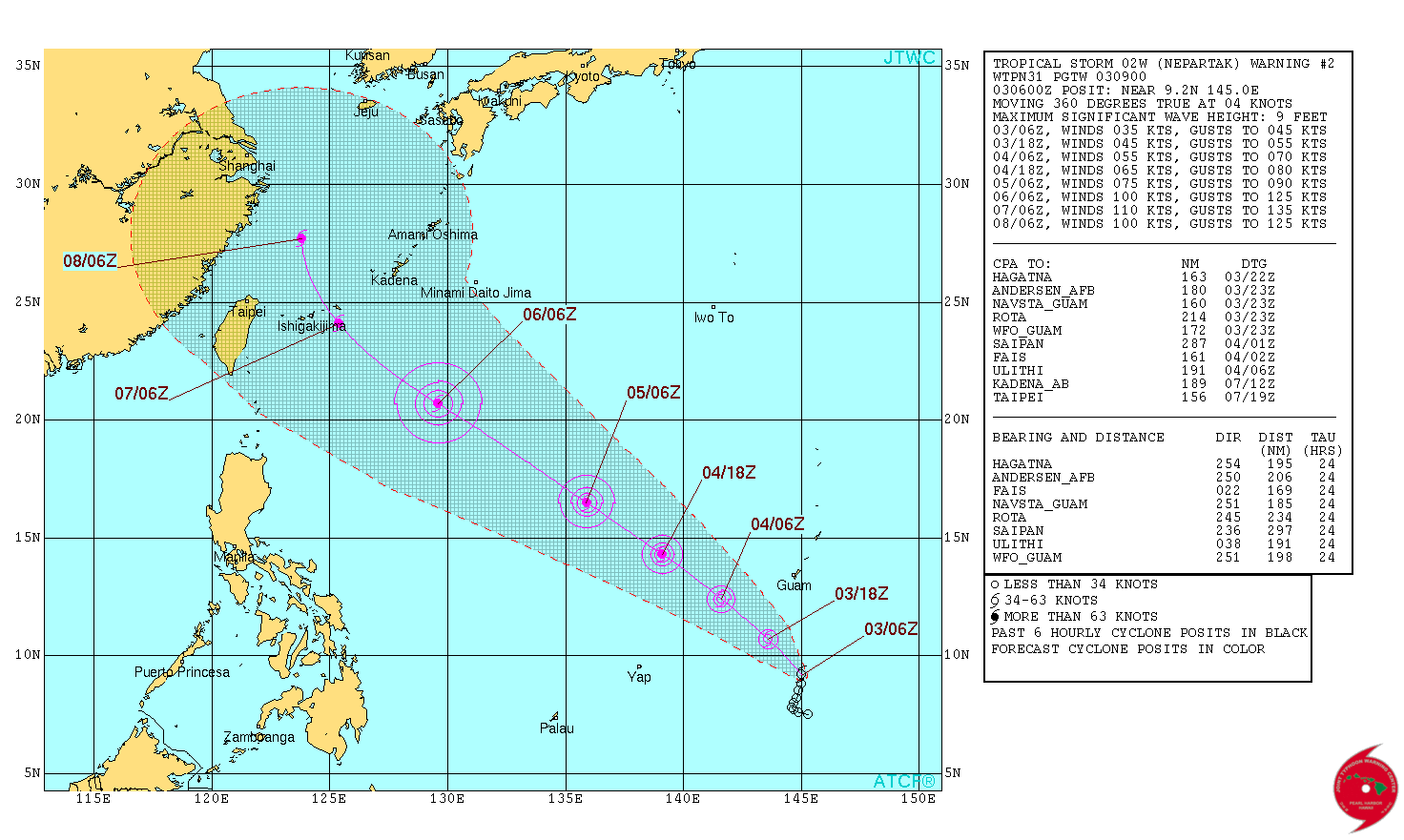
Tropical Storm "Nepartak" forecast track by JTWC at 09:00 UTC on July 3, 2016
The Watchers team and our contributors bring the latest on extreme weather, earthquakes, volcanic eruptions, space weather, and all things science. We're all about making sense of the natural world and keeping you informed on what’s happening. Got a tip or a question? Hit us up using the form at newstips!
Commenting rules and guidelines
We value the thoughts and opinions of our readers and welcome healthy discussions on our website. In order to maintain a respectful and positive community, we ask that all commenters follow these rules.