
Large, complex and dangerous weather system developing over Australia
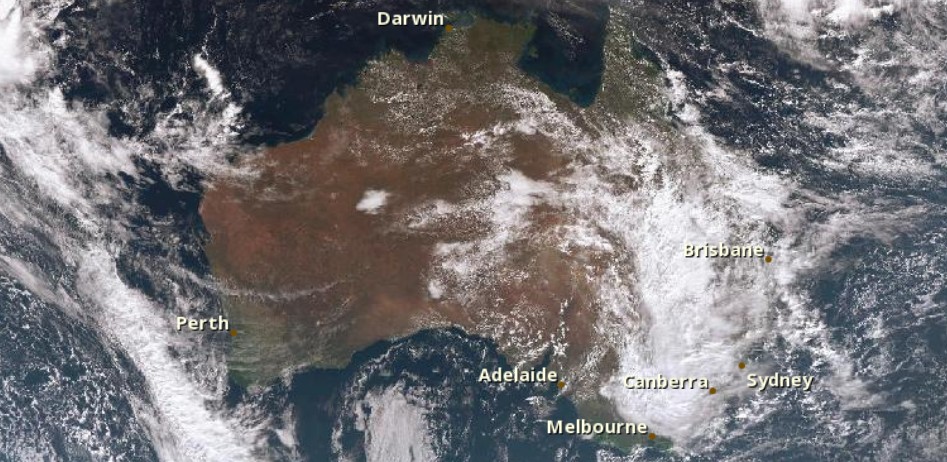
Image credit: JMA/Himawari via BOM (04:10 UTC on June 3, 2016)
The Australian Bureau of Meteorology warned residents in Australia's eastern states to pay close attention to local weather forecasts and warnings over the coming days as a large and complex weather system and developing East Coast Low will bring potentially serious impacts to some of Australia's most densely populated cities and regions. The main threats are severe rainfall, strong winds, riverine and flash flooding, huge seas and very dangerous surf, coastal inundation and beach erosion.
This dangerous system will affect parts of Queensland, New South Wales, Victoria and Tasmania this weekend and early next week.
Dr. Andrew Tupper, Bureau's National Operations Centre Director, said this is a very widespread event with potentially serious impacts on communities as far north as Fraser Island and as far south as Hobart. Severe weather warnings have been issued for New South Wales and Queensland, and are likely on Saturday, June 4, for Victoria and Tasmania.
"It will be a rough weekend for some communities with heavy rain, potential flooding, and damaging winds. A King Tide and huge seas will create very dangerous surf conditions which could lead to coastal inundation and beach erosion. Impacts will vary dramatically across different locations so it's important to stay up to date with forecasts and warnings for your region," Tupper warned.
Rainfall in the range of 20 to 80 mm (0.8 to 3.1 inches) is forecast across many locations. But with events like this, localized rainfall of 300 mm (11.8 inches) is possible in coastal and elevated areas.
Wild weather for the eastern states over the next few days. Stay safe & check warnings at https://t.co/wdUcA329Ly pic.twitter.com/dGGtASea1A
— BOM Australia (@BOM_au) June 3, 2016
Southeast Queensland and northern New South Wales will be first to receive a deluge of rainfall caused by a developing East Coast Low, on Friday, June 3.
Acting Queensland Regional Director Bruce Gunn said rainfall will increase to a range of 50 to 150 mm (1.9 to 5.9 inches) in coastal regions of southeast Queensland and northern NSW with the heaviest falls in these areas expected on Saturday afternoon.
"With events like this, localized rainfall in excess of 250 mm (9.8 inches) are possible, particularly in coastal areas and at elevation including the Sunshine Coast Hinterland and ranges extending south into NSW," he said.
The system is relatively fast moving, with conditions expected to ease on the northern fringe from Bundaberg to the Sunshine Coast Saturday afternoon, clearing Brisbane, the Gold Coast and northern NSW overnight Saturday.
Acting New South Wales Regional Director, Jane Golding, said as the system moves south it is likely to develop into an East Coast Low.
"The system will likely impact the entire NSW coast and adjacent ranges over the weekend, with widespread heavy rain and high winds that have the potential to cause riverine and flash flooding, bring trees down and cause property damage," she said.
NSW SES Acting Commissioner Greg Newton urged people to get ready now for the severe weather. “People can prevent damage to their homes by cleaning their gutters and downpipes, trimming overhanging branches and securing or putting away any loose items around the yard or balcony," Newton said.
"With the heavy rain forecast, we’re urging people to stay away from floodwater, particularly if you are driving. If you come across a flooded road, pull over and wait for the water to recede or turn around and find an alternate route. If people need emergency help in a flood or storm they can call the NSW SES on 132 500 but they should dial Triple Zero (000) if the situation is life threatening.”
Heavy rain, strong northeast winds and damaging surf are expected for northern and eastern Tasmania on Sunday and Monday, June 5 and 6.
The Bureau of Meteorology's Regional Director Tasmania John Bally said rainfall totals in excess of 100 mm (3.9 inches) are possible in the northeast and about the western tiers on Sunday.
"Falls in the range of 40 to 80 mm (1.6 to 3.1 inches) are likely for the remainder of the north and east, with further significant rainfall expected on Monday," Bally said.
Accumulated rainfall of 200 mm (7.9 inches) is possible in parts of the northeast over the course of this event.
The strong northeasterly airstream is likely to lead to damaging easterly wind gusts of 80 to 100 km/h (49.7 to 62.1 mph) through coastal areas in the north and east on Sunday and Monday.
Damaging surf conditions due to heavy northeast swells are expected about the east coast during Monday that may lead to significant coastal erosion.
.gif)
Members of the public are urged to stay tuned for updated forecasts and warnings, follow the advice of local emergency services and not to drive, ride or walk through flood water.
For further information. Including Flood and Weather Warnings, and rainfall and radar information, go to the Bureau's website www.bom.gov.au.
The Watchers team and our contributors bring the latest on extreme weather, earthquakes, volcanic eruptions, space weather, and all things science. We're all about making sense of the natural world and keeping you informed on what’s happening. Got a tip or a question? Hit us up using the form at newstips!
Commenting rules and guidelines
We value the thoughts and opinions of our readers and welcome healthy discussions on our website. In order to maintain a respectful and positive community, we ask that all commenters follow these rules.