
M4.2 earthquake registered under Bardarbunga, strongest since eruption ended in 2015

Featured image: Bardarbunga erupting on September 2, 2014. Credit: Stefano Di Nicolo (CC - Flickr)
A major earthquake measuring M4.2 on the Richter scale was registered 3.5 km (1.9 miles) under northern edge of the Bardarbunga volcanic craters at 00:10 UTC on April 8, 2016. This is the strongest quake to hit the volcano since it stopped erupting in February 2015.
By 16:29 UTC, Icelandic Met Office (IMO) registered 12 aftershocks, the most powerful of which was M3.5 at a depth of 4.3 km (2.7 miles).


Credit: IMO
Martin Hensch, IMO's earthquake specialist, said that there is no evidence of lava movements or of any eruption activity connected to the earthquakes, but that the situation will be monitored carefully. There were two quakes in the same location on April 3, measuring 3.4 and 3 on the Richter scale.
The recent eruption at Bardarbunga, known as Holuhraun eruption, lasted 6 months, from August 31, 2014 ~ February 28, 2015. Lava field produced by the eruption measured 85 km2 (32.8 mi2). Its average thickness was 10 – 14 m (33 – 46 feet) (max 40 m / 131 feet) and its volume was 1.4 km3 (20.4 mi2).

Seismic events in Bárðarbunga started August 16, 2014. Volcanic eruption began in Holuhraun August 31, 2014. This photo is taken January 31, 2015 of the lava field, by then closely approaching 85 km2. A month later, February 28, 2015, the eruption was declared over. Image copyright Ólafur Sigurjónsson.
Bardarbunga is the second highest mountain in Iceland, approximately 2 km (1.2 miles) above sea-level, located in northwestern Vatnajökull ice cap.
Its 11-km (6.8 miles) wide caldera is covered with approximately 850 m (0.52 miles) thick glacial ice. Inevitably, immense eruptions and explosive eruptions are a possibility in the system with imminent threat of ice melting in great magnitude causing a huge jökulhlaup (glacial outburst flood).
It is presumed that Jökulsárgljúfur and Ásbyrgi were created in such cataclysmic events in prehistoric times. Large jökulhlaup in Kelduhverfi in the 17th century are believed to be related to volcanic activity in Bárðarbunga.
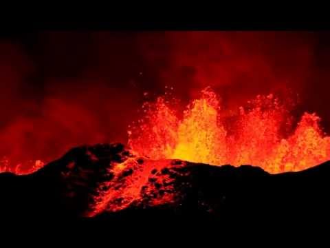
Video credit: Jiri VonDrak

Teo Blašković founded The Watchers in 2011 and edited it until 2026, covering seismic and volcanic activity, extreme weather, space weather and near-Earth objects. Articles on this page are his archive.
Published in the last 24 hours
- High Risk of excessive rainfall covers Florida’s Space Coast as St. Johns River near Cocoa reaches 5.67 m
- Four small asteroids will pass close to Earth from November 21 to 23
- Cyclone Akvan weakens after landfall near Gopalpur; more than 300 000 evacuated in Odisha, India
- A broad low over southeastern Florida and the northwestern Bahamas has a 30 percent chance of subtropical or tropical development within 48 hours and a 50 percent chance within 7 days, the National Hurricane Center says
