
Largest earthquakes since 2014 – 15 eruption hit Bardarbunga volcano, Iceland
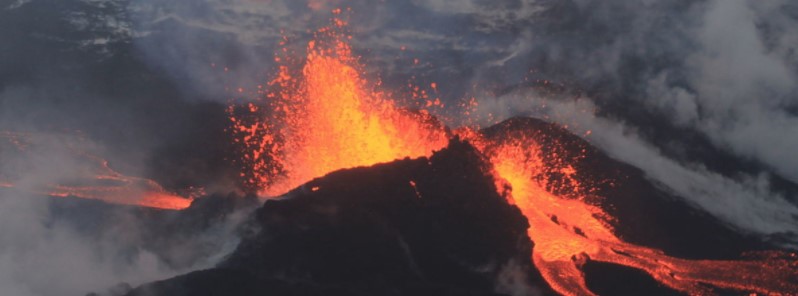
Featured image: Bardarbunga eruption on September 4, 2014. Credit: Peter Hartree
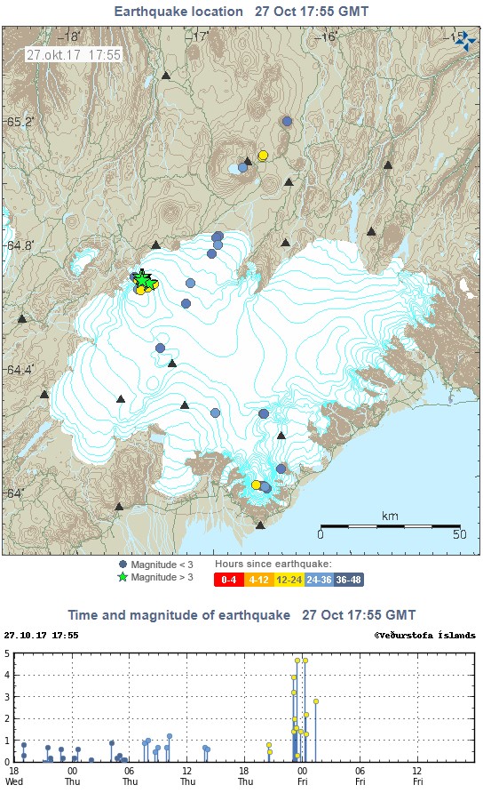
Over the past 48 hours, the Bardarbunga volcanic complex has been hit by 18 earthquakes with magnitudes ranging from 0.2 to 4.7, according to data provided by the Icelandic Met Office at 17:55 UTC, October 27, 2017. The last eruption of this volcano started in September 2014 and ended in February 2015.
The largest earthquakes were two M4.7, registered at 23:26 UTC on Thursday, October 26 (depth 5 km / 3.1 miles) and 00:16 UTC on October 27 (depth 3.1 km / 1.9 miles), respectively. These are the largest earthquake registered under Bardarbunga since the 2014 – 2015 eruption.
The office also registered one M3.9 at 23:02 UTC on October 26 at a depth of 4.1 km (2.5 miles) and one M3.2 at 23:03 UTC on October 26 at a depth of 0.1 km (0.06 miles). Other earthquakes over the past 48 hours had magnitudes between 0.2 and 2.8 km (0.1 to 1.7 miles) and depths between 0.1 and 16.3 km (0.06 and 10.1 miles).
A magnitude 4.1 earthquake was detected under the volcano earlier this week.
In September 2017, an earthquake swarm started in the Bardarbunga caldera with a magnitude 4.1 earthquake at 02:15 UTC on September 7.
"Quite a few earthquakes have been detected, the largest one of magnitude 4.5 at 03:08 UTC, but there is no volcanic tremor visible," IMO's specialist said at the time.
A total of 36 earthquakes were registered between 02:15 and 17:48 UTC, with magnitudes ranging from 0.1 to 4.5 and depths between 0.8 and 7.1 km (0.5 and 4.4 miles).
On April 8, 2017, a M4.2 earthquake was registered at a depth of 3.5 km (1.9 miles) under the volcano. At the time, it was the strongest quake to hit the volcano since the 2014 – 2015 eruption.
Geological summary
The large central volcano of Bárðarbunga lies beneath the NW part of the Vatnajökull icecap, NW of Grímsvötn volcano, and contains a subglacial 700-m-deep (2 300 feet) caldera. Related fissure systems include the Veidivötn and Trollagigar fissures, which extend about 100 km SW to near Torfajökull volcano and 50 km (31 miles) NE to near Askja volcano, respectively.
Voluminous fissure eruptions, including one at Thjorsarhraun, which produced the largest known Holocene lava flow on Earth with a volume of more than 21 km3 (5 mi3), have occurred throughout the Holocene into historical time from the Veidivötn fissure system.
The last major eruption of Veidivötn, in 1477, also produced a large tephra deposit. The subglacial Loki-Fögrufjöll volcanic system to the SW is also part of the Bárðarbunga volcanic system and contains two subglacial ridges extending from the largely subglacial Hamarinn central volcano; the Loki ridge trends to the NE and the Fögrufjöll ridge to the SW. Jökulhlaups (glacier-outburst floods) from eruptions at Bárðarbunga potentially affect drainages in all directions. (GVP)

Teo Blašković founded The Watchers in 2011 and edited it until 2026, covering seismic and volcanic activity, extreme weather, space weather and near-Earth objects. Articles on this page are his archive.
Earlier reporting
Nothing on Watchers was published in the last 24 hours. These are older articles.
- M6.6 earthquake hits the Banda Sea 148 km west-southwest of Tual, Indonesia, at 68 km depth, USGS issues Green alert
- On October 22, 2017, a single flash of lightning stretched 515 miles from eastern Texas to near Kansas City, a distance that takes eight hours to drive, and nobody realized how far it had gone until scientists went back through the satellite data years later Epicenter
- CPC posts a slight risk of heavy rain from the Gulf Coast to the Northeast urban corridor November 25-29, and a moderate risk of West Coast wind and Sierra snow on November 25
- Florida's east coast faces a moderate flash flood risk Wednesday through Friday, with 4 to 8 inches of rain forecast and the St. Johns River near Cocoa already in major flood at 17.13 feet
