
Typhoon “Dolphin” passes almost directly between Guam and Rota
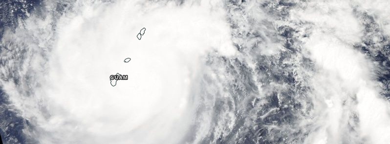
Featured image: Typhoon "Dolphin" on May 15, 2015. Image credit: NASA Aqua/MODIS.
The eye of Typhoon "Dolphin" passed through the Rota Channel between Guam and Rota shortly before 09:00 UTC on May 15, 2015.
It's rain-free, 40-km wide (25 miles) eye appeared almost exactly within the channel with the convective eye-wall over Guam and Rota simultaneously.
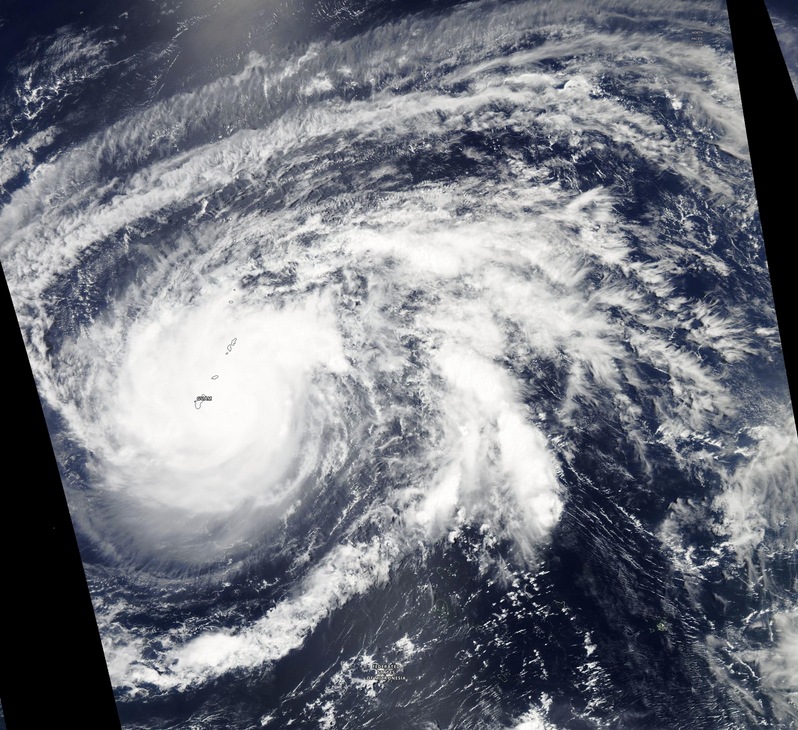
Typhoon "Dolphin" on May 15, 2015. Image credit: NASA Aqua/MODIS.
At the time, Dolphin was moving toward the northwest at 16 km/h (10 mph) with maximum sustained winds of 177 km/h (110 mph).
Typhoon #Dolphin threads the needle between Guam and Rota. Photos and video: http://t.co/MjXRtnK6FJ pic.twitter.com/yGOI3SziQG
— Capital Weather Gang (@capitalweather) May 15, 2015
After passing through #Guam, #Dolphin has improved its core structure = RI pattern @hepomodeler pic.twitter.com/7c87kFXkT2
— Pedro C. Fernández (@PedroCFernandez) May 15, 2015
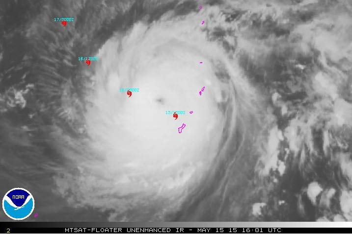
At 11:12 UTC, NWS Guam said that latest radar imagery shows Typhoon "Dolphin" veering more to the NW after passing almost directly between Guam and Rota.
Seas have reached nearly 6.7 meters (22 feet) at the Ipan buoy, just east of Guam. The highest seas were likely blocked by the landmass of Guam.
Winds and seas will gradually decrease as Dolphin slowly moves away from the Marianas, the agency said.
.jpg)
A Typhoon Warning remains in effect for Guam, Rota, Tinian and Saipan. A Flash Flood Warning is in effect for Rota.
At the press time (16:31 UTC) there is no information about damage this typhoon caused. It is currently late night in Guam and Rota (02:31 local time, UTC+10) and first information is expected in the morning.
Typhoon "Dolphin" is expected to continue its WNW trajectory today and tomorrow.
Over the next 48 hours, environmental conditions will remain mostly favorable, leading to a slow intensification rate up to 212 km/h (132 mph). Its weakening trend is expected to begin after about 4 days (May 19).
.gif)
Typhoon "Dolphin" forecast track by JTWC on May 15, 2015.
Satellite animations
- Storm-Centered Infrared (MTSAT; NOAA/SSD)
- Storm-Centered Infrared (Aviation Color Enhancement) (MTSAT; NOAA/SSD)
- Storm-Centered Water Vapor (MTSAT; NOAA/SSD)
- Storm-Centered Visible (MTSAT; NOAA/SSD)
- Storm-Centered Visible (Colorized) (MTSAT; NOAA/SSD)
- Storm-Centered Infrared (MTSAT2; CIMSS)
- Storm-Centered Enhanced Infrared (MTSAT2; CIMSS)
- Storm-Centered Water Vapor (MTSAT2; CIMSS)
- Storm-Centered Visible (MTSAT2; CIMSS)
- Tropical West Pacific Infrared (MTSAT2; NOAA)
- Tropical West Pacific Enhanced Infrared (MTSAT2; NOAA)
- Tropical West Pacific Water Vapor (MTSAT2; NOAA)
- Tropical West Pacific Visible (MTSAT2; NOAA)
I'm a dedicated researcher, journalist, and editor at The Watchers. With over 20 years of experience in the media industry, I specialize in hard science news, focusing on extreme weather, seismic and volcanic activity, space weather, and astronomy, including near-Earth objects and planetary defense strategies. You can reach me at teo /at/ watchers.news.
Commenting rules and guidelines
We value the thoughts and opinions of our readers and welcome healthy discussions on our website. In order to maintain a respectful and positive community, we ask that all commenters follow these rules.