
Severe weather warning in place for northern and central Tasmania
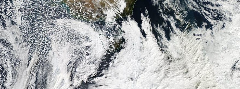
Image credit: NASA Aqua/MODIS image acquired May 5, 2015.
Eastward cold front in combination with a deep low pressure system is expected to bring rough weather to the state of Tasmania, over the coming days.
Severe weather warning has been issued for northern and central Tasmania. UBIMET meteorology company expects the wind speeds of up to 130 km/h (80.7 mph), in combination with heavy rainfall and snow.
Australian Bureau of Meteorology has put gale wind warning in place for the areas of Far North West Coast, Central North Coast, Banks Strait and Franklin Sound, East of Flinders Island, Upper East Coast, Lower East Coast, South East Coast, South West Coast and Central West Coast.

Image credit: Australian Bureau of Meteorology
Meteorologist James Wilby said: "Following the passage of the front, colder air will spread across the state with heavy, possibly thundery showers, with some falling as snow over the highest peaks. Some areas could receive up to 80 mm of rain over a 24 hour period." (AAP)
The severe storm warning will be in place for the next few days, although the winds are expected to ease by Wednesday afternoon.
Commenting rules and guidelines
We value the thoughts and opinions of our readers and welcome healthy discussions on our website. In order to maintain a respectful and positive community, we ask that all commenters follow these rules.