
Tropical Storm Matmo on the track to become new typhoon
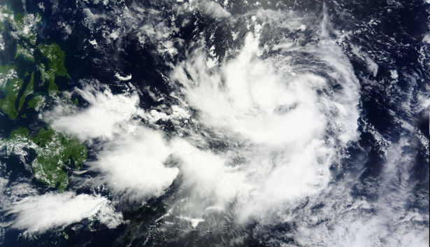
Featured image: Aqua/MODIS satellite image of Tropical Storm Matmo during July 17, 2014, (Credit: LANCE Rapid Response/MODIS)
The tenth tropical depression of the Northwestern Pacific Ocean has become better organized and is now named Tropical Storm Matmo (Henry for Philippines). Favorable sea surface temperatures and improved upper-level conditions will allow the system to further intensify.
(1).jpg)
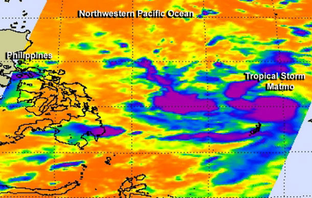
MTSAT IR satellite image of tropical disturbances across western Pacific at 23:30 UTC on July 18, 2014. (Credit: NOAA/UW-CIMSS)
According to latest report by Joint Typhoon Warning Center (JTWC) at 21:00 UTC on July 18, 2014, the center of Tropical Storm Matmo was located approximately 244 nm north-northwest of Koror and was moving westward at speed of 17 km/h (10.5 mph). Maximum sustained winds were 83 km/h (51 mph) with gusts up to 102 km/h (63 mph).
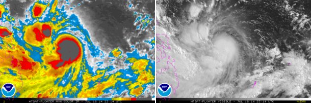
MTSAT's AVN IR and visible satellite image of TS Matmo at 23:14 UTC on JUly 18, 2014. (Credit: NOAA/MTSAT)
Aqua/MODIS false-colored infrared satellite image taken at 16:59 UTC on July 17, 2014 shows the concentration of the strongest thunderstorms (purple) around Tropical Storm Matmo's center and a band of thunderstorms west of center. (Credit: NASA/JPL/Ed Olsen)
JTWC forecast calls for Matmo to reach typhoon intensity by July 20, 2014 as it continues on a northwesterly track toward landfall in northern Taiwan around July 23, 2014 as a Category 2 typhoon.
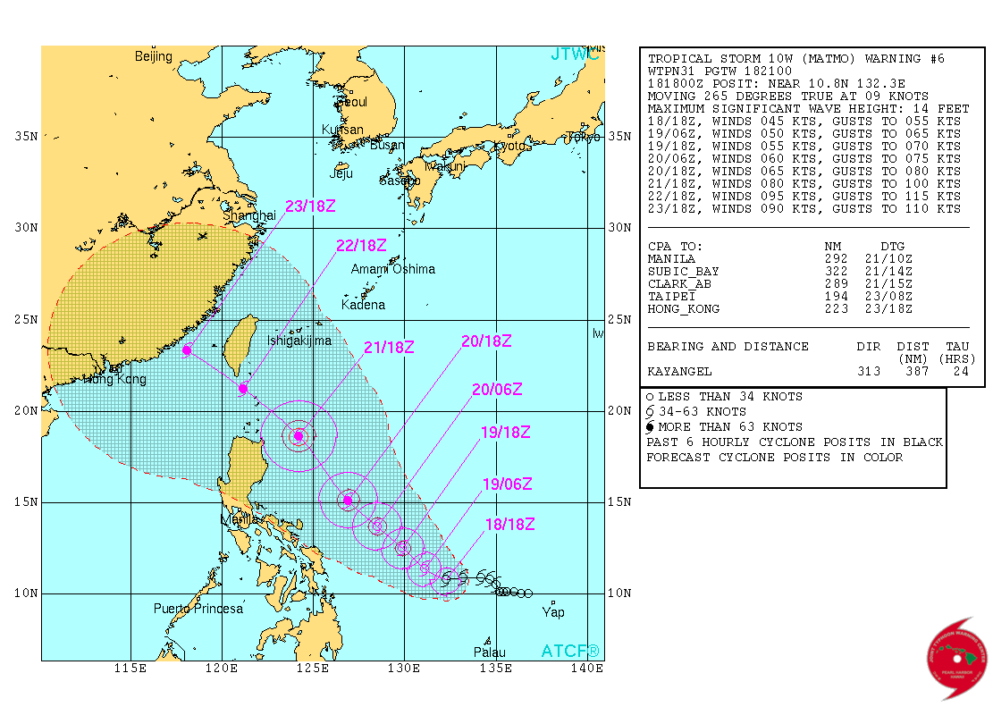
TS Matmo forecast track by JTWC (Credit: JTWC)
Satellite Animations
- Storm-Centered Infrared (MTSAT2; NOAA/SSD)
- Storm-Centered Infrared (Aviation Color Enhancement) (MTSAT2; NOAA/SSD)
- Storm-Centered Water Vapor (MTSAT2; NOAA/SSD)
- Storm-Centered Visible (MTSAT2; NOAA/SSD)
- Storm-Centered Visible (Colorized) (MTSAT2; NOAA/SSD)
- Storm-Centered Infrared (MTSAT2; CIMSS)
- Storm-Centered Enhanced Infrared (MTSAT2; CIMSS)
- Storm-Centered Water Vapor (MTSAT2; CIMSS)
- Storm-Centered Visible (MTSAT2; CIMSS)
- Tropical West Pacific Infrared (MTSAT2; NOAA)
- Tropical West Pacific Enhanced Infrared (MTSAT2; NOAA)
- Tropical West Pacific Water Vapor (MTSAT2; NOAA)
- Tropical West Pacific Visible (MTSAT2; NOAA)
(4).jpg)
Commenting rules and guidelines
We value the thoughts and opinions of our readers and welcome healthy discussions on our website. In order to maintain a respectful and positive community, we ask that all commenters follow these rules.