
Strong M 6.3 earthquake struck Kermadec Islands, New Zealand
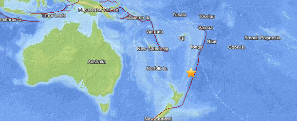
Image credit: USGS National Earthquake Information Center
Strong and deep earthquake registered as M 6.3 (USGS) struck near L'Esperanze Rock at Kermadec Islands archipelago, New Zealand at 21:24 UTC on October 11, 2013. The epicenter was located 87 km (54 miles) NNE of L'Esperanze Rock at coordinates 30.752°S 178.439°W. Depth was measured at 146.5km (91.0 miles).
.jpg)
Intensity map (Credit: USGS)
GEONET registered also M 6.3 at focal depth of 33km and EMSC registered M 6.2 at 146 km.
Tectonic summary
The Kermadec-Tonga subduction zone generates many large earthquakes on the interface between the descending Pacific and overriding Australia plates, within the two plates themselves and, less frequently, near the outer rise of the Pacific plate east of the trench. Since 1900, 40 M7.5+ earthquakes have been recorded, mostly north of 30°S. However, it is unclear whether any of the few historic M8+ events that have occurred close to the plate boundary were underthrusting events on the plate interface, or were intraplate earthquakes. On September 29, 2009, one of the largest normal fault (outer rise) earthquakes ever recorded (M8.1) occurred south of Samoa, 40 km east of the Tonga trench, generating a tsunami that killed at least 180 people.
More information on regional seismicity and tectonics
Commenting rules and guidelines
We value the thoughts and opinions of our readers and welcome healthy discussions on our website. In order to maintain a respectful and positive community, we ask that all commenters follow these rules.