
Tropical depression forms near Philippines
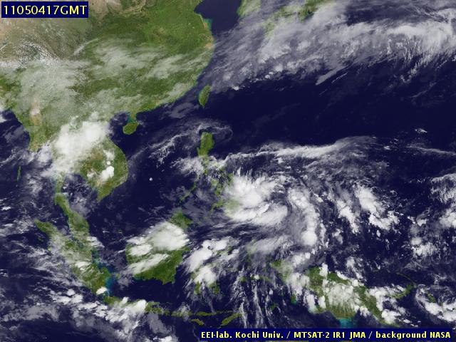
Image credit: TW
An early-season tropical storm may spin up east of the Philippines amid widespread tropical rain during the next two to three days. Localized flooding and strong winds will accompany the system’s path through the Philippines region. The area of widespread showers and thunderstorms at midweek was stretched eastward over the southern Philippine Sea, from the island of Mindanao to the area of Yap and Palau.
A tropical depression will form within 100-200 miles of southeastern Philippines during the next two to three days. Movement of this low will be to the west and northwest.
Late in the week, the weather system may cross shores of the Philippines or, on the other hand, narrowly skirt the eastern side of the archipelago. Either way, flooding rain will be a threat to lands along and near the track. Damaging winds would also threaten the area, given the attainment of tropical storm status.
Early next week, the low, potentially as a named tropical cyclone, will veer northward at sea, perhaps approaching Taiwan near the middle of next week. (AccuWeather)

Meteorology of the Philippines
I'm a dedicated researcher, journalist, and editor at The Watchers. With over 20 years of experience in the media industry, I specialize in hard science news, focusing on extreme weather, seismic and volcanic activity, space weather, and astronomy, including near-Earth objects and planetary defense strategies. You can reach me at teo /at/ watchers.news.
Commenting rules and guidelines
We value the thoughts and opinions of our readers and welcome healthy discussions on our website. In order to maintain a respectful and positive community, we ask that all commenters follow these rules.