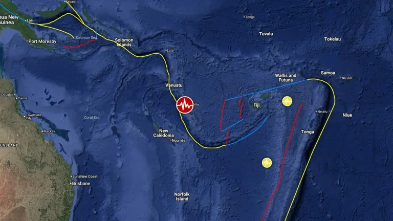
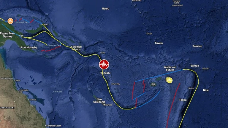
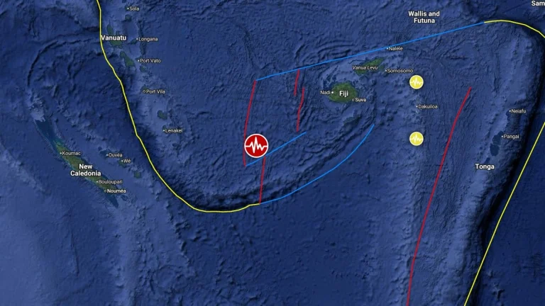
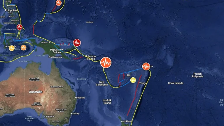
• Major M7.3 earthquake hits near Luganville, Vanuatu

    A major earthquake registered by the USGS as M7.3 hit near Luganville, Vanuatu at 08:44 UTC (19:44 LT) on March 30, 2026. The agency is reporting a depth of 115.8 km (72 miles). EMSC is reporting M7.3 at a depth of 116 km. According to the Pacific Tsunami Warning Center (PTWC), there is no tsunami threat from this event.

  • Strong and shallow M6.1 earthquake hits Vanuatu

    A strong and shallow earthquake registered by the USGS as M6.1 hit 100 km (62.5 miles) WNW of Isangel, Vanuatu, at 02:30 UTC on March 20, 2026. The earthquake occurred at a depth of 10 km (6.2 miles). This is the second M6+ earthquake of the day, following M6.6 in the South Shetland Islands at 00:22 UTC.

  • Acid rain from Ambae reaches four islands as Vanuatu readies emergency response

    Ambae’s Manaro Voui volcano remained in minor eruption on March 6, 2026, as Vanuatu’s government approved emergency response measures after acid rain and ash impacts spread beyond the island. Authorities maintained Alert Level 3 and prepared evacuation plans in case activity escalates further, but said no mass evacuation had been ordered at this stage.

  • Vanuatu issues Red alert for Tafea Province as Tropical Cyclone Urmil intensifies

    Tropical Cyclone Urmil formed on February 27, 2026, south of Vanuatu, prompting a Red Alert for Tafea Province as the system began strengthening over the region. At 09:00 UTC, Urmil had intensified to 102 km/h (63 mph) and was moving southeast at about 15 km/h (9 mph). The cyclone is forecast to strengthen further over open waters between Vanuatu and Fiji, potentially reaching Category 2 intensity.

    Urmil is the first named storm of the 2025–26 South Pacific cyclone season. It set a new record as the latest-ever first named cyclone in the basin, surpassing Cyclone Bart, which was named on February 21, 2017.

  • Ambae volcano Alert Level raised to 3, Vanuatu

    The Vanuatu Meteorology and Geo-Hazards Department (VMGD) raised the Volcanic Alert Level for Ambae volcano to Level 3 on February 23, 2026, following increased eruptive activity that began on February 20. Ash emissions have reached up to 4 900 m (16 000 feet) above sea level on February 24, and the hazard zone has expanded to a 3 km (1.9 miles) radius around the active vent in Lake Voui.

  • Strong and shallow M6.4 earthquake hits near Port-Olry, Vanuatu

    A strong and shallow earthquake registered by the USGS as M6.4 struck near Port-Olry, Vanuatu at 02:27 UTC on February 14, 2026. The agency is reporting a depth of 10 km (6.2 miles). The EMSC is reporting M6.5 at the same depth. According to the Pacific Tsunami Warning Center (PTWC), there is no tsunami threat from this earthquake.

  • Ambae volcano erupting after months of quiet, Vanuatu

    Low-level eruptive activity resumed at Ambae volcano (Manaro Voui) in Vanuatu, with intermittent ash emissions observed since December 1, 2025. Satellite imagery from Himawari-9 confirmed continuous low-level ash and gas plumes reaching up to 1.8 km (6 000 feet) above sea level, drifting northwest. The Wellington Volcanic Ash Advisory Centre (VAAC) issued its latest advisory on December 4, describing the eruption as continuous but confined within the volcano’s summit area.

  • Strong M6.4 earthquake hits Vanuatu region

    A strong and shallow earthquake registered by the USGS as M6.4 hit Vanuatu region at 21:47 UTC on September 8, 2025. The agency is reporting a depth of 10 km (6.2 miles). EMSC is reporting the same magnitude and depth.