• Second kona low threatens renewed flooding in Hawaiʻi after record-breaking storm

    A second Kona low is expected to affect the Hawaiian Islands beginning the evening of March 19, 2026, bringing additional rainfall to areas already impacted by record-breaking flooding from a previous storm. A Flood Watch is in effect from 18:00 LT on March 19 through 18:00 LT on March 22 for Maui County, Oʻahu, and Hawaiʻi Island.

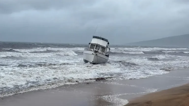
  • Kona low brings extreme rainfall to Maui and Oʻahu, causing flooding and landslides across Hawaiʻi

    A slow-moving Kona low brought extreme rainfall to the Hawaiian Islands between March 10–16, 2026, producing record-breaking totals at multiple long-term stations, particularly on Maui and Oʻahu. Honolulu and Kahului both set new daily rainfall records on March 13, while multi-day accumulations on Maui reached up to about 1 170 mm (46 inches), triggering flooding, landslides, and widespread disruption.

  • Early-season heatwave intensifies across western United States, Extreme Heat Warnings issued

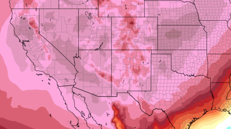
    An anomalously early-season heatwave intensified across the western United States on March 18, 2026, with Extreme Heat Warnings in effect for parts of the Desert Southwest and temperatures forecast to expand east into the Rockies and Great Plains by March 20. Highs are expected to reach 40–44°C (104–112°F) in the hottest desert regions, with numerous daily and some monthly March records likely to be broken.

  • Historic March blizzard buries parts of Michigan’s Upper Peninsula under up to 132 cm (52 inches) of snow

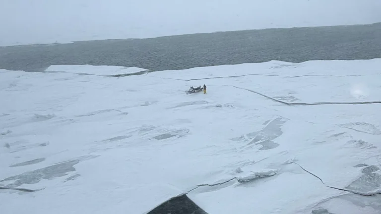
    A late-season blizzard affected northern Michigan between March 15 and 17, 2026, dropping up to 132.1 cm (52 inches) of snow in parts of the Upper Peninsula and breaking snowfall records at the National Weather Service office in Marquette. Governor Gretchen Whitmer declared a state of emergency on March 17 for seven counties in the Upper Peninsula and northern Lower Peninsula as heavy snow, ice, and strong winds disrupted travel and power service.

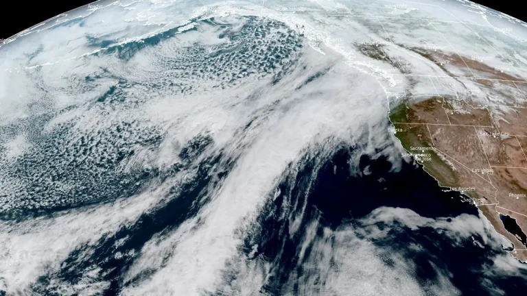
  • Atmospheric river forecast to stall over Washington, raising flood risk through March 20

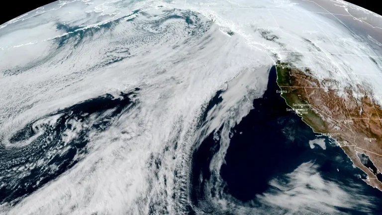
    A stalled atmospheric river over the Pacific Northwest is forecast to deliver 127–254 mm (5–10 inches) of precipitation to parts of Washington between March 17 and 20, 2026. High freezing levels above 2 100 m (7 000 feet) will result in rainfall across most elevations, accelerating snowmelt and increasing the likelihood of riverine flooding.

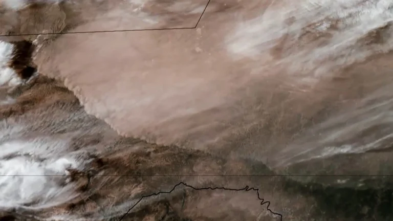
  • Dust storm triggers multi-vehicle crash on U.S. 287 in northern Texas

    A multi-vehicle crash occurred on U.S. Highway 287 near Quanah in Hardeman County, northern Texas, on March 15, after strong winds generated blowing dust that rapidly reduced visibility and created dangerous driving conditions. Video footage recorded in the area shows dense dust moving across the highway as vehicles traveled through the corridor. Visibility deteriorated rapidly…

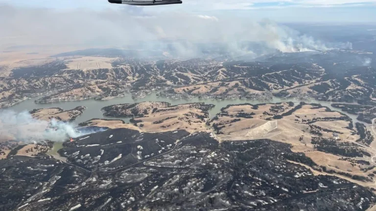
  • Morrill Fire becomes largest in Nebraska history as statewide fires top 243 000 ha (600 000 acres)

    A wildfire outbreak in western and central Nebraska has burned more than 243 000 ha (600 000 acres) since March 12, 2026, according to state officials, including the Morrill Fire, which Gov. Jim Pillen described as the largest wildfire in Nebraska history. One fatality has been confirmed as strong winds and critically dry vegetation fueled a rapid fire spread across the Nebraska Sandhills. The fires have also burned parts of Crescent Lake National Wildlife Refuge within the Sandhills, a region regarded as the world’s most intact temperate grassland.

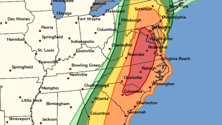
  • Rare Moderate Risk (4/5) issued for Mid-Atlantic as severe thunderstorms raise threat of damaging winds and tornadoes

    A Moderate Risk (Level 4 of 5) for severe thunderstorms has been issued across parts of the Mid-Atlantic United States for Monday, March 16, 2026, as a powerful multi-hazard storm threatens over 100 million people across the U.S. Fast-moving storms capable of producing damaging winds and a few strong tornadoes are forecast to develop from the Carolinas into Virginia and Maryland during the afternoon and evening hours. A Moderate Risk is an unusually high severe weather category for the Mid-Atlantic and is not issued often for this region. The National Weather Service office serving the Washington, D.C. area described the setup as a “quite rare Day 2 Moderate Risk area” ahead of the event.