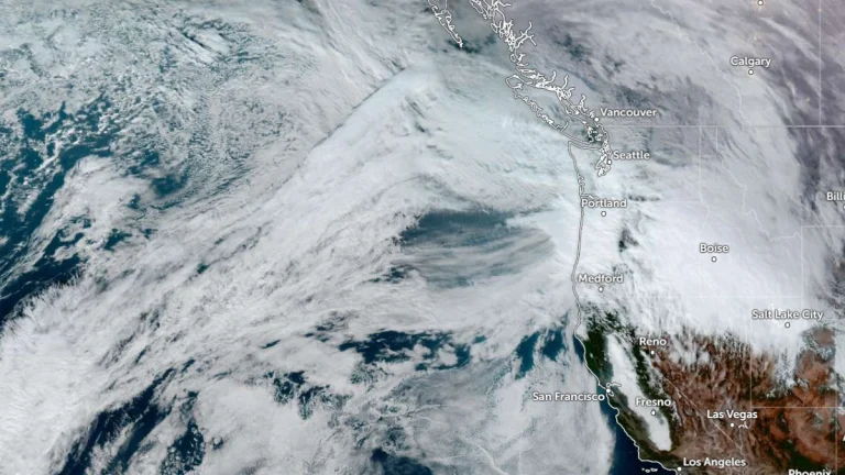
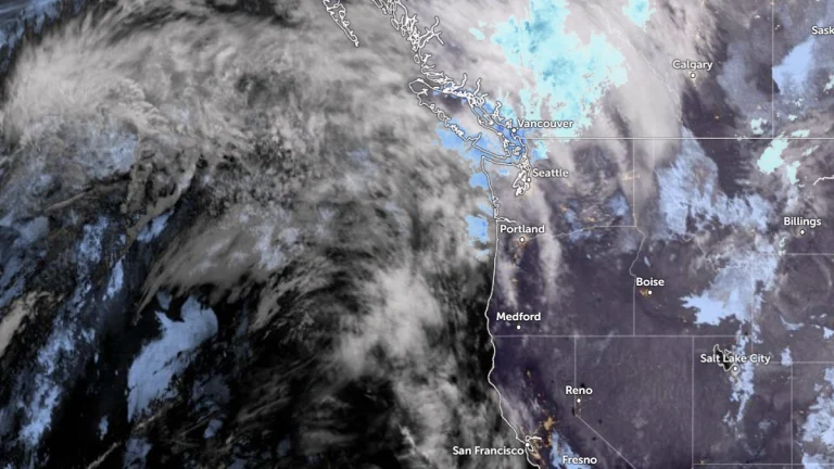
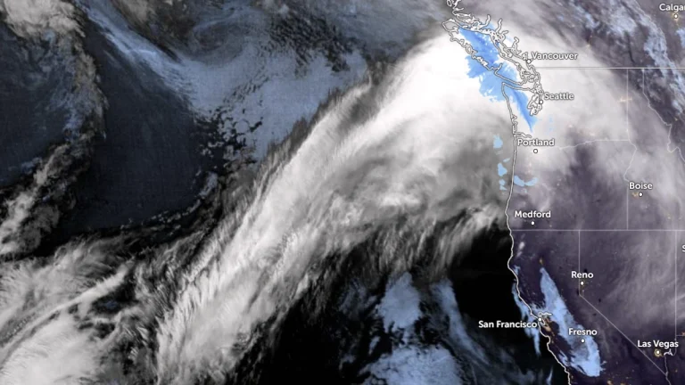
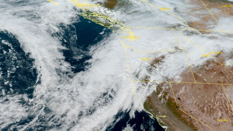
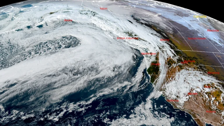
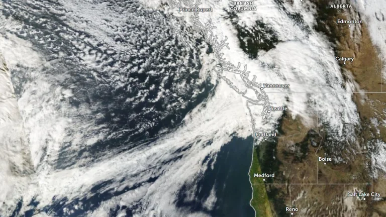
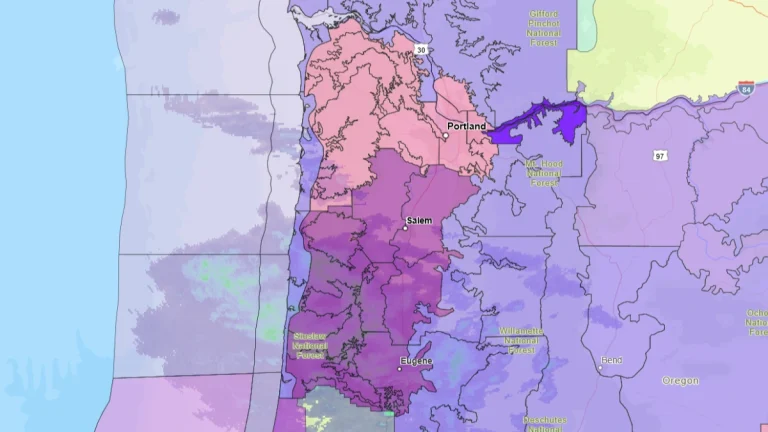
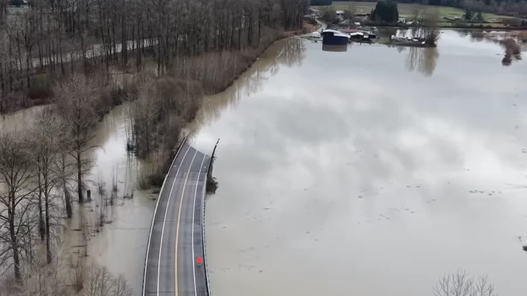
• Major atmospheric river forecast to impact the Pacific Northwest with heavy rain and flooding risk

    A major atmospheric river (AR4–AR5 possible) is forecast to make landfall over the Pacific Northwest early Monday, December 8, 2025, and persist through Wednesday, December 10, bringing multiple days of heavy rain and elevated snow levels. Ensemble guidance shows ~70–80% of members reaching at least AR4 in southern coastal Washington, with ~20–30% indicating AR5, raising the risk of widespread riverine flooding.

  • Four atmospheric rivers forecast to bring heavy rainfall across the U.S. West Coast

    Four back-to-back atmospheric rivers are forecast to make landfall along the U.S. West Coast between November 3 and November 9, 2025. Heavy rainfall totals of 76–130 mm (3–5 inches), with isolated amounts up to 177 mm (7 inches), could lead to localized flooding in parts of northern California and Washington State throughout the week.

  • Back-to-back atmospheric rivers forecast to bring heavy rainfall and mountain snow to the Pacific Northwest and northern California

    The Pacific Northwest will see back-to-back atmospheric rivers (ARs) beginning late Thursday, October 23, 2025, bringing significant precipitation and unsettled weather conditions through the end of October.The Weather Prediction Center has issued a Marginal Risk of excessive rainfall for coastal areas of Washington, Oregon, and northern California as the AR approaches.

  • Rare weather alert issued for Seattle, Portland, Vancouver and Salem

    The Storm Prediction Center (SPC) has issued a rare level 2 out of 5, or Slight Risk, for severe thunderstorms across parts of the Pacific Northwest from March 26 to 27, potentially impacting over 7.2 million people in major cities such as Seattle, Portland, and Vancouver. The threats include hail in excess of 2.5 cm (1 inch), wind gusts over 93 km/h (58 mph), and possible isolated tornadoes.

  • Ice storm warnings and winter weather advisories issued across Oregon

    An Ice Storm Warning has been issued for the Central and Southern Willamette Valley, the Central Oregon Coast Range Lowlands, and the Central Oregon Coast Range as winter storms bring hazardous conditions to the region. The warning will be in effect from 01:00 local time (LT) on February 13 to 04:00 LT on February 14, with significant ice and snow accumulation expected.