
Atmospheric river forecast to make landfall over the Pacific Northwest on February 22
A new atmospheric river (AR) forming over the Pacific Ocean is forecast to make landfall over the Pacific Northwest early on Saturday, February 22, 2025, and continue affecting the region through Sunday, February 23.
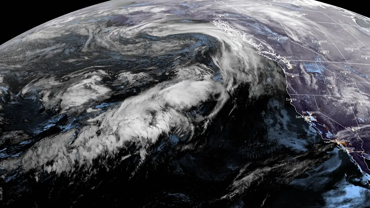
Image credit: NOAA/GOES-West, RAMMB/CIRA, The Watchers. Acquired at 10:10 UTC on February 20, 2025
A new atmospheric river (AR) is developing over the Western Pacific and is forecast to make landfall over the Pacific Northwest early Saturday, February 22 (LT), and continue affecting the region through Sunday, according to the Center for Western Weather and Water Extremes (CW3E).
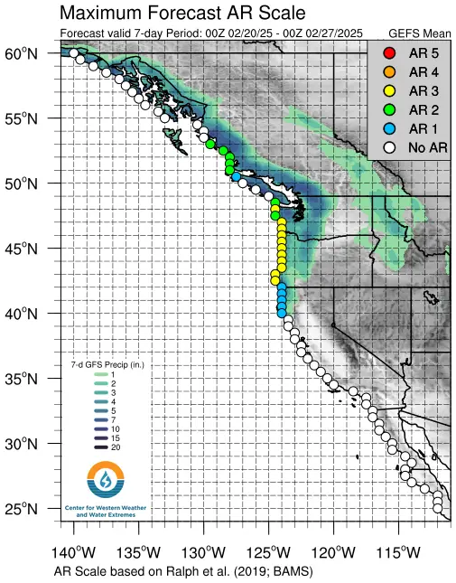
The current forecast calls for AR 3–4 conditions on the Ralph et al. (2019) AR scale of 1–5 along the Oregon and Washington coasts, while AR 1–2 conditions are forecast for Vancouver Island and Northern California.
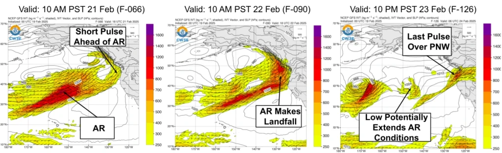
A low-pressure system developing behind the AR could extend AR conditions over the Pacific Northwest as it interacts with residual moisture in the northeastern Pacific.
CW3E’s AR Recon field campaign continues to forecast and plan atmospheric sampling flights over the Northeast Pacific, with flights from Honolulu, Hawaii, and Sacramento, California, planned for midnight UTC on February 21 to improve observations of initial atmospheric conditions in the global forecast models.
More than 100 mm (4 inches) of total precipitation is expected from Saturday through Monday, February 24, over the Olympic Peninsula, Washington, the Oregon Coast Ranges, and the Cascades.
Freezing levels are forecast to rise from approximately 900 m (3 000 feet) to over 1 800 m (6 000 feet) as the AR arrives on Saturday. This follows an AR that made landfall over the Pacific Northwest on Wednesday, February 19, meaning most of the precipitation will fall as rain, even at higher elevations.
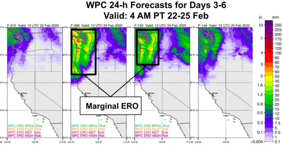
A marginal-risk Excessive Rainfall Outlook has been issued for the Olympic Peninsula, Washington, and the Oregon Coast, indicating a 5% chance of flooding in the region. This outlook covers two 24-hour periods ending at 04:00 local time (LT) on Sunday and Monday.
Rainfall could increase the risk of runoff, particularly as it will fall on existing snow accumulation from recent snowfall events.
Multiple locations in Washington and Oregon are forecast to experience rising stream levels. The Northwest River Forecast Center predicts that one station in eastern Washington will exceed the minor flood stage, while 14 stations, primarily in western Washington, are expected to surpass the action/bankfull stage.
Atmospheric rivers are long, narrow bands of concentrated moisture in the atmosphere, often leading to heavy precipitation when they make landfall, particularly affecting the west coast of the United States.
References:
1 AR Update: 19 February 2025 Outlook – CW3E -February 19, 2025

I am an Assistant Editor and Severe Weather & Science Journalist at The Watchers, specializing in real-time severe weather coverage, geophysical event reporting, and research-driven scientific analysis. You can reach me at rishav(at)watchers(.)news.
Commenting rules and guidelines
We value the thoughts and opinions of our readers and welcome healthy discussions on our website. In order to maintain a respectful and positive community, we ask that all commenters follow these rules.