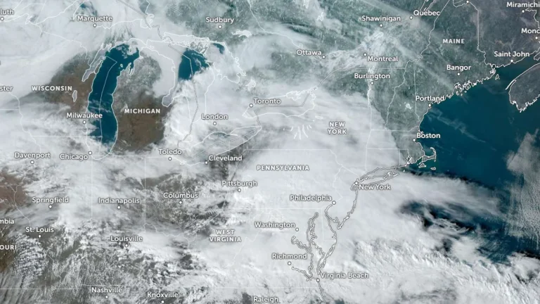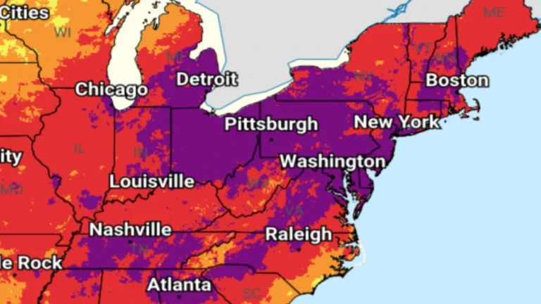
• Dangerous heat wave continues into July 4 as record temperatures spread across the eastern U.S.

    A dangerous heat wave continued to intensify across much of the central and eastern United States on Friday, July 3, 2026. Numerous daily temperature records have already broken and more are expected through the Fourth of July holiday weekend. The National Weather Service (NWS) warned of widespread Major to Extreme HeatRisk and heat index values reaching 46°C (115°F).
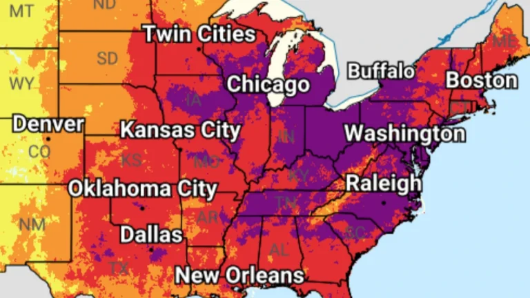

  • Extreme heat alerts cover portions of 31 U.S. states, heat index up to 46°C (115°F)

    Extreme Heat Warnings, Extreme Heat Watches, and Heat Advisories are in effect across 31 U.S. states after the National Weather Service (NWS) issued a series of heat alerts on June 29, 2026. Peak heat index values are forecast to reach 46°C (115°F), with dangerous heat and humidity expected to persist into early July across parts of the Midwest, Northeast, Southeast, and central United States.

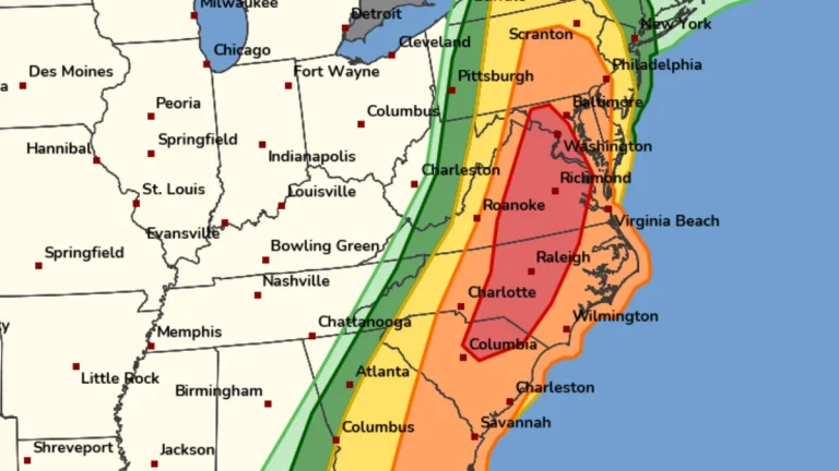
  • Rare Moderate Risk (4/5) issued for Mid-Atlantic as severe thunderstorms raise threat of damaging winds and tornadoes

    A Moderate Risk (Level 4 of 5) for severe thunderstorms has been issued across parts of the Mid-Atlantic United States for Monday, March 16, 2026, as a powerful multi-hazard storm threatens over 100 million people across the U.S. Fast-moving storms capable of producing damaging winds and a few strong tornadoes are forecast to develop from the Carolinas into Virginia and Maryland during the afternoon and evening hours. A Moderate Risk is an unusually high severe weather category for the Mid-Atlantic and is not issued often for this region. The National Weather Service office serving the Washington, D.C. area described the setup as a “quite rare Day 2 Moderate Risk area” ahead of the event.

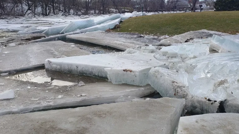
  • Ice jam causes flooding in Ausable Forks, New York, as snowmelt accelerates across the Adirondacks

    An ice jam formed on the Ausable River in the hamlet of Ausable Forks, northern New York, on March 8, 2026, as warming temperatures and snowmelt accelerated the seasonal breakup of river ice across the Adirondack region. Water backed up behind the jam and flooded several low-lying areas in the community, prompting officials in the Town of Jay to declare a local state of emergency.

  • Severe winter storm paralyzes the New York metropolitan area, grounding flights and closing schools

    A major blizzard struck New York on February 22, 2026, prompting a citywide travel ban and declaration of a State of Emergency. Snowfall totals reached 35.6 cm (14.0 inches) on Staten Island and 23.6 cm (9.3 inches) in Central Park. All schools have been closed on February 23, as Mayor Zohran Mamdani declared the first traditional snow day since 2019. No remote instruction will take place, and all after-school activities are cancelled.

  • Blizzard Warnings issued for Delaware, New Jersey, New York and southern Connecticut February 22-23

    Blizzard Warnings were issued February 21, 2026, for parts of Delaware, New Jersey, New York, and southern Connecticut, with heavy snow and wind gusts up to 90 km/h (55 mph) forecast from February 22 through 18:00 EST on February 23. Snow accumulations of 15–50 cm (6–20 inches) are expected, with visibility potentially dropping below 0.4 km (0.25 miles) in blowing snow, producing whiteout conditions and dangerous travel.

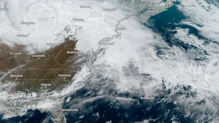
  • Confidence increases for significant winter storm to impact Northeast and Mid-Atlantic

    Forecast confidence is increasing for an impactful winter storm to hit the Northeast and the Mid-Atlantic over the weekend into Monday, February 23, 2026. Lake-enhanced and lake-effect snow are forecast as the storm moves into the Great Lakes Region starting Saturday, February 21. Snowfall rates of over 25 mm (1 inch) an hour coupled with gusty winds will create dangerous travel conditions with low visibility and slick roads.

  • Winter storm warnings and advisories issued across Great Lakes and Northeast U.S.

    Winter Storm Warnings and Winter Weather Advisories were issued across parts of Michigan, New York, New England, and Pennsylvania early Friday, February 20, 2026, with heavy snow and ice forecast to impact travel through February 21. Snowfall totals of 10 to 28 cm (4 to 11 inches) and ice accumulations up to 6 mm (0.25 inches) are expected in warning areas.