
Winter storm warnings and advisories issued across Great Lakes and Northeast U.S.
Winter Storm Warnings and Winter Weather Advisories were issued across parts of Michigan, New York, New England, and Pennsylvania early February 20, 2026, with heavy snow and ice forecast to impact travel through February 21. Snowfall totals of 10 to 28 cm (4 to 11 inches) and ice accumulations up to 6 mm (0.25 inches) are expected in warning areas.
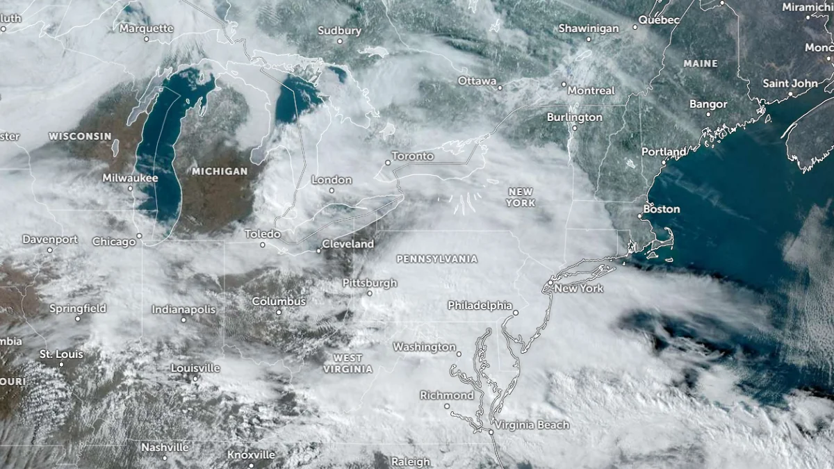
Satellite image of northeast USA at 20:40 UTC on February 19, 2026. Credit: NOAA/GOES-19, Zoom Earth, The Watchers
Winter Storm Warnings remain in effect across portions of Michigan’s Upper Peninsula, northern New York, Vermont, New Hampshire, and southwest Maine on February 20.
Additional Winter Weather Advisories extend across adjacent counties in Michigan, central New York, northeast Pennsylvania, coastal Maine, and southern New England.
In Michigan’s Upper Peninsula, warning areas including Baraga, Marquette, Iron, Dickinson, Keweenaw, Northern Houghton, and Menominee counties are forecast to receive an additional 10 to 25 cm (4 to 10 inches) of snow, with locally higher amounts in elevated terrain. Ice accumulations in some counties may reach approximately 5 mm (0.2 inches). Hazardous road conditions are expected to affect both morning and evening commute periods.
Advisory-level snowfall across nearby counties in the region is expected to range between 5 and 18 cm (2 and 7 inches), with mixed precipitation producing localized ice accretion.
Across portions of northern New York and Vermont, winter storm warnings call for total snow accumulations between 15 and 28 cm (6 and 11 inches) from late morning February 20 through the morning of February 21.
Snowfall rates may exceed 2.5 cm (1 inch) per hour during peak intensity periods. Initial wet snow may increase loading on tree limbs and utility lines, with isolated to scattered outages possible where totals exceed 25 cm (10 inches).
In southwest Maine and large areas of New Hampshire, warning-level snowfall totals of 13 to 20 cm (5 to 8 inches) are forecast from midday February 20 through early February 21. Travel conditions are expected to deteriorate during the afternoon and evening hours.
Winter weather advisories extend into central New York and northeast Pennsylvania, where mixed precipitation is forecast to produce light snow accumulations generally up to 2.5 cm (1 inch) and ice accretions around 2 to 5 mm (0.1 to 0.2 inches), particularly over higher elevations. Lower elevations are forecast to transition to rain as temperatures rise.
Southern New England, including parts of Connecticut, Massachusetts, and Rhode Island, is under winter weather advisories for snow and sleet accumulations ranging from a coating to 8 cm (3 inches), with ice accumulations up to 5 mm (0.2 inches). Reduced visibility and slippery road conditions are forecast through early February 21.
Snowfall intensity is forecast to decrease overnight into Saturday, February 21, as precipitation gradually tapers from west to east.
References:
1 Winter Storm Warning – NWS/WPC – February 20, 2026
2 Winter Weather Advisory – NWS/WPC – February 20, 2026

I am an Assistant Editor and Severe Weather & Science Journalist at The Watchers, specializing in real-time severe weather coverage, geophysical event reporting, and research-driven scientific analysis. You can reach me at rishav(at)watchers(.)news.
Commenting rules and guidelines
We value the thoughts and opinions of our readers and welcome healthy discussions on our website. In order to maintain a respectful and positive community, we ask that all commenters follow these rules.