
Confidence increases for significant winter storm to impact Northeast and Mid-Atlantic
Forecast confidence is increasing for an impactful winter storm to hit the Northeast and the Mid-Atlantic over the weekend into Monday, February 23, 2026. Lake-enhanced and lake-effect snow are forecast as the storm moves into the Great Lakes Region starting Saturday, February 21. Snowfall rates of over 25 mm (1 inch) an hour coupled with gusty winds will create dangerous travel conditions with low visibility and slick roads.
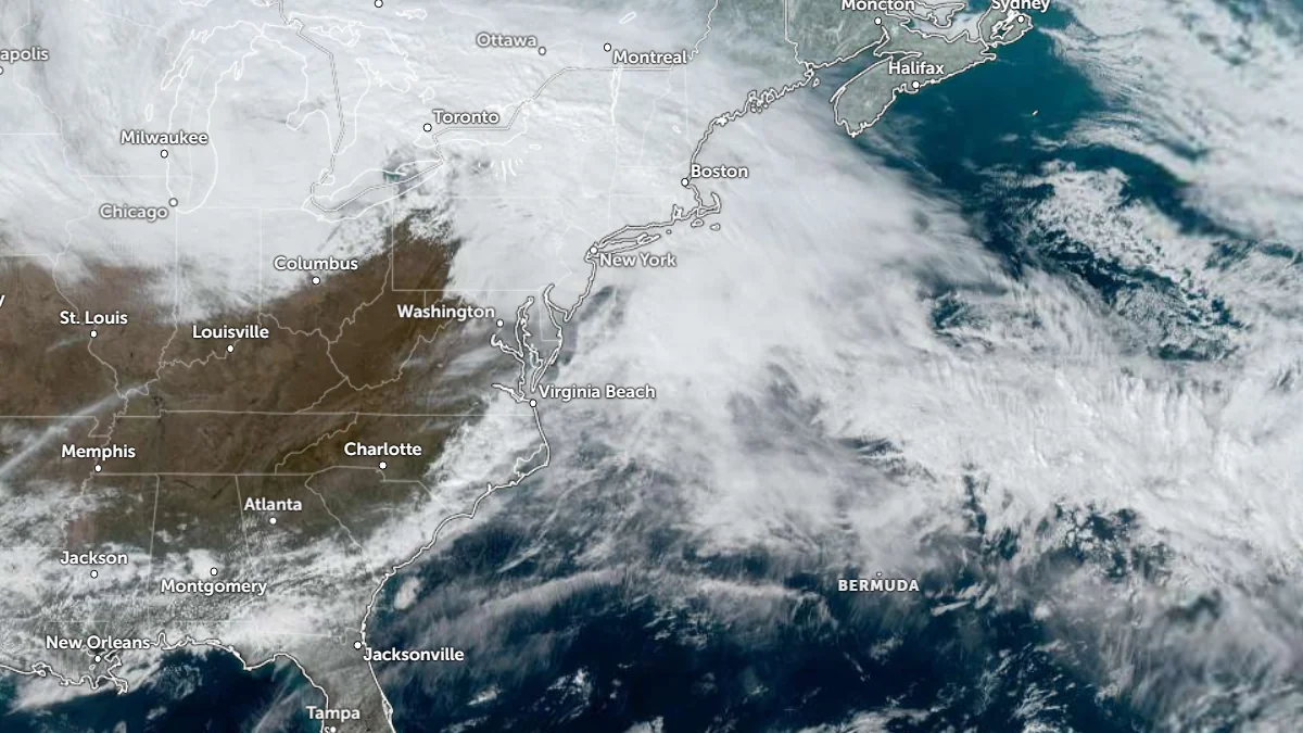
Satellite image of the U.S. East Coast at 00:10 UTC on February 21, 2026. Credit: NOAA/GOES-19, Zoom Earth, The Watchers
Forecast confidence continues to increase for a significant winter storm to affect the Northeast and the Mid-Atlantic from Sunday into Monday. However, exact snowfall totals remain uncertain due to small variations in the expected storm track.
An upper-level low over the Great Lakes moves eastward out over the Atlantic by Saturday afternoon, February 21. The storm will produce lake-enhanced snow and then lake-effect snow over the Great Lakes through Monday, February 23.
Snowfall rates of over 25 mm (1 inch) per hour will be possible in the heaviest bands. If snow totals exceed 150 mm (6 inches), the weight of the snow could cause scattered power outages, particularly where the snow is wet and accumulates on trees and power lines, according to the Weather Prediction Center (WPC).
The combination of strong winds and snow is most likely along the I-95 corridor from Philadelphia to New York, Boston, and nearby coastal areas, creating low visibility and near-blizzard conditions. This will lead to dangerous travel conditions as snowmelt refreezes, creating slick roads.
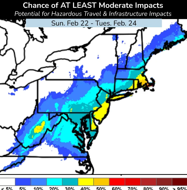
There is a 20–50% chance of at least moderate impacts across a corridor extending from portions of the central Appalachians through eastern Pennsylvania, northern New Jersey, southeastern New York, Connecticut, Rhode Island, and parts of Massachusetts.
The probability of significant impacts increases closer to the coast in parts of New Jersey and southern New England, where overlapping snow and wind hazards are forecast.
Strong winds are forecast from the coastal Mid-Atlantic into southern New England. Localized power outages will be possible if gusts down trees and power lines. Meanwhile, minor coastal flooding and beach erosion are also expected for parts of the East Coast.
Forecast uncertainty remains high, particularly regarding the exact storm track and rain–snow line placement.
Small shifts in the low-pressure center can substantially alter snowfall totals and the affected area. Additional forecast updates and refinements are expected as the event approaches.
Residents across the Mid-Atlantic and Northeast are advised to monitor official forecasts and updates from the local forecast offices as confidence and impact details evolve.

I am an Assistant Editor and Severe Weather & Science Journalist at The Watchers, specializing in real-time severe weather coverage, geophysical event reporting, and research-driven scientific analysis. You can reach me at rishav(at)watchers(.)news.
Commenting rules and guidelines
We value the thoughts and opinions of our readers and welcome healthy discussions on our website. In order to maintain a respectful and positive community, we ask that all commenters follow these rules.