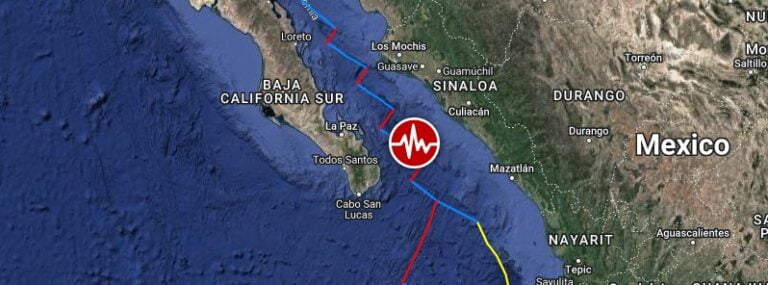
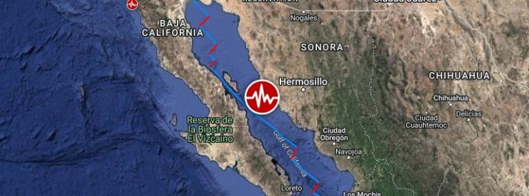
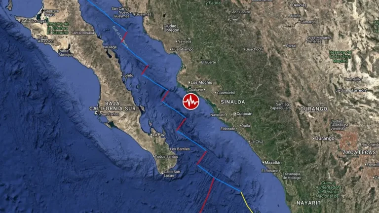
Strong and shallow M6.2 earthquake hits the Gulf of California

Strong and shallow M6.2 earthquake hits the Gulf of California

A strong and shallow earthquake, registered by the USGS as M6.2, hit the Gulf of California at 10:02 UTC on November 4, 2022. The agency is reporting a depth of 10 km (6.2 miles). EMSC is reporting M6.1 at a depth of 30 km (18.6 miles).

Strong and shallow M6.3 earthquake hits the Gulf of California

Strong and shallow M6.3 earthquake hits the Gulf of California

A strong and shallow earthquake registered by the USGS as M6.3 hit the Gulf of California at 16:18 UTC (08:18 PST) on January 19, 2018. The agency is reporting a depth of 10 km (6.2 miles). EMSC is reporting M6.2 at a depth of 30 km (18.6 miles). Tsunami is not…

Strong and shallow M6.6 earthquake hits Gulf of California

Strong and shallow M6.6 earthquake hits Gulf of California

A strong and shallow earthquake registered as M6.6 by USGS hit Gulf of California at 08:14 UTC on September 13, 2015. The agency is reporting depth of 10 km (6.2 miles).Epicenter was located 59 km (37 miles) SSW of Topolobampo, 79 km (49 miles) SSW of Los Mochis, 85 km

Very strong M6.2 earthquake hit Gulf of California, Mexico

Very strong M6.2 earthquake hit Gulf of California, Mexico

A strong earthquake measuring M6.2 on the Richter scale hit Gulf of California, Mexico on October 8, 2014, at 02:40 UTC. USGS is reporting depth of 10 km (6.2 miles).Epicenter was located at sea, 121 km (75 miles) WSW of El Dorado, 128 km (80 miles) SW of Navolato, 128

M 6.0 earthquake hit Gulf of California

M 6.0 earthquake hit Gulf of California

Earthquake M6.0 hit Gulf of California on October 08, 2012 at 06:26:22 UTC. The epicenter was located  93 km (58 miles) SSW (209°) from Ahome, Sinaloa and Los Mochis, Sinaloa, Mexico (25.182°N, 109.622°W) at depth of 10.1 km (6.3 miles) according to USGS.EMSC

Earthquake M 6.2 struck Gulf of California

Earthquake M 6.2 struck Gulf of California

Strong M6.2 earthquake struck in Gulf of California on  September 25, 2012 at 23:45:26 UTC. The epicenter was located 75 km (47 miles) N (11°) from La Paz, Baja California Sur and 154 km (96 miles) E (98°) from Constitución, Baja California Sur, Mexico

Scientists drill into San Andreas Fault to understand its secrets

Scientists drill into San Andreas Fault to understand its secrets

Earthquake-Report.com came across a video of the National Science Foundation that explains what scientists are currently doing to understand what is going on inside the San Andreas Fault. The video has been aired in the PBS NewsHour. Understanding what happens at…

Swarm of earthquakes rattles Gulf of California

Swarm of earthquakes rattles Gulf of California

Swarm of earthquakes rattles Gulf of California with strongest recorded as 5.9 magnitude according to USGS with epicentre 86 km (53 miles) SW of Los Mochis, Sinaloa, Mexico at depth of 10.2 km (6.3 miles). Nine earthquakes was above magnitude 5. SCSN Recent