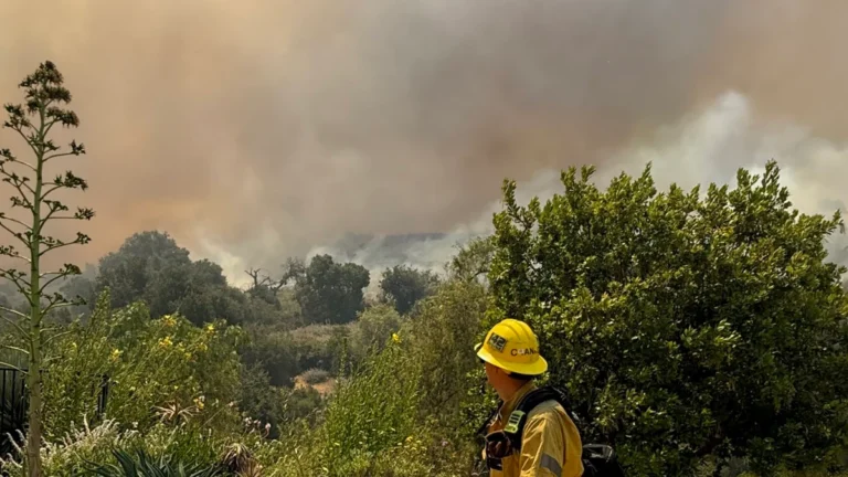
• Sandy Fire forces evacuations and school closures in Ventura County, California

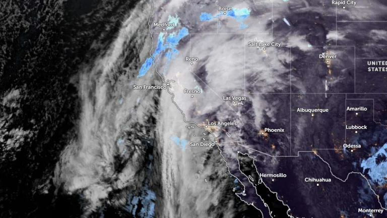
    The Sandy Fire, discovered at around 10:50 local time (LT) on May 18, 2026, has burned more than 526 ha (1 300 acres) across Simi Valley in Ventura County, California, forcing mandatory evacuations for more than 10 000 homes and triggering warnings for thousands more as firefighters battle rapid fire spread driven by dry and windy conditions.

  • Pair of mid-level troughs forecast to bring widespread precipitation to California

    Two mid-level troughs with associated surface lows are forecast to bring widespread precipitation to California between February 14 and 19, 2025. The first system is forecast to begin affecting the state on February 14–15, followed by a second trough deepening offshore from February 16–17. Snowfall totals over the Sierra Nevada could exceed 60 cm (24 inches), while rainfall totals of 25–50 mm (1–2 inches) are forecast across much of the state during the initial 72-hour period.

  • Strong atmospheric river to bring heavy rain, snow, and flooding to California this week

    A strong atmospheric river is forecast to impact California from December 23 to 27, 2025, bringing widespread heavy rainfall, flash flooding, and high-elevation snow. The system is expected to produce 250 to 500 mm (10–20 inches) of precipitation in parts of the Sierra Nevada and 150 to 300 mm (6–12 inches) in the Coast and Transverse Ranges. The National Weather Service has issued high-risk alerts for flash flooding across southern California and moderate winter storm impacts over the Sierra Nevada.

  • Heavy snow over the Sierra Nevada on Monday

    Heavy snow and gusts to about 65 km/h (40 mph) are forecast for the West Slope Northern Sierra Nevada and Western Plumas County/Lassen Park in California on Monday, November 17, 2025, with a Winter Weather Advisory in effect until 16:00 PST. A brief break is forecast for Tuesday and Wednesday, followed by increased chances for rain and snow showers on Thursday, November 20.

  • Winter Weather Advisories issued as Sierra Nevada prepares for heavy snow

    A strengthening low-pressure system offshore is forecast to spread heavy precipitation and mountain snow across the Sierra Nevada from Thursday, November 13 through November 15, 2025. Winter Weather Advisories are in effect for the Eastern Sierra Slopes, Greater Lake Tahoe Area and the West Slope Northern Sierra Nevada, with snow levels forecast to drop into November 14 and accumulations reaching 30–60 cm (12–18 inches) at the highest peaks.

  • Flood Watch and marine Storm and Gale Warnings in effect for Mendocino and Lake counties region, California

    Interior Mendocino and Lake counties are under a Flood Watch from late Wednesday, November 12, through Thursday morning, November 13, 2025, as 50–75 mm (2–3 inches) of rain is forecast within several hours. Marine Storm and Gale Warnings are also in effect offshore, where winds up to 95 km/h (60 mph) and seas up to 8 m (27 feet) are expected.