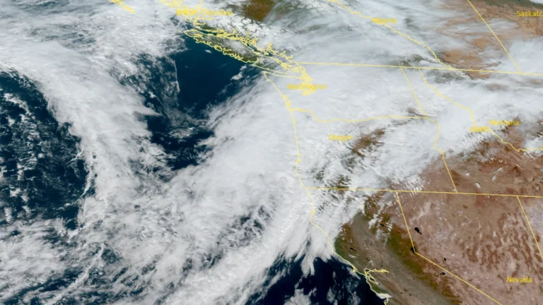
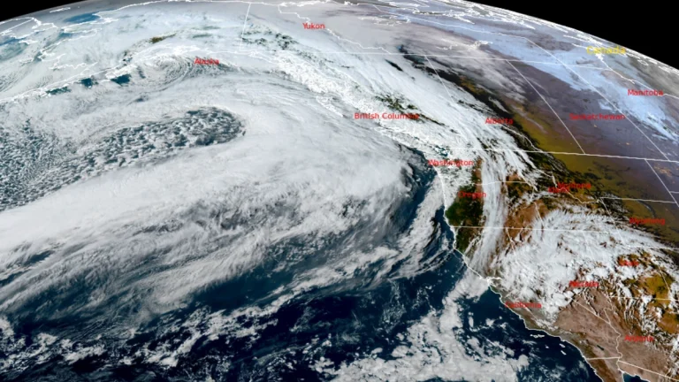
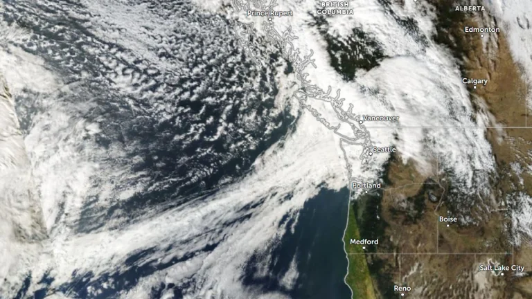
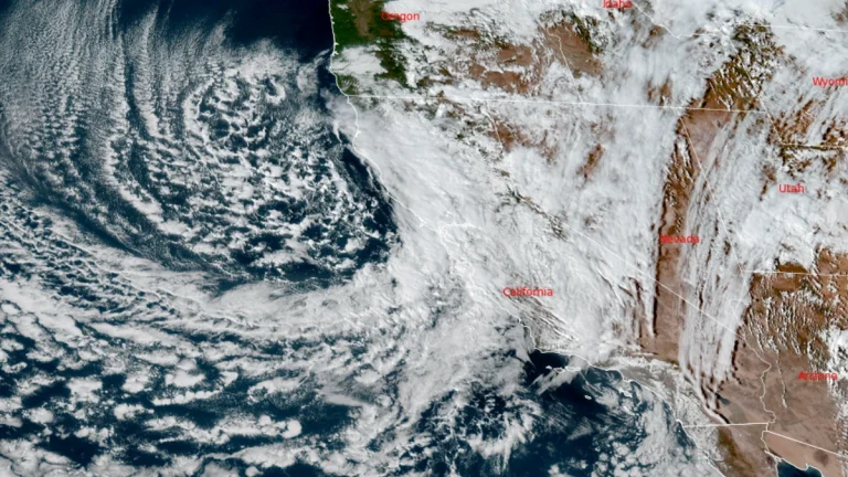
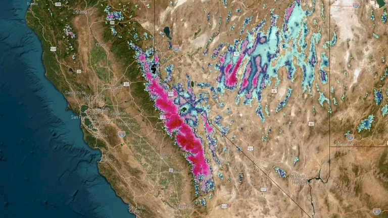
• Atmospheric river forecast to bring heavy precipitation to California from November 12 to 15

    A developing low-pressure system over the Northeast Pacific is forecast to direct a strong atmospheric river (AR) toward California between November 12 and 15, 2025. The Center for Western Weather and Water Extremes (CW3E) indicates a high probability of moderate to strong AR conditions in Northern and Central California, with heavy precipitation possible in the Sierra Nevada and coastal ranges.

  • Four atmospheric rivers forecast to bring heavy rainfall across the U.S. West Coast

    Four back-to-back atmospheric rivers are forecast to make landfall along the U.S. West Coast between November 3 and November 9, 2025. Heavy rainfall totals of 76–130 mm (3–5 inches), with isolated amounts up to 177 mm (7 inches), could lead to localized flooding in parts of northern California and Washington State throughout the week.

  • Back-to-back atmospheric rivers forecast to bring heavy rainfall and mountain snow to the Pacific Northwest and northern California

    The Pacific Northwest will see back-to-back atmospheric rivers (ARs) beginning late Thursday, October 23, 2025, bringing significant precipitation and unsettled weather conditions through the end of October.The Weather Prediction Center has issued a Marginal Risk of excessive rainfall for coastal areas of Washington, Oregon, and northern California as the AR approaches.

  • Rare October storm prompts rescues and tornado warnings in central and southern California

    Tornado warnings were issued across parts of Central California, including San Luis Obispo County, as a rare October storm brought heavy rainfall, gusts exceeding 110 km/h (70 mph), and localized flooding on October 13–14, 2025. Evacuation warnings were declared in Los Angeles County for burn-scar areas at risk of debris flows, while forecasters maintained a marginal tornado risk for southern coastal regions.

  • Major to extreme impacts expected across the central Sierra Nevada as Pacific storm moves into California

    A Pacific storm will move into California from the northwest between October 13 and 15, 2025, bringing widespread valley rain and heavy snow to the Sierra Nevada. Snowfall totals along the Sierra crest may reach 30–90 cm (12–36 inches), with hazardous driving conditions expected across Interstate 80 and other major passes. The National Weather Service warns that chain controls and travel delays are likely during the peak of the event.

  • Flood Watches in effect as post-tropical Mario drives moisture into the U.S. Southwest

    Moisture from post-tropical Mario is forecast to spread into southern California on September 18, 2025, bringing thunderstorms and rainfall totals of 25–75 mm (1–3 inches) through Friday. Rainfall rates may exceed 25 mm/h (1 inch/h), prompting Flood Watches and Flash Flood Watches across much of the region. Arizona and New Mexico are also expected to see widespread showers and thunderstorms with localized flooding into September 19.