
Heavy snow over the Sierra Nevada on Monday
Heavy snow and gusts to about 65 km/h (40 mph) are forecast for the West Slope Northern Sierra Nevada and Western Plumas County/Lassen Park in California on Monday, November 17, 2025, with a Winter Weather Advisory in effect until 16:00 PST. A brief break is forecast for Tuesday and Wednesday, followed by increased chances for rain and snow showers on Thursday, November 20.
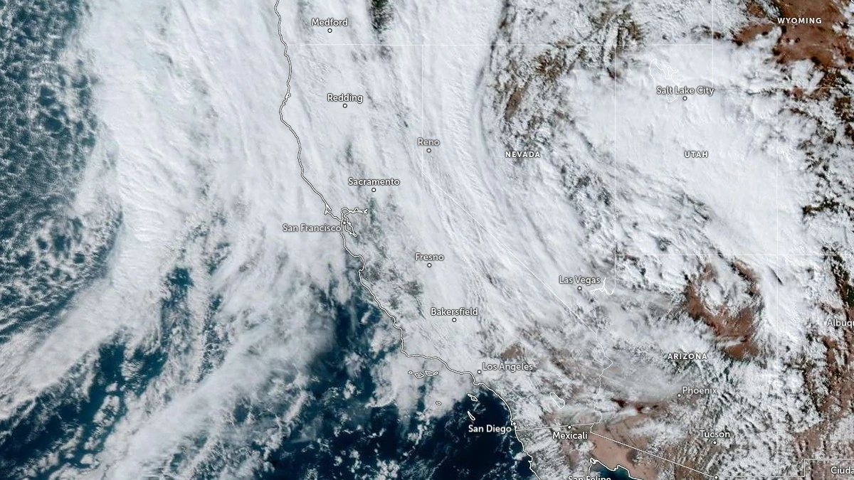
Satellite image acquired at 21:50 UTC on November 16, 2025. Credit: NOAA/GOES-East, Zoom Earth, The Watchers
A developing upper-level low along the California coast is forecast to drift south toward northwestern Mexico by Wednesday, producing West Coast precipitation and heavy Sierra Nevada snow mainly on Monday, with showers and embedded thunderstorms over central California through early Tuesday and high-elevation snow extending into the Southwest through Wednesday morning.
For the West Slope Northern Sierra Nevada, the forecast calls for heavy rain and snow today, tapering to chances of rain/snow tonight, then partial clearing Tuesday into Wednesday before another disturbance brings rain and snow showers on Thursday, November 20.
Snow levels are around 2 000 m (6 500 feet) today, lowering to roughly 1 700 m (5 500 feet) tonight, then rising again Tuesday afternoon. Expected accumulations today are about 8 to 25 cm (3 to 9 inches) at higher elevations, with little to none at lower elevations; up to about 2.5 cm (1 inch) is possible tonight at higher elevations.
A Winter Weather Advisory remains in effect for Western Plumas County/Lassen Park and the West Slope Northern Sierra Nevada until 16:00 PST Monday.
Forecast totals are 15 to 30 cm (6 to 12 inches), with 30 to 60 cm (1 to 2 feet) possible on the highest peaks. South to southwest wind gusts may reach about 65 km/h (40 mph). Advisory guidance places snow levels generally near 2 000–2 100 m (6 500–7 000 feet) today, lowering to roughly 1 500–1 800 m (5 000–6 000 feet) by Monday morning.
Travel impacts are possible across higher passes during heavier snowfall and gusty winds; motorists should check Caltrans conditions and chain requirements before travel.
A brief break with partly cloudy conditions is forecast Tuesday and Wednesday, followed by increased chances for rain and snow showers on Thursday with moderate additional accumulations possible, then a drier trend Friday into the weekend.

Teo Blašković founded The Watchers in 2011 and edited it until 2026, covering seismic and volcanic activity, extreme weather, space weather and near-Earth objects. Articles on this page are his archive.
Earlier reporting
Nothing on Watchers was published in the last 24 hours. These are older articles.
- 2 atmospheric rivers to bring heavy Sierra snow and California flood risk
- Florida's east coast faces a moderate flash flood risk Wednesday through Friday, with 4 to 8 inches of rain forecast and the St. Johns River near Cocoa already in major flood at 17.13 feet
- El Niño floods kill 2 in Guayaquil as 172.8 mm of rain swamps Milagro, Ecuador's toll rises to 14
- Southern Thailand braces for heavy rain, 15 provinces on flood and landslide alert for November 18-22
