
Cutoff low and developing atmospheric river to bring widespread precipitation along the US West Coast
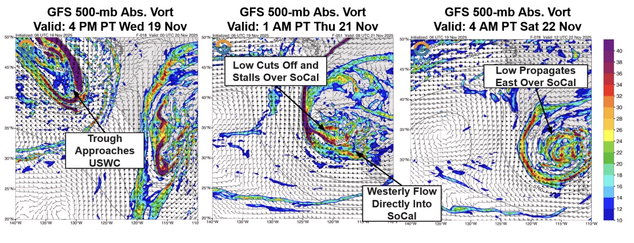
A mid-level trough deepening along the US West Coast is forecast to evolve into a cutoff low over Southern California and a potential atmospheric river (AR) over the Pacific Northwest between November 19 and 24, 2025.
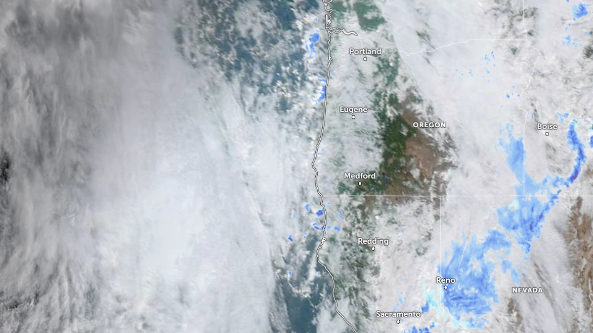
Satellite image of the U.S West Coast at 17:20 UTC on November 20, 2025. Credit: NOAA/GOES-19, Zoom Earth, The Watchers
A mid-level trough deepening along the United States West Coast this week is forecast to evolve into two related systems, a cutoff low affecting Southern California and a developing atmospheric river (AR), expected to bring heavier precipitation to the Pacific Northwest through November 24.
The trough is expected to close off into a cutoff low near Southern California during November 20–22, pulling Pacific moisture into the region and producing moderate rainfall across Southern California, the southern Sierra Nevada, and southwestern Arizona.
According to the Weather Prediction Center (WPC), precipitation totals are forecast to reach 25–50 mm (1–2 inches) across Southern California and the central to southern Sierra Nevada, and 13–25 mm (0.5–1 inch) along the northern California coast, through 04:00 PST November 22.
The WPC has issued a marginal risk of excessive rainfall for the 24-hour periods ending 04:00 PST on November 21 and November 22, covering coastal Southern California, desert regions, and southwestern Arizona. While heavy hourly rainfall rates are not expected, even small rainfall totals can trigger flash floods in the area with saturated soils from recent storms.
Farther north, ensemble models indicate the same broader trough will interact with a moist subtropical plume, producing AR conditions along the Washington and Oregon coasts.
Both the Global Ensemble Forecast System (GEFS) and the ECMWF Ensemble Prediction System (EPS) show 40–60 % probability of AR1conditions or greater for the Washington coast between November 21 and 24. There is uncertainty in the duration, with some ensemble members indicating continuous AR conditions lasting more than 48 hours.
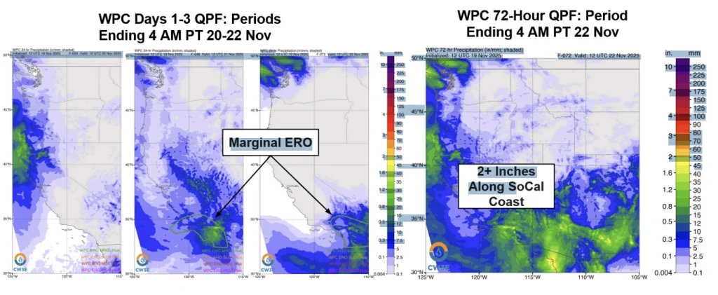
The WPC forecasts 50–100 mm (2–4 inches) of precipitation over the Olympic Peninsula and Washington Cascades for the 72-hour period ending at 16:00PST on November 24. Hydrologic guidance indicates rises in smaller basins of western Washington and Oregon but no widespread exceedances of flood thresholds.
This dual-system setup–a cutoff low to the south and an AR to the north–is a late-autumn transition pattern along the West Coast. When weakened, upper-level flow favors cutoff development, while the northern jet retains enough strength to transport subtropical moisture into the Pacific Northwest.
References:
1 Quick Look at the Precipitation Events Forecast to Impact US West Coast – CW3E – November 19, 2025

I am an Assistant Editor and Severe Weather & Science Journalist at The Watchers, specializing in real-time severe weather coverage, geophysical event reporting, and research-driven scientific analysis. You can reach me at rishav(at)watchers(.)news.
Commenting rules and guidelines
We value the thoughts and opinions of our readers and welcome healthy discussions on our website. In order to maintain a respectful and positive community, we ask that all commenters follow these rules.