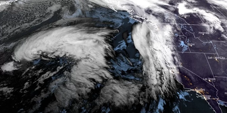
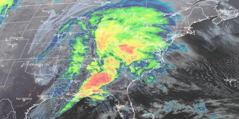
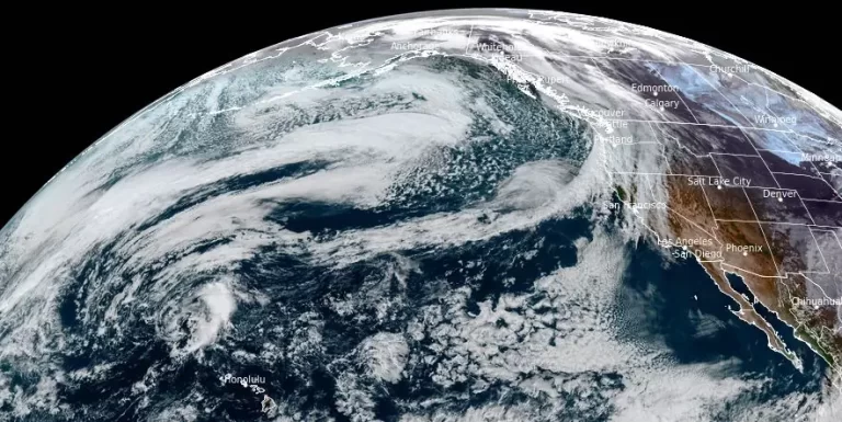
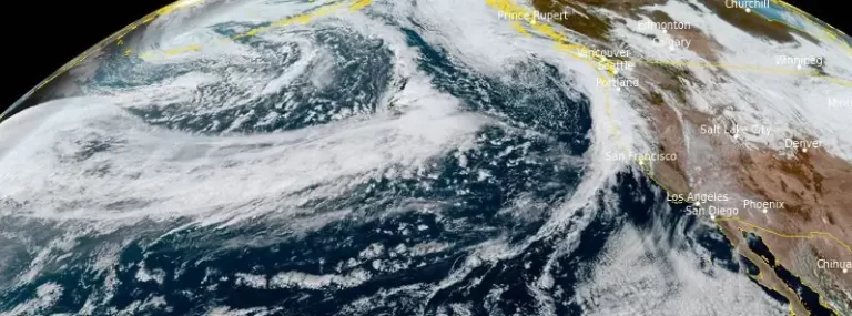
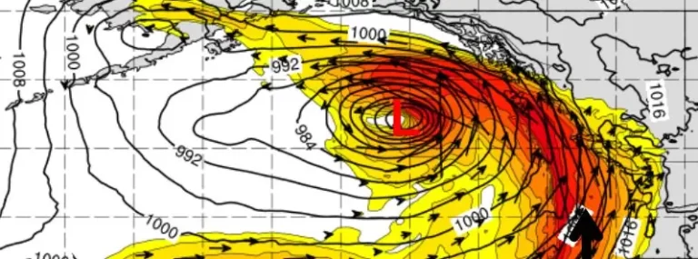
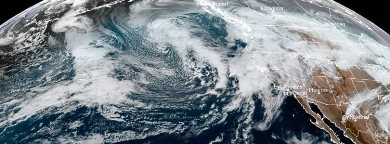
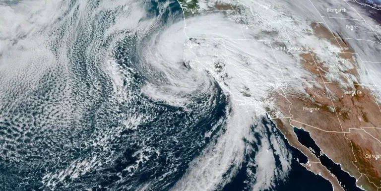
• Powerful atmospheric river triggers state of emergency in Southern California, rare Level 4 of 4 risk of excessive rainfall

    An intense atmospheric river event hit California on Sunday, February 4, 2024, prompting Gov. Gavin Newsom to declare a state of emergency in eight counties due to the potential for “life-threatening” flooding, mudslides, and widespread power outages. The National Weather Service warns of significant rainfall, powerful winds, and heavy snowfall continuing over the next few days.

  • Strong atmospheric river to impact the US West Coast

    Starting Tuesday night, January 30, 2024, an atmospheric river will affect southern Oregon and northern California, bringing widespread rain, heavy mountain snow, and strong winds, with impacts expanding to central California and continuing through February 2.

  • Prolonged winter storm to batter Pacific Northwest with rain and heavy snow

    The Pacific Northwest is bracing for a prolonged winter storm that is forecasted to last through the weekend, threatening the region with a mix of heavy rain in the coastal ranges and lower Cascades and significant snowfall in the mountain passes. This event corresponds with the CW3E’s forecast of several atmospheric rivers, set to affect the area from Saturday, December 2, through the following week.

  • California set for significant precipitation as atmospheric river develops

    An evolving storm system off the California coast, forecasted to develop into at least one atmospheric river, is set to deliver substantial rainfall and snowfall across the West Coast starting this weekend. With the Northeast Pacific Ocean as the stage, the interaction of several low-pressure systems is predicted to have significant impact, particularly from November 14 to 17, as per the Atmospheric River Reconnaissance field campaign.

  • Endless onslaught of atmospheric river events in California claim 14 lives, residents urged to be hyper-vigilant

    California is once again under threat as an energetic low pressure system quickly gathers strength off the West Coast, bringing with it heavy precipitation, thunderstorms and several feet of snow in the Sierra Nevada region. This, along with already saturated soils and high river levels, is expected to exacerbate ongoing flooding, prolong the risk of flash flooding, and mudslides, especially in recent burn scar regions. The National Weather Service has issued a warning for residents to be prepared, as the heavy rainfall, especially in southern California, is expected to be excessive today and tonight.

  • Parade of intense storms continues to batter California — rapid river rises, mudslides, and burn scar flash floods expected

    The continuous rounds of heavy rain on already saturated soils across California will likely lead to significant flooding, rapid river rises, mudslides, and flash floods or debris flows in burn scar areas. In addition, gusty winds may cause trees and power lines to fall. Travel in the mountains may also be hazardous due to heavy snowfall.