
California set for significant precipitation as atmospheric river develops
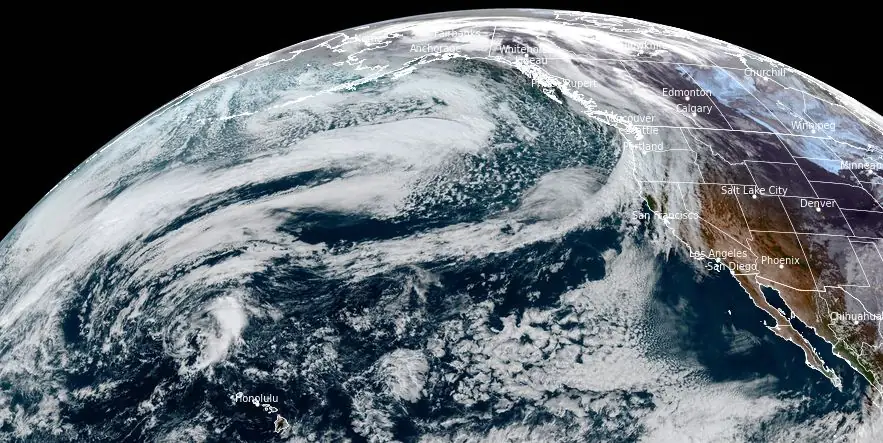
Image credit: NOAA/GOES-West, RAMMB/CIRA, The Watchers. Acquired at 23:10 UTC on November 9, 2023.
An evolving storm system off the California coast, forecasted to develop into at least one atmospheric river, is set to deliver substantial rainfall and snowfall across the West Coast starting this weekend. With the Northeast Pacific Ocean as the stage, the interaction of several low-pressure systems is predicted to have a significant impact, particularly from November 14 to 17, as per the Atmospheric River Reconnaissance field campaign.
A significant weather event is shaping up off the California coastline as multiple low-pressure systems convene over the Northeast Pacific, prompting the evolution of a deep storm system poised to usher in a significant atmospheric river (AR).
According to the Center for Western Weather and Water Extremes (CW3E), this event is expected to result in considerable precipitation across the West Coast, with the focus shifting from the Oregon and Northern California coasts to Central and Southern California between November 14 and 17, 2023.
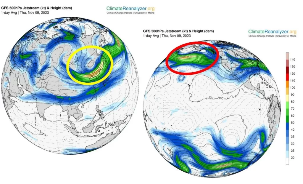
Forecasting models from both the Global Forecast System (GFS) and the European Centre for Medium-Range Weather Forecasts (ECMWF) have indicated a high likelihood of AR conditions, with an integrated water vapor transport (IVT) exceeding 250 kg/(ms). Specifically, data suggest a 60% probability of these conditions affecting the Oregon and Northern California coasts by Tuesday, November 14.
This probability is projected to extend southward as the week progresses, peaking on Thursday, November 16. However, it is essential to note the forecast’s uncertainty regarding the exact timing and evolution of these systems.
In terms of precipitation, the NOAA/NWS Weather Prediction Center (WPC) anticipates 25 – 50 mm (1 – 2 inches) across lower elevations and 50 – 150 mm (2 – 6 inches) in higher elevations through November 13.
As the week advances, the storm system is expected to migrate onshore, with AR conditions potentially intensifying and spreading into California. Here, the National Blend of Models (NBM) foresees up to 125 mm (5 inches) of rainfall in Northern and Central California. Southern California may receive up to 50 mm (2 inches), nearly double the region’s monthly average for this period.
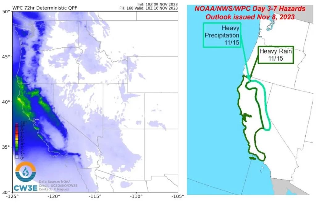
In the Sierra mountain range, a 60% chance of exceeding 30 cm (12 inches) of snowfall has been indicated. However, snow levels within the Upper Yuba River watershed remain uncertain, with models presenting a wide range of outcomes.
Residents in affected areas are advised to stay informed through local NOAA/NWS offices for official weather updates and forecasts.
References:
1 CW3E Atmospheric River Outlook – November 9, 2023
The Watchers team and our contributors bring the latest on extreme weather, earthquakes, volcanic eruptions, space weather, and all things science. We're all about making sense of the natural world and keeping you informed on what’s happening. Got a tip or a question? Hit us up using the form at newstips!
Commenting rules and guidelines
We value the thoughts and opinions of our readers and welcome healthy discussions on our website. In order to maintain a respectful and positive community, we ask that all commenters follow these rules.