
Widespread severe thunderstorms across the Upper Ohio Valley into southern New England, U.S.
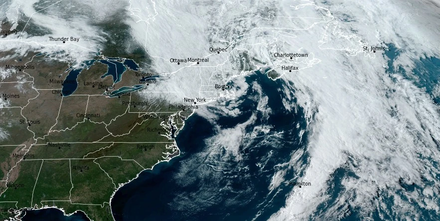
Image credit: NOAA/GOES-East, RAMMB/CIRA, The Watchers. Acquired at 20:10 UTC on April 13, 2024
Widespread severe thunderstorms will develop across the Upper Ohio Valley into southern New England on Sunday, April 14, 2024, the National Weather Service (NWS) warns. The main threats will be damaging winds however, large hail and a few tornadoes can’t be ruled out.
“Energy circulating around the southern periphery of an upper trough stationed over northern Quebec will influence potentially impactful severe weather across parts of the Northeast on Sunday,” NWS forecaster Kebede noted.
A fast-moving surface low pressure system will swing through the region during the day and promote scattered to isolated showers and thunderstorms from the Ohio Valley into the Northeast.
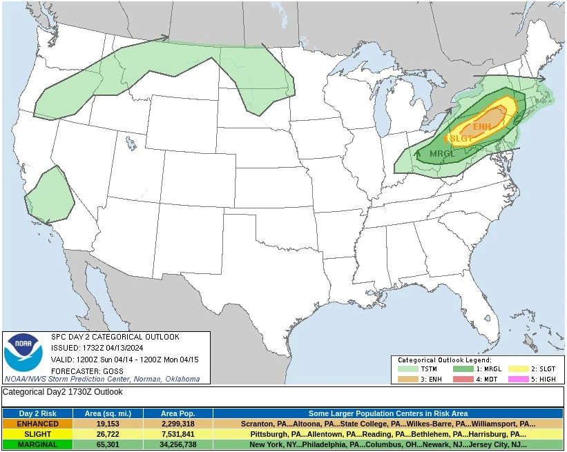
The NWS Storm Prediction Center (SPC) issued an Enhanced Risk of Severe Thunderstorms over parts of Pennsylvania for Sunday with the primary threat being damaging winds with a tornado or two and large hail also possible.
“Steep mid-level lapse rates aloft are forecast to overspread the northeastern quarter of the country Sunday, as a cold front drops southward across the Northeast states” SPC forecaster Steve Goss noted.
“Beneath this eastward-advecting mid-level lapse rate plume, modest east-northeastward advection of low-level moisture will occur, with 50s dewpoints expected ahead of the front, from southwestern New England westward, by late afternoon in a narrow east-to-west corridor. This — combined with diurnal heating across the warm sector, should yield mixed-layer CAPE values to reach 500 J/kg over southern New York/eastern Pennsylvania, to 1 500 J/kg into western Pennsylvania and Ohio.
“As the front sags southward and destabilization maximizes through the afternoon, storm initiation along and just ahead of the front is expected. Storms may initially include cellular mode, especially from central Pennsylvania westward, but flow roughly parallel to the front should favor quick upscale/linear evolution. Still, weak veering and rapid strengthening of the flow with height will support organized storms — including rotating updrafts within the line, and particularly with any storms which can remain at least transiently cellular.
“While the expected linear storm mode should help to limit tornado potential, a couple of tornadoes are anticipated, particularly across western and central Pennsylvania, where large hail may also occur. Otherwise, the primary severe risk across the region should be damaging wind gusts, aided by 40 to 50 kt westerlies extending as low as 900 mb per model point-forecast soundings. Storms will spread southward into the evening, but should eventually weaken diurnally as the boundary layer begins to stabilize.”
“Things should clear up in the Northeast by Monday,” Kebede noted.
Meanwhile, a potent mid-level cut-off low will propagate through interior portions of the West and influence impactful weather through early next week. Heavy snow will develop over the Sierra Nevada and Shasta Siskiyous tonight and continue through Sunday afternoon as the upper trough moves ashore.
Snowfall totals between 15 and 30 cm (6 – 12 inches) are likely to accumulate over the next 24 hours for the California mountain ranges, with locally higher amounts possible at the highest elevations.
Snow and rain impacts will come to an end over California on Sunday as the upper trough shifts into the Four Corners region.
Amplified troughing in the West will support below-average temperatures across California, Nevada and into the Four Corners region through Monday. Downstream of this, southerly flow beneath an upper ridge and will allow for anomalous warmth to expand across the central U.S. and eastern parts of the country.
High-temperature anomalies in those places are expected to be between 8 and 14 °C (15 – 25 °F) above average over the next couple of days.
Additionally, a serious severe weather event is likely to unfold over parts of the Central/Southern Plains on Monday night.
References:
1 Short Range Forecast Discussion – NWS Weather Prediction Center College Park MD – 337 PM EDT Sat Apr 13 2024
2 Day 2 Convective Outlook – NWS Storm Prediction Center Norman OK – 1232 PM CDT Sat Apr 13 2024
I'm a dedicated researcher, journalist, and editor at The Watchers. With over 20 years of experience in the media industry, I specialize in hard science news, focusing on extreme weather, seismic and volcanic activity, space weather, and astronomy, including near-Earth objects and planetary defense strategies. You can reach me at teo /at/ watchers.news.
Commenting rules and guidelines
We value the thoughts and opinions of our readers and welcome healthy discussions on our website. In order to maintain a respectful and positive community, we ask that all commenters follow these rules.