• Nearly one million lose power as severe storms sweep Midwest, Northeast and Ontario

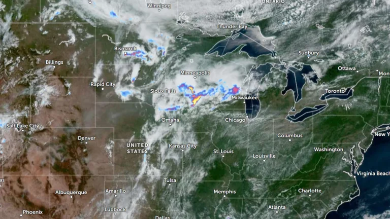
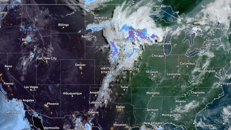
    Severe thunderstorms driven by extreme heat and abundant moisture swept across the Midwest and Northeast on Friday and Saturday, July 3 and 4, 2026 toppling trees, damaging power infrastructure and disrupting holiday travel across one of the busiest weekends of the year. Utility crews continued restoration efforts after hundreds of thousands of customers lost electricity across multiple states and parts of Ontario.
  • Super Typhoon Bavi strengthens into Category 5 as Guam, Northern Mariana Islands brace for possible catastrophic impacts

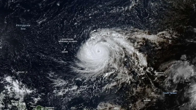
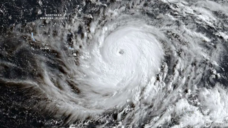
    Super Typhoon Bavi reached Category 5 strength over the western North Pacific on Saturday, July 4, 2026 as it tracked toward the Mariana Islands. Forecasters expect the cyclone to pass very near Rota before moving between Guam and Saipan on Monday morning. Typhoon warnings have been issued for Guam, Rota, Tinian, and Saipan amid forecasts of destructive winds, life-threatening coastal inundation, widespread flash flooding and catastrophic damage early next week.

  • Adelaide hit by 70% of its July rainfall in one day as successive cold fronts bring flooding and damaging winds to South Australia

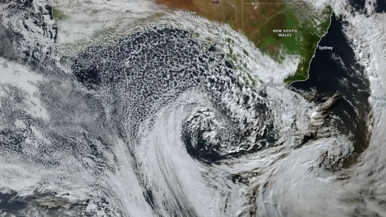
    Heavy rain from successive winter cold fronts flooded roads and properties across South Australia during July 2–3, 2026, prompting hundreds of State Emergency Service (SES) call-outs, disrupting transport, triggering a statewide Code Blue response for vulnerable people and delivering more than 100 mm (3.9 inches) of rain to parts of the Mount Lofty Ranges, according to the Bureau of Meteorology (BOM) and the SES.

  • Typhoon Bavi forecast to approach the Mariana Islands as a Category 5 super typhoon

    Typhoon Bavi rapidly intensified over the western North Pacific on Friday, July 3, 2026, increasing from 157 km/h (98 mph) to 194 km/h (121 mph) within six hours. The storm is forecast continue strengthening potentially becoming a Category 5 equivalent super typhoon by Sunday, July 5. Typhoon, tropical storm and flood watches remained in effect Friday across Guam and the Commonwealth of the Northern Mariana Islands.

  • Peru declares state of emergency ahead of 2026–2027 El Niño rains

    Peru has declared a 60-day state of emergency in 796 districts across 22 departments and the Constitutional Province of Callao on July 2, 2026, because of the imminent threat of intense rainfall associated with the 2026–2027 El Niño phenomenon, activating nationwide preparedness and disaster risk reduction measures.

  • Enhanced Risk of severe thunderstorms issued for eastern South Dakota, southwest Minnesota, and northwest Iowa

    The Storm Prediction Center (SPC) has placed parts of eastern South Dakota, southwest Minnesota and northwest Iowa under an Enhanced Risk of severe thunderstorms through Thursday, July 2, 2026. A broader Slight Risk extends from the Dakotas into the western Great Lakes and includes western Kansas, the Tennessee Valley and the southern Appalachians. Damaging wind gusts and large hail are expected to be the primary severe weather hazards across the affected regions.

  • Bavi forecast to intensify into super typhoon near Northern Mariana Islands

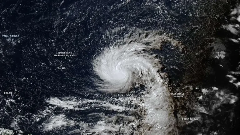
    Tropical Storm Bavi is forecast to undergo rapid intensification from late July 2, 2026, and become a super typhoon as it approaches the Northern Mariana Islands. The Joint Typhoon Warning Center (JTWC) forecast issued at 09:00 UTC calls for 1-minute sustained winds of 250 km/h (155 mph) near the system’s peak intensity around July 5.

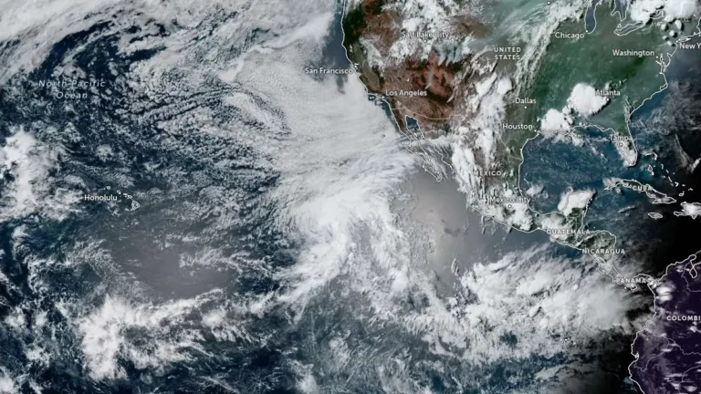
  • Tropical Storm Douglas forms over the eastern Pacific, forecast to weaken into a remnant low by July 3

    Tropical Storm Douglas formed over the eastern North Pacific Ocean at 21:00 UTC on July 1, 2026, and became the fourth named storm of the 2026 eastern Pacific hurricane season. The cyclone is located well west-southwest of the southern tip of Baja California, Mexico, and is expected to remain over open waters while weakening into a post-tropical remnant low by July 3.

  • Enhanced Risk issued for severe thunderstorms across Midwest and Upper Great Lakes

    Severe thunderstorms will affect portions of the Upper Midwest and Great Lakes through Wednesday, July 1, 2026, with damaging wind gusts of up to 130 km/h (80 mph), isolated large to very large hail and a few tornadoes possible. Parts of the region have been put under an Enhanced Risk of severe thunderstorms through Wednesday, while a Slight Risk extends across portions of the central High Plains and the Northeast.