
Record-breaking heatwave forecast to peak through August 8-9, Extreme Heat Warnings issued across western United States
A dangerous heat wave is peaking across the Western U.S. this weekend, with Extreme Heat Warnings covering parts of Arizona, California, Nevada and Utah. Mojave Desert temperatures are forecast to reach 43.3–48.9°C (110–120°F), while Reno and Salt Lake City have already set daily high-temperature records on August 7.
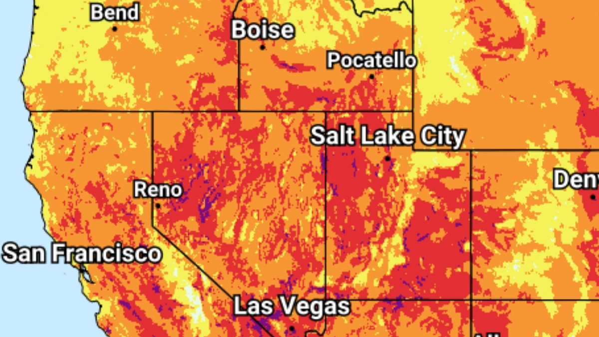
Image credit: NWS/WPC
A dangerous heat wave is peaking across the Desert Southwest and Intermountain West this weekend, with Extreme Heat Warnings in parts of Arizona, California, Nevada and Utah.
The National Weather Service (NWS) forecasts Mojave Desert highs of 43–49°C (110–120°F), nighttime lows of 27–35°C (80–95°F), and Major to Extreme HeatRisk.
Peak heat wave conditions are forecast to continue over much of the Desert Southwest and Intermountain West through August 8–9, according to the Weather Prediction Center (WPC).
Temperatures were forecast from the upper 30s°C to locally above 43°C (upper 90s°F to over 110°F), about 4–7°C (7–12°F) above normal, with widespread Major to locally Extreme HeatRisk through Sunday, August 9.
Record temperatures were reported in Reno and Salt Lake City on August 7. Reno-Tahoe International Airport reached 39.4°C (103°F), breaking the previous daily record of 38.9°C (102°F) from 1990; the station’s climate record dates back to 1888.
Salt Lake City also reached 39.4°C (103°F), topping the previous August 7 record of 37.8°C (100°F), set in 1994, 1995 and 2024; records there extend from 1874.
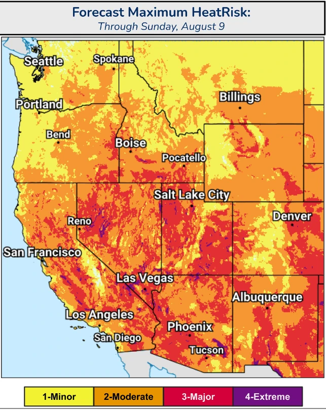
The highest forecast temperatures are concentrated across the lower deserts. NWS Las Vegas forecasts Mojave Desert highs of 43–49°C (110–120°F), with 35–41°C (95–105°F) across the southern Great Basin and Arizona Strip. Mojave Desert nighttime temperatures are expected to remain at 27–35°C (80–95°F). Extreme Heat Warnings in the area continue through Sunday evening, August 9.
Around Phoenix, temperatures are forecast at 43–46°C (109–114°F), with Major HeatRisk. Imperial County is forecast at 42–48°C (107–117°F), while the Coachella Valley and San Diego County deserts are expected to reach 42–46°C (108–114°F).
Extreme Heat Warnings also cover parts of Utah and western Nevada. Temperatures could reach 39°C (102°F) across the Salt Lake Valley and northern Wasatch Front, with little overnight relief through Sunday. Areas around Zion National Park and Lake Powell could reach 43°C (110°F).
In western Nevada’s Basin and Range, highs of 38–41°C (101–106°F) and overnight lows of 20–23°C (67–74°F) are forecast through Monday morning, with widespread Major HeatRisk and isolated Extreme HeatRisk in lower valleys.
Warm nights are keeping heat exposure high after sunset. NWS Hanford forecasts overnight lows of 24–27°C (75–80°F) in its warning area, while lows in the Mojave Desert are forecast at 27–35°C (80–95°F). NWS heat warnings advise people to stay hydrated, use air-conditioned or other cooled spaces, and limit strenuous outdoor activity during the hottest part of the day.
At the Grand Canyon, NWS Flagstaff forecasts 43–45°C (110–112°F) at Phantom Ranch on August 8. Day hikers on Bright Angel Trail are advised not to descend more than 2.4 km (1.5 miles) from the upper trailhead. Between 10:00 and 16:00 LT, hikers should be out of the canyon or at Havasupai Gardens or Bright Angel campgrounds, and physical activity is discouraged during that period.
In Maricopa County, the Phoenix warning directs residents to call 2-1-1 for information on free cooling centers, transportation, water, and other assistance. NWS warns that heat exposure can progress from heat cramps and heat exhaustion to heat stroke without intervention.
Wildfire smoke and fire-weather hazards are affecting parts of the same broader western region. NWS Boise reports hot conditions together with smoke from area wildfires and poor air quality, while Red Flag Warnings cover areas where very low humidity and gusty winds can allow new or ongoing fires to spread rapidly.
In central Washington, west-northwest winds of 16–32 km/h (10–20 mph) are forecast with gusts up to about 55 km/h (35 mph). Eastern Washington is forecast to see southwest-to-west winds of 16–32 km/h (10–20 mph), with gusts up to about 40 km/h (25 mph). Valley relative humidity is expected to fall to 8–20%.
References:
1 Short Range Forecast Discussion – NWS/WPC – August 8, 2026
2 Extreme Heat Warning – NWS/WPC– August 8, 2026
3 Heat Advisory – NWS/WPC – August 8, 2026

Rishav Kothari is Editor-in-Chief of The Watchers, where he runs the newsroom and covers earthquakes, volcanoes, severe weather and space weather.
Published in the last 24 hours
- 2 atmospheric rivers to bring heavy Sierra snow and California flood risk
- Weipa hits 41 straight days above 36°C as severe heatwave grips Far North Queensland through November 19
- Bay of Bengal system to become Cyclone Akvan, landfall forecast between Nellore and Tuni on November 20, India
- El Niño floods kill 2 in Guayaquil as 172.8 mm of rain swamps Milagro, Ecuador's toll rises to 14
