
Pineland Road Fire explodes to over 6 000 ha (16 000 acres) as over 100 fires burn across Georgia
Wildfires driven by drought conditions spread across Georgia, United States, with at least 112 active fires burning approximately 9 164 ha (22 643 acres) as of April 22. The largest blaze, the Pineland Road Fire in Clinch County, reached 6 686 ha (16 516 acres) with 10% containment, while multiple fires continued to expand under dry and windy conditions.
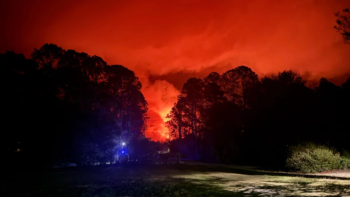
Smoke for Pineland road fire and Brantley Highway 82 fire in Georgia on April 21, 2026. Credit: Glynn County Fire Rescue
Widespread drought conditions have triggered multiple wildfires across Georgia this month, with at least 98 wildfires recorded over a three-day period from April 18 to 20.
At least 48 fires were reported on April 20 alone, burning over 405 ha (1 000 acres) across the state, according to the Georgia Forestry Commission. This figure excludes the largest blaze, the Pineland Road Fire in Clinch County, which ignited on private property earlier on April 18 and has been expanding rapidly since.
As of April 22, the Pineland Road Fire has nearly doubled in size, burning approximately 6 686 ha (16 516 acres) and reaching 10% containment. On April 21, the Georgia Forestry Commission reported the fire at 3 607 ha (8 911 acres). Growth accelerated under drought conditions and dry winds.
Meanwhile, the Brantley Highway 82 fire had burned around 1 538 ha (3 800 acres) and remained at 10% containment as of the morning of April 22.
As of 04:45 EDT (08:45 UTC) on April 22, at least 112 wildfires remained active across Georgia, burning approximately 9 164 ha (22 643 acres). At least 193 restrictions have been implemented statewide due to the fires, according to the Georgia Forestry Commission.
The wildfires are fueled by exceptional drought conditions across the state, affecting over 9 million people. March ranked as the 12th driest on record, with total precipitation of 52.6 mm (2.07 inches), marking a 76 mm (2.99 inches) drop from the monthly average of 128.5 mm (5.06 inches) according to the National Integrated Drought Information System.
The January–March period ranked as the 8th driest on record, with total precipitation of 200.7 mm (7.9 inches), nearly half of the usual average of 354.3 mm (13.95 inches).
I'm a dedicated researcher, journalist, and editor at The Watchers. With over 20 years of experience in the media industry, I specialize in hard science news, focusing on extreme weather, seismic and volcanic activity, space weather, and astronomy, including near-Earth objects and planetary defense strategies. You can reach me at teo /at/ watchers.news.
Commenting rules and guidelines
We value the thoughts and opinions of our readers and welcome healthy discussions on our website. In order to maintain a respectful and positive community, we ask that all commenters follow these rules.