
Rare severe weather outbreak brings tornado risk to Gulf states
A rare severe convective setup is forecast to develop across the Gulf region, including the United Arab Emirates, Qatar, and eastern Saudi Arabia, on March 26–27, 2026, as a deep low-pressure system and strong upper-level trough interact with high instability and wind shear. The environment may support organized thunderstorms capable of producing tornadoes, alongside heavy rainfall, hail, and damaging winds.
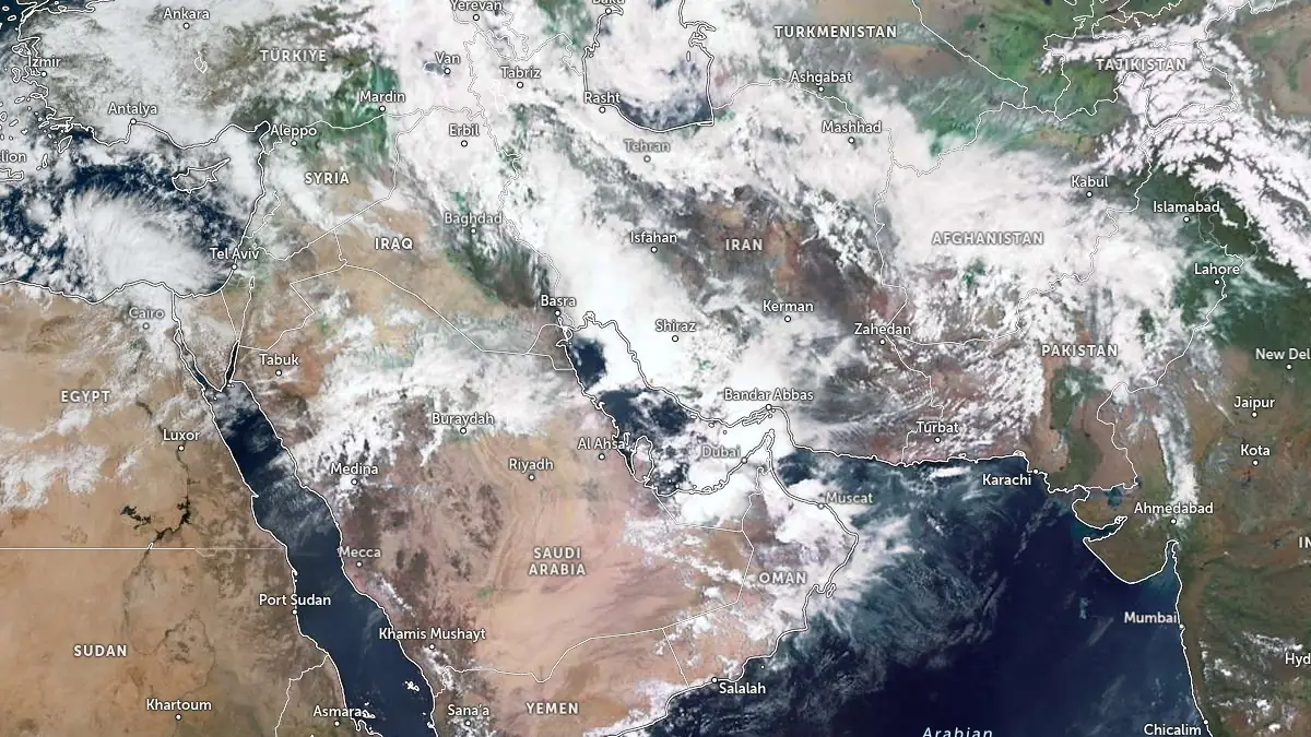
Satellite image of Middle East at 08:00 UTC on March 25, 2026. Credit: EUMETSAT/Meteosat, Zoom Earth, The Watchers
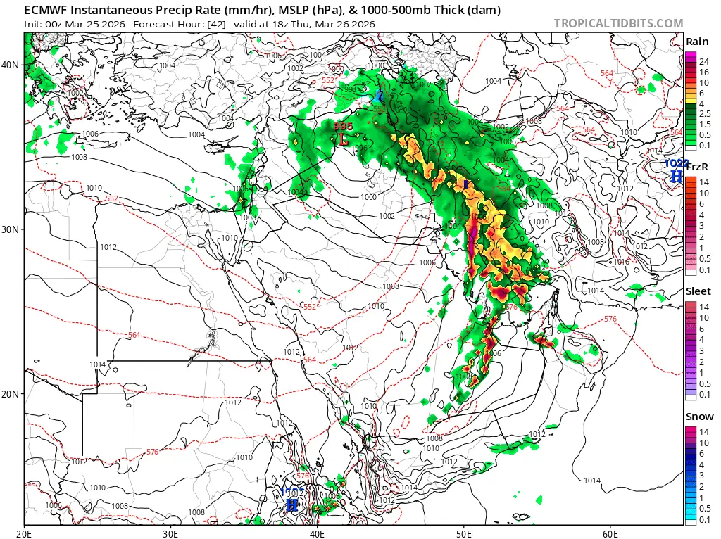
A severe convective environment is forecast to develop across the Gulf region on Thursday, March 26, as a deep synoptic-scale system evolves over the Middle East, supporting organized thunderstorms capable of producing tornadoes in areas where local conditions align.
Numerical weather prediction guidance shows a deep surface low forming over Iraq, with central pressure near 995 hPa, while an upper-level trough extending from Egypt into Saudi Arabia becomes increasingly negatively tilted.
This configuration enhances large-scale ascent and supports the development of widespread convection across eastern Saudi Arabia, Kuwait, Qatar, the United Arab Emirates, and adjacent areas of southern Iraq and western Iran.
High-resolution model output indicates the development of a north–south oriented convective line extending across the western Persian Gulf and into eastern parts of the Arabian Peninsula during the afternoon and evening hours on March 26. This structure is consistent with a squall line or quasi-linear convective system capable of producing damaging wind gusts and embedded rotating cells.
Meteorological analyses by Tomer Burg and other forecasters tracking the event indicate convective available potential energy reaching up to approximately 4 000–5 000 J/kg across parts of the Gulf region, combined with a strengthening low-level jet exceeding 70 km/h (43 mph).
The overlap of strong instability and vertical wind shear provides a supportive environment for organized convection, including supercells and embedded mesovortices within linear systems.
Such environments are capable of producing tornadoes, particularly where localized enhancements in low-level shear and storm-scale interactions occur.
While tornadoes remain infrequent across the Arabian Peninsula and Gulf states, the presence of these ingredients increases the probability of isolated occurrences, including potential waterspouts over the Persian Gulf.
The severe convective phase is expected to coincide with the intensification of a broader multi-day rainfall event already affecting the region. Forecast models indicate repeated rounds of precipitation, with some areas likely to receive significant rainfall totals over a short period — in some areas, a year’s worth of rain in just a few days, increasing the risk of flash flooding, especially in urban environments and dry river channels.
The National Center of Meteorology in the United Arab Emirates has issued forecasts for unstable weather conditions, including heavy rain, thunderstorms, and strong winds, through at least Friday, March 27. Similar conditions are expected across neighboring Gulf states as the convective system propagates eastward.
“Waterspouts are possible in the Red Sea, as are tornadoes in some areas affected by the current rainy weather in the Kingdom,” the UAE’s National Center of Meteorologists said. “We urge everyone to adhere to the instructions of the relevant authorities and follow all guidelines.”
In addition to convective hazards, strong outflow winds associated with thunderstorms may generate dust storms in drier regions, reducing visibility and affecting transport operations. The conditions are typical of organized convective systems interacting with desert environments, where dry surface layers enhance dust uplift.
Severe convective storms of this intensity are uncommon across the Middle East. The combination of a deep trough, strong moisture transport, and high instability places this setup outside the more typical range of March weather across the region.
Forecast confidence is high regarding the development of widespread thunderstorms and heavy rainfall, while tornado occurrence remains conditional on mesoscale processes that cannot be resolved with certainty at this stage.
I'm a dedicated researcher, journalist, and editor at The Watchers. With over 20 years of experience in the media industry, I specialize in hard science news, focusing on extreme weather, seismic and volcanic activity, space weather, and astronomy, including near-Earth objects and planetary defense strategies. You can reach me at teo /at/ watchers.news.
Commenting rules and guidelines
We value the thoughts and opinions of our readers and welcome healthy discussions on our website. In order to maintain a respectful and positive community, we ask that all commenters follow these rules.