
Major winter storm forecast to impact central and eastern United States this weekend
A major winter storm is forecast to sweep across much of the central and eastern United States between January 23 and 25, 2026, with a mix of snow, sleet, and ice likely from Texas and the Mid-South to the Northeast. Dangerous travel and freezing rain are expected in several regions as the system intensifies through the weekend.
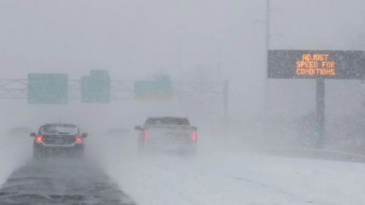
Image credit: NYSDOT
A major winter storm is forecast to develop over the southern and central United States late this week and strengthen as it tracks eastward between January 23 and 25.
A broad low-pressure system will organize over the southern Plains late in the week, drawing Gulf moisture northward into colder continental air.
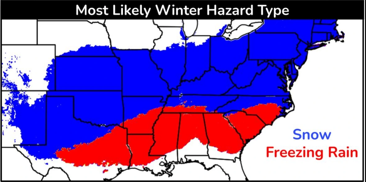
The system will move northeastward along a frontal boundary toward the Atlantic Coast by January 24, maintaining a wide zone of wintry precipitation. Snow, sleet, and freezing rain are all forecast across the region.
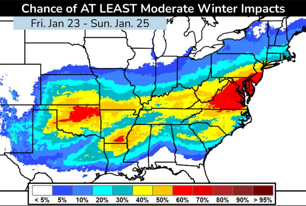
The storm is forecast to bring a combination of heavy snow, sleet, and dangerous ice accumulation to wide areas from the Southern Plains through the Ohio Valley and into the Mid-Atlantic and Northeast, according to the Weather prediction Center (WPC).
Forecast models suggest that cold Arctic air will meet moist subtropical flow from the Gulf of Mexico, producing a corridor of mixed precipitation, including freezing rain and sleet, across parts of Texas, Arkansas, Tennessee, and Kentucky before expanding eastward.
Travel disruptions are to be expected as subfreezing temperatures spread across multiple states. Even light ice coatings could lead to power outages and tree damage, particularly in areas where soils and ground temperatures remain cold following recent Arctic outbreaks.
While forecast confidence for the storm has increased, the exact placement of the heaviest snow and ice remains uncertain and will depend on small shifts in the storm’s track in the coming days.

I am an Assistant Editor and Severe Weather & Science Journalist at The Watchers, specializing in real-time severe weather coverage, geophysical event reporting, and research-driven scientific analysis. You can reach me at rishav(at)watchers(.)news.
Commenting rules and guidelines
We value the thoughts and opinions of our readers and welcome healthy discussions on our website. In order to maintain a respectful and positive community, we ask that all commenters follow these rules.